Good Monday morning, WABBLES! Spring has officially sprung, which means we’re slowly warming our way back to some seasonal high temperatures this week. With no significant precipitation expected over the next several days, all eyes are on our next greatest chance at seeing rainfall, which is currently expected to ring in the weekend this Friday. How warm will we get before precipitation returns to our area? And are there any storms expected with our end-of-week system? We’ll take a look at it together, in today’s weather blog!

Today’s Forecast
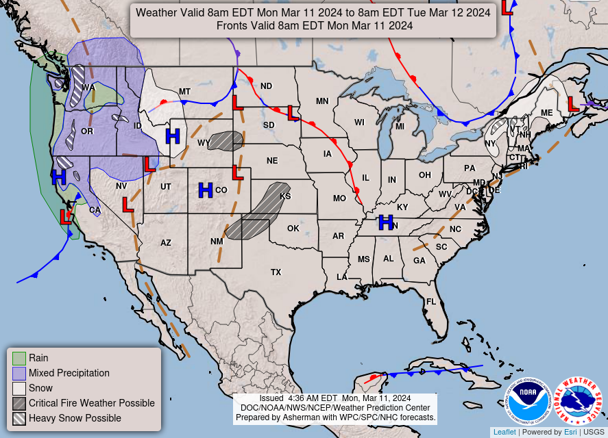
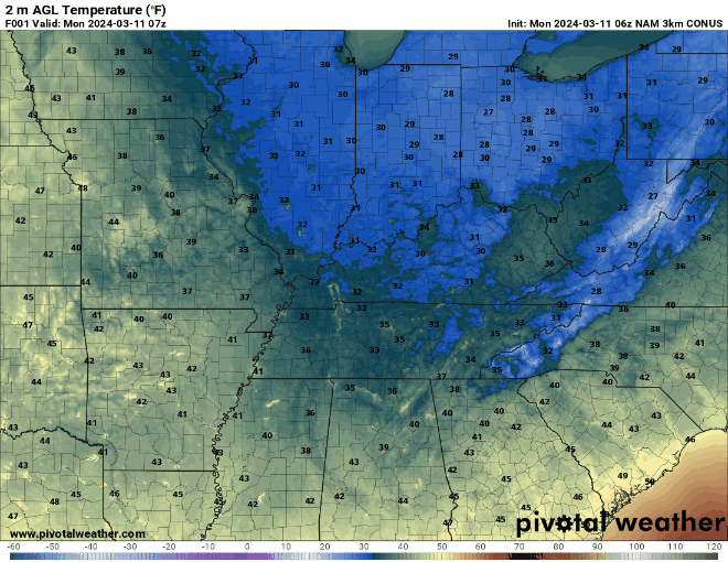
We’re keeping it on the chillier side today, as our warming-up process this week will be quite slow and steady. High pressure will remain dominant over our WABBLES area for the majority of our Monday and into the mid-week, which will ward off any rain chances and allow our local warm temperatures to slowly recover over the next several days. Most will see highs in the mid 60s top out this afternoon, with lows receding into the low-to-mid 30s overnight. Still chilly enough to keep that indoor heating going, but hopefully not for much longer!
Slow Warm-Up… Check. What About Rain?
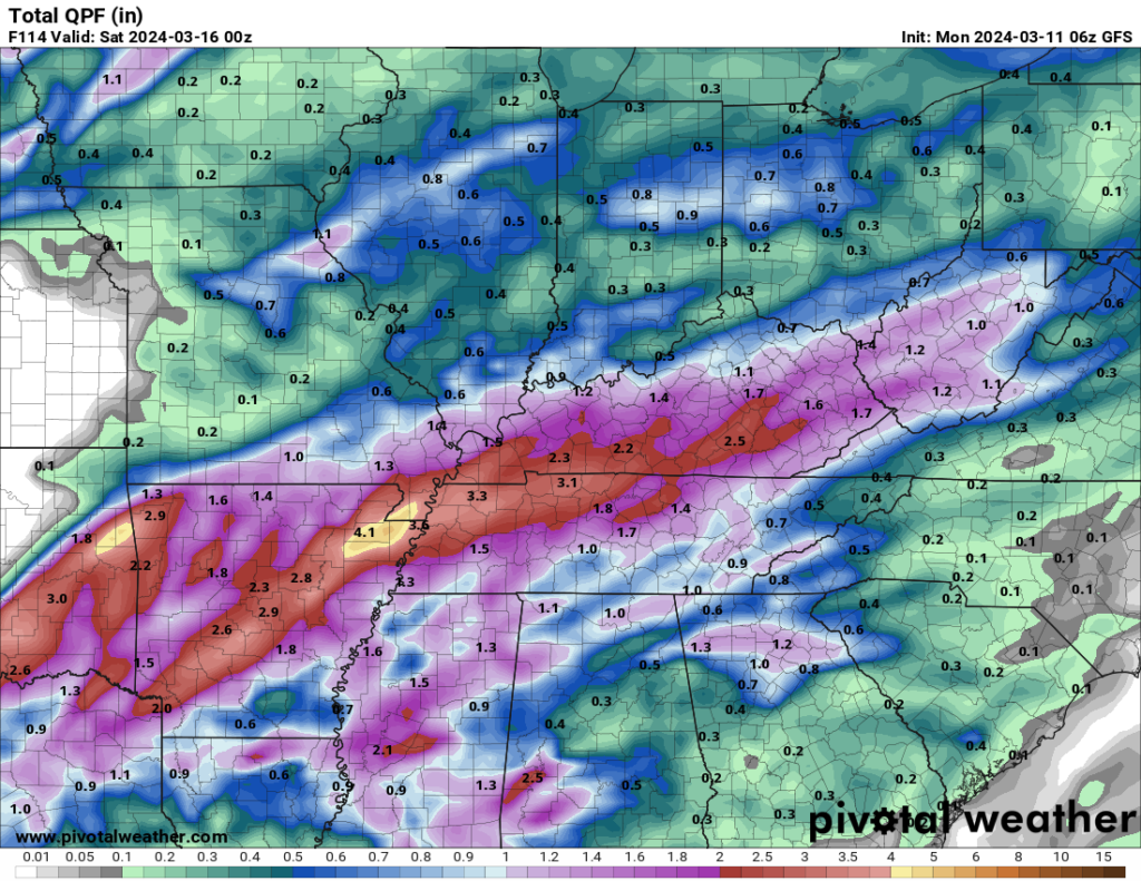
As mentioned earlier, we’re staying pretty bone dry this week until our next incoming system arrives in town before the weekend. A small shortwave disturbance could bring some scattered showers with minimal coverage on Wednesday and Thursday, but the more organized cluster of rain we’re currently watching is associated with a much larger digging low pressure system to our south. Because we’re still several days out, we don’t have any specific hazards forecast for this storm; you’ll want to keep in touch with us throughout the week as we grow closer to Friday, as we’ll continuously keep you guys in the loop as the system approaches WABBLES in real-time.
In the GIF above, you’ll notice the scattered showers I discussed earlier that may move through our area Wednesday into Thursday. But the real main event is the low and its associated rainfall that moves through afterward, which will likely take the form of consistent heavy rain similar to what we’ve seen in recent days. All of this projected precipitation is currently expected to remain sub-severe, but the chance for some rumbles of thunder or embedded smaller storms is certainly not out of the question yet.
Stick with us here on the blog and our Twitter page over the next several days, and we’ll ensure you’ve got the latest forecast and are prepared for the weather as you head into Friday! Until then, get outside and enjoy this springtime warm-up while the sun’s still shining. We’ll see you later, WABBLES!