


It has been a fairly pleasant week around WABBLES, with the exception of a few of those showers Tuesday night and into Wednesday. More showers are possible today as the weather turns warm and windy for the weekend.
Into the Weekend: Friday and Friday Night
A multi-day severe weather episode continues across the nation’s midsection as strong low pressure systems continue to traverse the region. One of those systems, as it weakens, will try to drag a warm front through the region as we head through the day. Severe weather will not be a concern, but we may be able to squeeze a shower or two out of it as it moves through late this morning and into the afternoon.
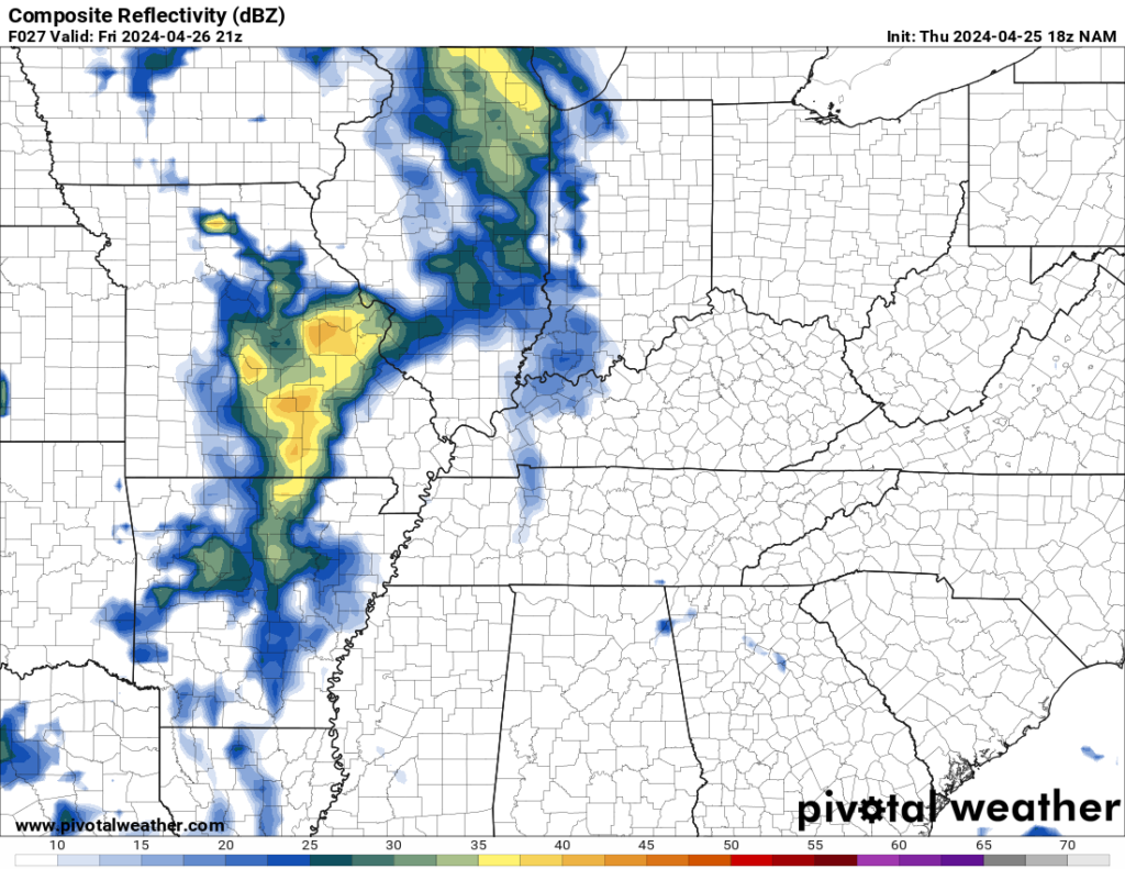
As the warm front pushes across the region, it should kick start our temperatures, which look to end up in the middle and upper 70s. Not only that, but we should get progressively more humid as well. In fact, overnight lows are going to struggle to briefly dip below 70º under mostly cloudy skies.
Weekend Breakdown: Saturday and Sunday
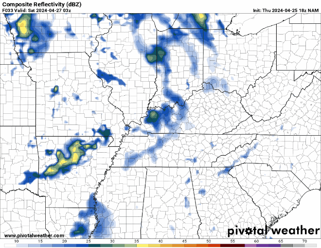
We’ll be watching a few of those thunderstorms out to our west as they attempt to scoot closer to the Ohio Valley, especially in the morning hours. They may make a run up into Southern Indiana, but they should leave us mostly alone as we head through the early hours.
I can’t completely take a stray shower or storm out of the forecast, but the major player for Saturday will be the wind.

We’re going to be squeezed by low pressure to the west and high pressure to the east and we’re going to be right in the pressure gradient zone that will kick up southerly winds, gusting at times 25-30 MPH. Combine that with sunshine under partly cloudy skies and things will warm up considerably as we head into the afternoon. Highs make a run into the lower 80s. Clearer skies overnight will allow lows down into the middle 60s…but the mugginess will prevent us from getting any lower than that.
A carbon copy on Sunday, though perhaps not quite as windy. Plenty of sunshine is expected as things stay warm and muggy in the afternoon.

Highs look to climb up into the lower to middle 80s yet again as our attention turns to the west. We’ll watch showers and storms attempt to push in, but they will be weakening as they do so.
Overnight lows are back into the middle 60s with showers pushing in.
After the Weekend: Into Derby Week
Apparently there’s some horse racing going on up in Louisville this week?

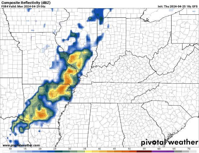
We’re still going to be watching showers and storms trying to push through the region as we head through the day on Monday. Showers and storms look to be scattered throughout the region during the day on Monday as highs make it back into the lower 80s. Showers and storms look to continue as we head into the overnight hours as another disturbance pushes through. Lows are back in the middle 60s.

The low pressure associated with this cold front has far outrun it, meaning that it’s just kind of going to turn stationary in the region as we head through the middle of the week. We’ll have to watch weak impulses pushing along it because they could spark daily chances for spotty showers and storms as we head through Tuesday, Wednesday and Thursday.
Highs will stay warm and muggy in the upper 70s to lower 80s as these work through. I don’t think it rains all day each day, but the pattern looks distinctly summerlike as we head through the middle of next week or so…stay tuned!
That’s it for me for now! You can always keep up with the latest on all of our social media platforms. Have a tremendous day and a great weekend!