

")
Happy Sunday to my friends out there across WABBLES! I hope everyone is having a great day so far in the frigid cold. Unfortunately, it looks like we will be getting even colder in the near future with the added chance for impactful snow.

Current Conditions
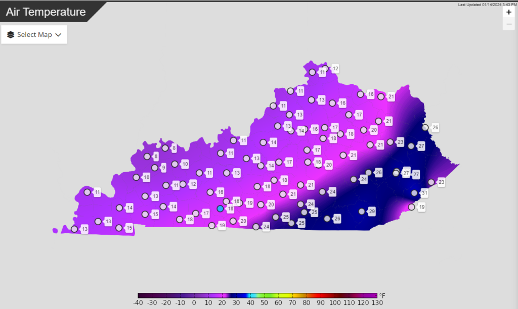
Currently, temps are quite frigid across WABBLES with most places sitting in the teens. This will continue into the evening, especially as snow starts to fall.
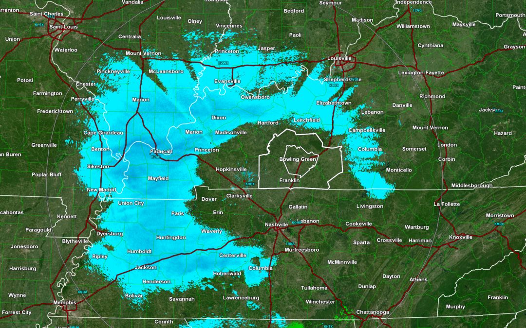
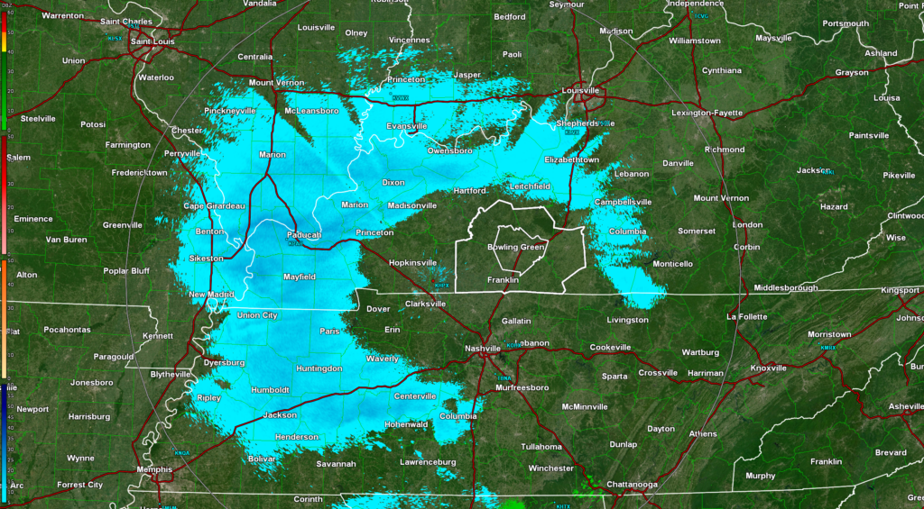
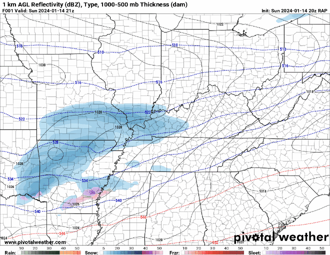
On radar, we see snow starting to approach WABBLES from the west. This will continue into the evening/night, but it will likely take a bit of time for the snow to reach the ground because the atmosphere needs to saturate.
Migraine Snow Analysis
Starting off looking at the longer range global models that have been “seeing” this system the longest, they primarily keep the heaviest snow far south into Tennessee and far eastern Kentucky. The only snow they give WABBLES is minimal.
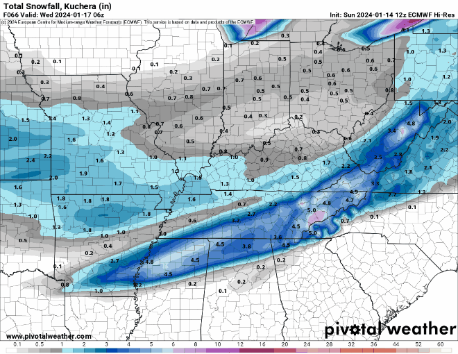
Here is my problem with these global models, they are all currently underdoing the moisture. They are about 8 degrees or more dryer than the observed dew points which is a lot when dealing with this system so I am more hesitant to believe what these models are suggesting.
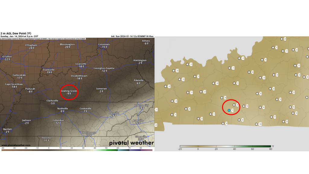
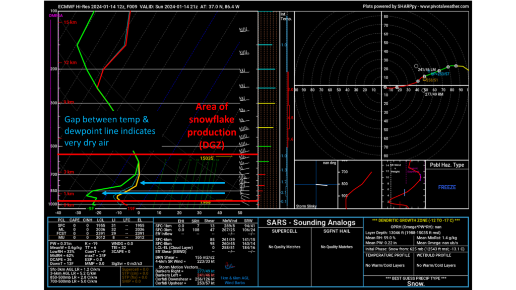
The moisture at the surface and at the lowest levels are crucial with this system because with it being so cold, the snowflakes are being made in that lowest parts of the atmosphere. If we are dry in that area of snowflake production (dendritic growth zone) then no snow can be produced.
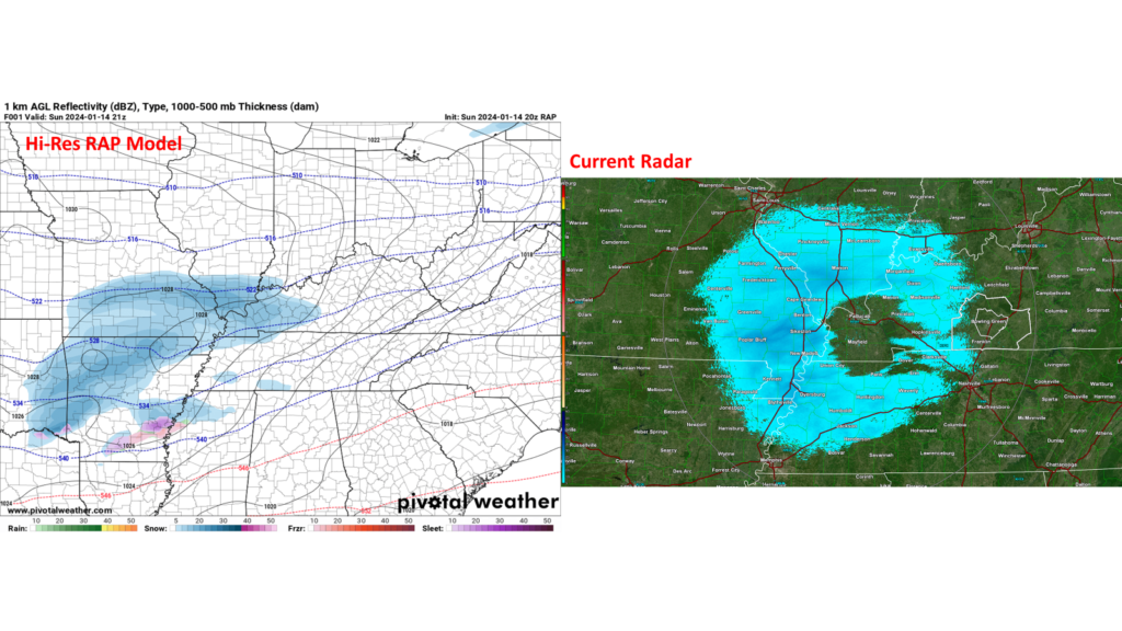
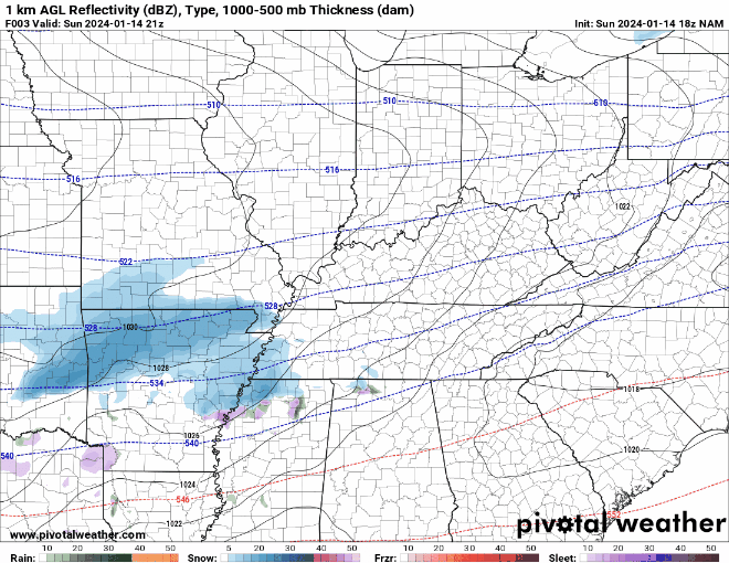
When looking at the hi-res models, they are initializing with the moisture better and are offering a different solution. Since they are initializing better, I am leaning more towards their solution. That solution is more snow starting sooner tonight and lasting longer, more moisture means more snow.
Another interesting trend with the hi-res models is with the heavier snow swath migrating back to the north/northwest closer to WABBLES. It is hard to say if this will continue to move further north/northwest or not at this time, but it is something to keep an eye on.
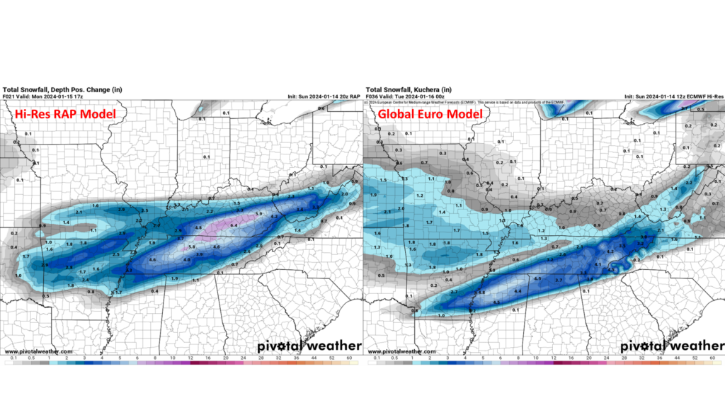
Personally, I am favoring the RAP model. It has initialized the best with moisture and looks the most like current radar so I think it has a good handle on the situation.
With that being said, I believe we see snow starting anytime in the next couple of hours and lasting into tomorrow. What time this ends tomorrow is still pretty “cloudy” but it should continue into the late morning at least, potentially longer.
So, what about snow totals? this is probably where I am most uncertain and don’t want to just throw a number out there. I am becoming more confident that WABBLES will see a good swath of snow, but there are still several failure modes in place that could keep us getting next to nothing, so keep that in mind.

However, the biggest saving grace with this snow is that since it will be so cold snow should stick pretty fast. Additionally, it is so cold that the snow ratios should be very high. This means that it takes much less water in the atmosphere to get a big bang for your buck with snow.

Final Forecast
- Snow to start across WABBLES over the next couple of hours or sooner.
- Snow will likely last into tomorrow morning or potentially later in the day.
- Heavy snow is possible at times.
- High ratio snow will be very dry, powdery, and easily blown by wind.
- Snowfall totals around WABBLES 1-4″ with locally higher totals possible.
That will be all for this update, folks! I highly encourage everyone to follow us on our social media accounts @wxornotBG for the latest on this storm.
Have a blessed day!
Just wanted to let you know you are the only weather source I trust. Love your content. Keep up the good work.