

")
Good Wednesday Morning my friends across WABBLES! I hope everyone has been enjoying the beautiful weather out there, I know I certainly have. Unfortunately, we have some typical April storm chances to potentially rain on our parade.

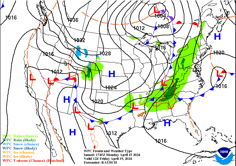
April Storms
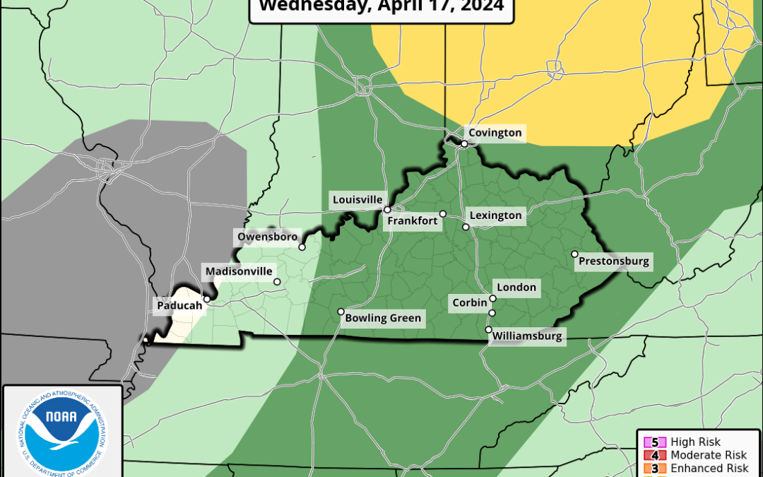
Starting off with today, the SPC has all of WABBLES in a Marginal (level 1/5) Risk. This is primarily a wind and hail driven threat with a less than 2% risk forecast for tornadoes within 25 miles of a point.
Although the atmosphere will be marginally supportive for hail and damaging winds, the likelihood of any storms developing around WABBLES remains low. This will leave our overall storm chances low for today.
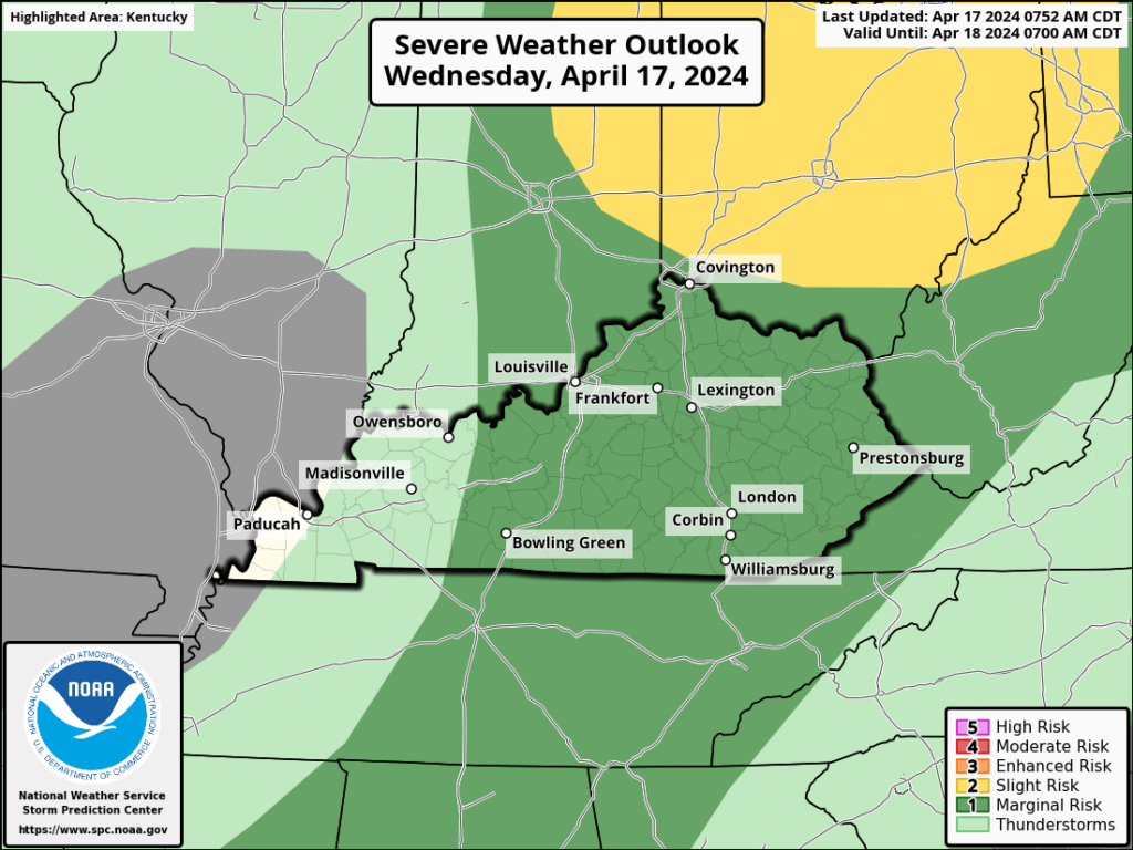
Tomorrow, we will find ourselves under yet another Marginal (level 1/5) Risk for severe weather. This is once again an April storm threat with a wind and hail driven threat with a nonzero tornado threat.
April Storm development is much more likely in this case thanks to better forcing with a cold front.
The biggest hinderance to storms becoming strong to severe will be the timing. Current solutions have a time frame of 8pm to 2am, instability will be quickly dwindling at this time. Waning instability will help mitigate severe potential, but not eliminate it.
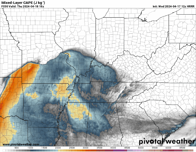
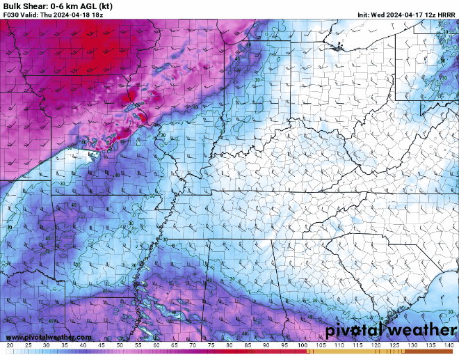
Bulk wind shear looks to be in the 30-40kts range, which is sufficient for a severe weather threat. However, this amount of wind shear will likely struggle to compensate for dwindling instability.
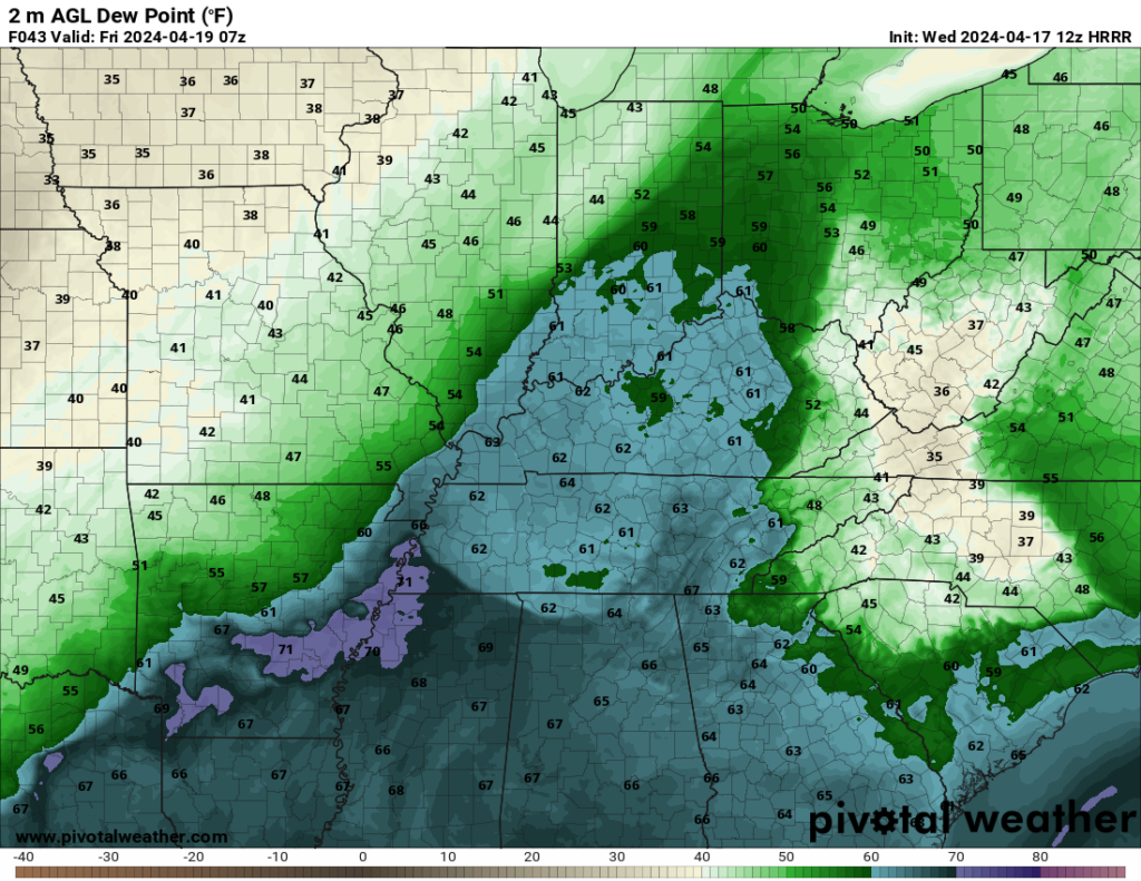
Dewpoints look to recover into the lower 60s by the time storms pass through which could help storms at becoming strong to severe, but not by a lot.
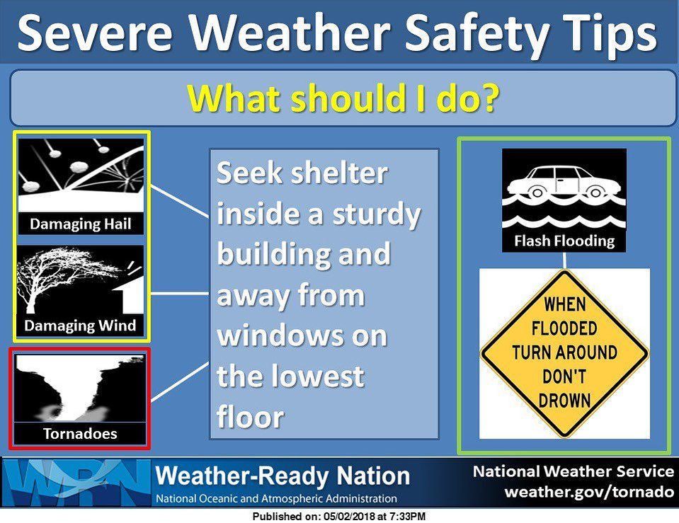
Overall, I do believe a severe weather threat is present for tomorrow night. However, I believe it is on the very low end with a lot of hurtles for storms to jump over in order to reach severe levels. If storms can become severe, we will primarily be dealing with damaging winds and large hail. Tornadoes are technically possible, but represent a nonzero threat. Regardless, remember to have a plan in place if warnings are issued.
That will be all for today folks! I hope everyone enjoys the wonderful weather out there today. I recommend everyone come give us a follow on our social media accounts @wxornotBG for the latest on the upcoming storm threat.
Have a blessed day!