

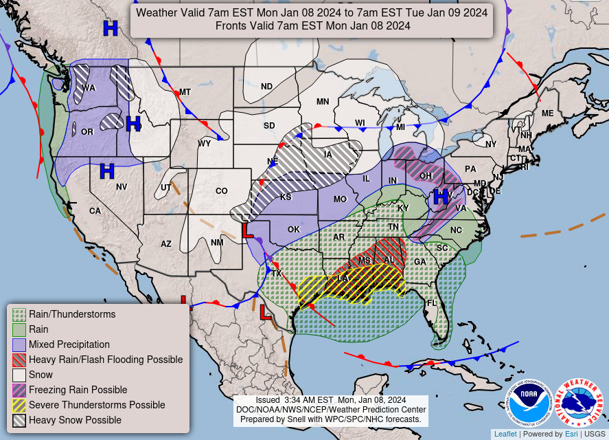
Happy Monday morning, WABBLES! We’re off to the races with another impactful weather-maker to ring in the second week of January with a bang. While we’ll be sunny and pleasant for most of the daytime, all eyes are on a windy, rainy system that’s expected to push into the area later this evening. How long will said storm stick around? And since it’s January, after all, could we see some wintery precipitation attached to it? We’re breaking it all down together, in today’s weather blog!
Today’s Forecast
As mentioned previously, the talk of today’s forecast will be a sharp southeast breeze cutting up from the Gulf for most of the day beginning early this morning. These strong surface winds, attached to the storm system pushing in tonight, will intensify throughout the day and are expected to strengthen enough for the National Weather Service WFO in Louisville to have issued a Wind Advisory in advance beginning tonight at midnight, lasting through 10 AM on the 9th. Otherwise, we’ll be partly sunny and dry up until sundown this evening, with high temperatures expected to reach the upper 40s and lows only reaching the low 40s as a result of the wet weather moving in late.
So… Just Wind and Rain?
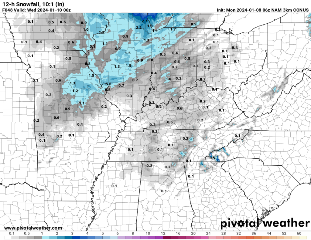
Not exactly! Keen eyes will notice that there’s a little bit of blue attached to the back of the storm shown in the GIF above, and the reasoning for that is this: it’s January! Though it may not feel like it, we’re deep into winter here in WABBLES and most (if not all) big rain-makers will have the potential for some flurries on the backside, located square within the area of much colder air that’s pushing the rain out east like a broom pushes away dust.
Temperatures won’t exactly plummet in our area once the wet weather moves out of our area, though. Still, we’ll definitely be around the freezing mark after sundown on Tuesday, so some of us in the area will inevitably see a snow shower or two. Do we think we’ll see anything stick? Unfortunately no, as most of the moisture in the system will have preceded the snow by rain, and the ground temperatures will be too warm for anything frozen to stay frozen once it reaches the myriad of grass and asphalt that keeps WABBLES pretty well-covered.
Once this system moves out tonight and throughout the day tomorrow, we’ll be back on a warming trend and much less windy until a second rainy, messy storm system lines us up in its crosshairs at the end of this week. Our local weather pattern is just now waking up, folks, so it’s time for you to get used to keeping up with the blogs here and WXornotBG’s Twitter page, where we put out frequent updates on all the latest meteorological news for the WABBLES region. Make sure to check back in here tomorrow morning, and stay weather-aware this week! We’ll see you soon!

Any idea about the possible storm coming in on Sunday night and Monday morning??