


Good morning and Happy “Almost” Friday WABBLES. Temperatures continue to fall as the leaves change into our favorite seasonal colors. However, we do have chances for some showers today so stay tuned for more on that. Keep your raincoats and umbrellas on standby, Your Thursday forecast starts now.

Umbrellas Ready!! (GIPHY)
Morning Hours
Temps in the 60s to start the morning commute but, don’t forget to keep the rain gear ready for you and your loved ones. Mostly cloudy skies with a calm southwestern wind increasing in speed as we progress through the morning hours. Overall, a peaceful and warm start to our Thursday.
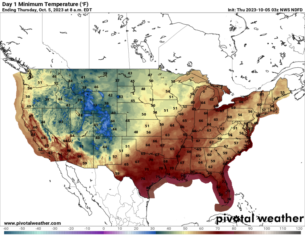
Warm to start as cooler temps creep in from the west (PIVOTAL)
Afternoon Showers
As we roll towards the Afternoon hours, we will experience highs in the 70s as more clouds roll into our region. The southwestern winds pick up with possible gusts up to 20mph as our first chances of showers roll in around 1 p.m. An 80% chance of showers with rainfall totals with the potential to reach a quarter of an inch may cause some slick spots out there. Drive safely during your afternoon errands and commute back home.
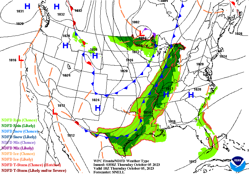
Cold Front brings Autumn rain and cooler temps (WPC)
Wet Overnight
Showers will keep us company as we head into the overnight hours. The combination of rain and clouds will keep the lows in the 60s along with a 3-6mph southern wind. Chances for rain continue to remain high until they begin to taper off early Friday morning for some of us. This could change those slick spots into ponding water areas, so be careful when driving in low-lying areas tonight.

Cold air from the north makes its presence known as we head into the weekend (WPC)
That concludes our Thursday forecast for the region. Keep the rain gear handy and take the proper precautions as we head towards a cooler weekend. Don’t let the showers ruin your day as the sunshine will make its way back to us just in time for the weekend. Stay Classy and WABBLE on.

I Have The Power!! (GIPHY)