

")

After a couple of the toastiest days of the year so far, things look to turn unsettled again as we roll on into Derby weekend.
Into Derby Weekend: Oaks Day and Tonight
We continue to watch a cold front begin to work toward the region as we head through the day today. This front will serve as a focusing mechanism for showers and thunderstorms.

Dynamics are such that severe weather is not expected, but the rainfall could be heavy at times, especially if you get under a storm or two. The clouds around should keep it milder than we have been during the day, with highs in the upper 70s.
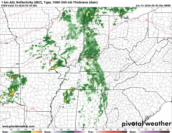
With the frontal boundary in the area, showers continue off and on through the overnight hours with lows in the middle 60s. Again, severe weather is not expected, but some locally heavy downpours can’t be ruled out, along with some scattered thunder and lightning.
Derby Weekend: Saturday and Sunday
Whether you’re headed up 65 to join the throngs of crowds at the track or staying right here in WABBLES and throwing a horse-adjacent hootenanny, the forecast remains complicated as we have to see where Friday’s front goes before we can know for sure what Saturday’s forecast looks like.

At this point, it looks like the front should clear the area, if only temporarily, before working back to the west during the afternoon and evening hours. Either way, clouds should be in abundance, but showers may take a break after the morning hours.
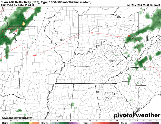
The clouds in place will keep us from getting excessively warm like yesterday, with highs only making it near 80º or so. Showers may try to filter back in as we head into the afternoon and stay scattered into the evening hours as lows fall back into the middle 60s.
Post-equine shenanigans, i.e. Sunday, looks unsettled as that frontal boundary just kinda hangs out in the region.

That front will not only be a focusing mechanism for scattered showers and storms, it will also be a path that weak disturbances from the plains states and the Mississippi Valley take as they head our direction. That will once again provide us with summer-like scattered shower and storm chances as we head into Sunday afternoon.
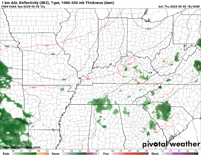
Despite the widespread scattered storm chances, we should continue to stay warm, with highs again expected in the lower to middle 80s. We should start to diminish chances once we head past the sunset hour, lows stay muggy though, in the middle 60s.
Past the Weekend: Next Week Looking Active
We continue the unsettled pattern as we head into the first full week of May. And I mean active.

We could see a few showers and storms developing during the day on Monday as another weak disturbance sneaks on into the region and interacts with our humid airmass. Highs are back into the lower 80s. Lows are back into the middle 60s.
We’re going to have to watch the Tuesday through Thursday time frame next week. Much of the medium-range guidance that we look at has been highlighting these days for the potential for strong to severe thunderstorms.
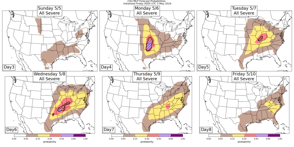
It’s still too early to pinpoint details like timing each day or main threats, but the pattern suggests that these will be repeated complexes of thunderstorms blowing through the region that could produce high wind and heavy rain that could cause isolated flooding issues. We’ll continue to watch it through the weekend.
Outside of storms, it will feel like summer: partly to mostly cloudy skies with highs in the middle 80s with heat indices knocking on the door of 90º. So when you’re not soaked from storms, you’re drenched from the high dew points.

That’s it for me for now! You can always keep up with the latest on all of our social media platforms. Have a tremendous day and a great weekend!