")
Good Monday morning, WABBLES! Showers and storms return to the forecast this week after an incredible few days of miscellaneous sky phenomena. The extremely rare mid-latitude aurora has come and gone, and now we return to more typical early summer weather as spotty rain chances will increase today and throughout the week. Are we expecting any severe weather? And how long will the precipitation stick around? We’re going through it all together in today’s weather blog!

Today’s Forecast
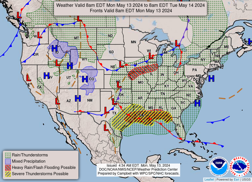
We are staying comfortable and calm to start this mid-May Monday here in WABBLES! Temperatures will linger around the mid-70s for a high this afternoon as cloud coverage increases throughout the day, bringing our low temps into the low-60s overnight. Some showers may develop to the south and move into the region this evening and into the overnight hours, but they’ll be just that: harmless rain showers. No severe weather is expected with the weak low pressure system that’ll move through over the next two to three days, but you’ll want to have your umbrella handy, because the likelihood of rain here in our lovely WABBLES region stays pretty high through Wednesday night this week.
Showers and Storms Once More?
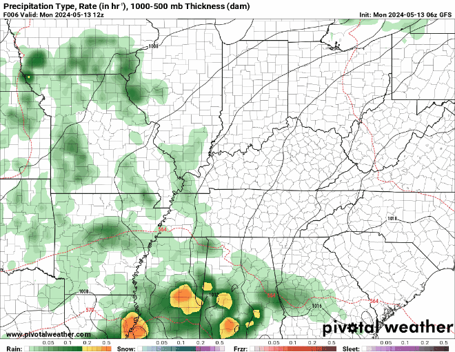
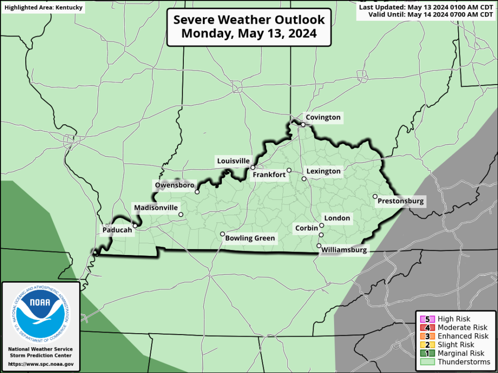
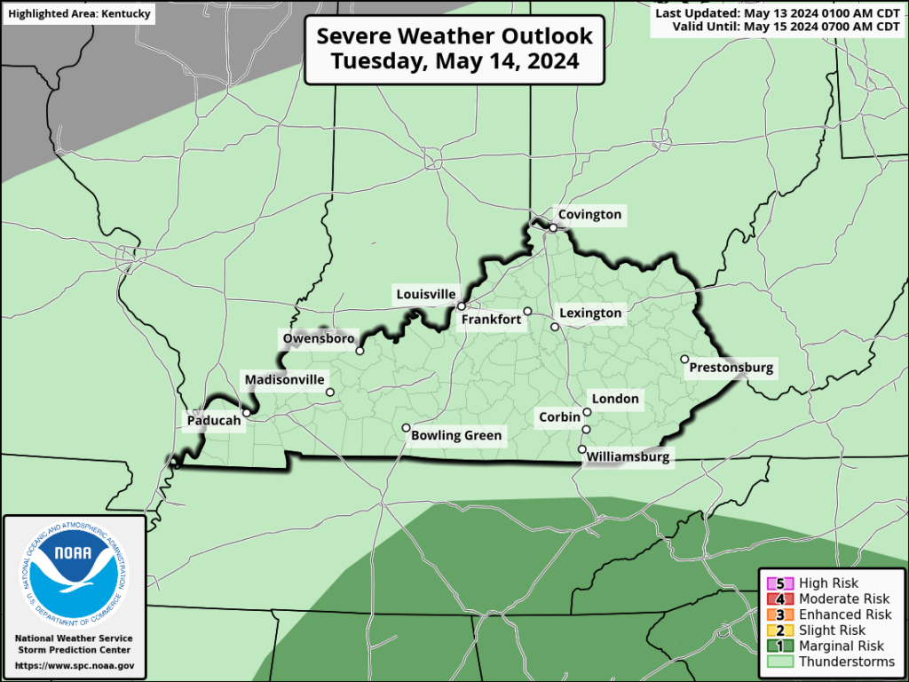
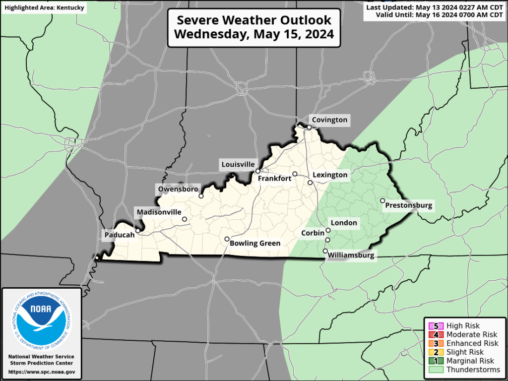
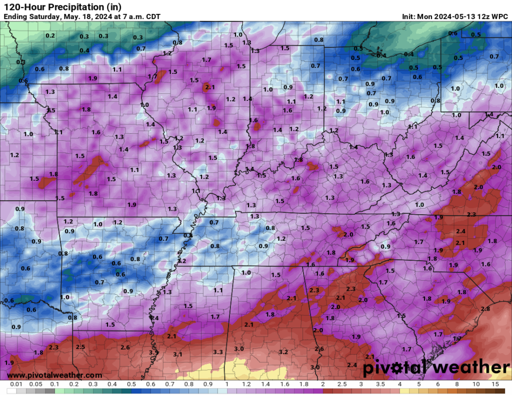
As shown in the GIF above, we’ve got another pretty active week ahead for the Southern Kentucky region. The good news, however, is that it’s mostly going to remain unproblematic in terms of dangerous storms. The Storm Prediction Center has not issued any outlook for our area larger than a “General Thunder” risk, which clocks in at less than a 1 out of 5 on their severe weather forecasting scale. Though this weather might be a little disruptive to those of y’all who spend most of your days outdoors, aside from the occasional rumble or lightning strike with some of the heavier rain to come, it isn’t expected to be incredibly impactful to our WABBLES family.
Despite that fact, however, the multiple rounds of showers expected through the midweek will continue to put down measurable rain here in WABBLES, with most of the area seeing an additional inch to two inches of rain before the end of the week. Because this is already on top of some of the rains that we experienced with our severe weather last week, our grounds are likely still susceptible to ponding and inundation, which means one thing: AVOID FAIRVIEW!
And that’s about all we have for you today, folks! The weather is doing its best to return to more normal conditions this week, so we hope you got your fill of the chaos from last week and are ready for a bit of a break. Don’t worry, we are too! It’s definitely a relief to be seeing some simple showers the next few days, even if it’s a little inconvenient for some of us. Just pack that raincoat and prepare to get a little damp if you’ve got business outdoors, and you’ll be just fine!
If you’re interested in keeping up with the forecast between blog uploads and you aren’t already, please make sure to go give us a follow over on the Twitter page, where we post daily updates on the latest WABBLES weather conditions. Until next time, take care out there y’all, and stay dry! We’ll see ya later!