Happy Monday morning, friends and family of WABBLES! Smoky Canadian haze is not the only thing making its comeback this week; thunderboomers are back on the menu beginning early this morning, and the possibility of stronger storms will remain on the table for the rest of this week as we re-enter our active summer pattern. How long until we get another break? We’ll go through the forecast together in today’s weather blog!

Today’s Forecast
Temperatures are resuming their climb back into the 90s today, with most of WABBLES expected to hit the high-80s to low-90s by this afternoon. We’ll swoop down into the mid-60s after sundown this evening, but until then you’ll want to be keeping hydrated and out of the sun for too long. The good thing is that we may see some clouds disrupt those rays as opportunities for storms will be present throughout the day.
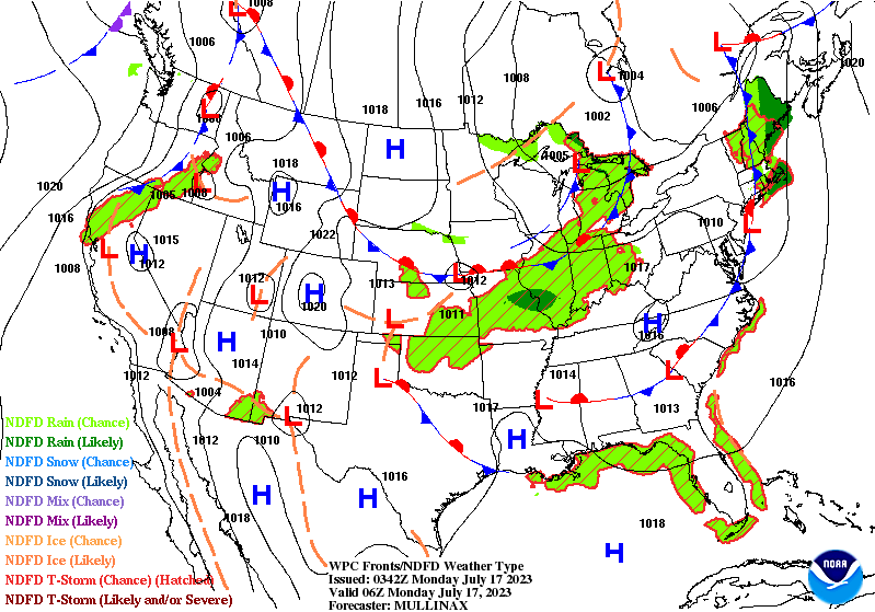
Starting today, a slow-moving cold front will be making its way out of the north and down into the Ohio Valley region. At any time ahead of this front, storms could ignite, as a result of the higher-than-average Convective Available Potential Energy (or CAPE) values that can be found lingering over WABBLES. To give a more productive timeline, we’re currently looking at two different chances to see organized convection; around 8 to 9 AM this morning, and shortly before midnight this evening.
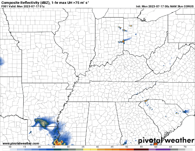
These storms will likely be the remnants of more robust systems making their way in from the west, so no serious hazards are expected with them. However, the potential for gusty winds and localized heavy rain is something to look out for! You’ll want to have a way to receive your weather alerts no matter the forecast, for summer convection is often difficult to predict and can pop up very suddenly.
The Week Ahead
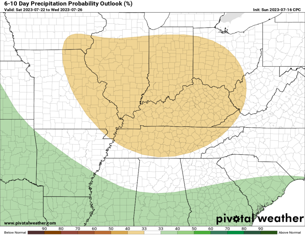
The slow-moving cold front mentioned earlier will end up pushing its way through WABBLES by the end of the week, maintaining the chance for spotty precipitation through at least Friday morning. Carry an umbrella with you this week- you’ll want to ensure you’re protected when those summer showers roll in! Despite this, the Climate Prediction Center is forecasting below-average precipitation levels for our area through late this month, meaning that we will likely not see any large-scale rain systems until at least the start of August.
Is That All?
Pretty much! If you can help it, stay weather aware this week WABBLES family. Keep those umbrellas and rainjackets on hand just in case, and you’ll thank us later when foul weather rolls in. If not, count yourself lucky! No matter the forecast, the team here at WXornotBG will always be here each morning to keep you updated with the latest weather info. Take care out there folks, and we’ll see you tomorrow!