

")

We’ve enjoyed so much warmth so far this spring, so it was only natural that things might tilt the other direction for a change. Of course, it happens while Kentucky is on the world’s stage…because naturally.
Keeping it Cool: Friday and Friday Night
The rather dynamic systems that brought us plenty of storminess earlier in the week have long since scooted out of our hair, ushering in cooler weather as we’ve gone through the week.

While the pattern is more tranquil, it’s not necessarily completely sunny or free of rain chances. As a matter of fact, we’re going to be watching a weak little disturbance trying to scoot on into the region to bring us a few showers into our Friday afternoon. Something to watch for our friends who would like to enjoy the horses up north during the day.
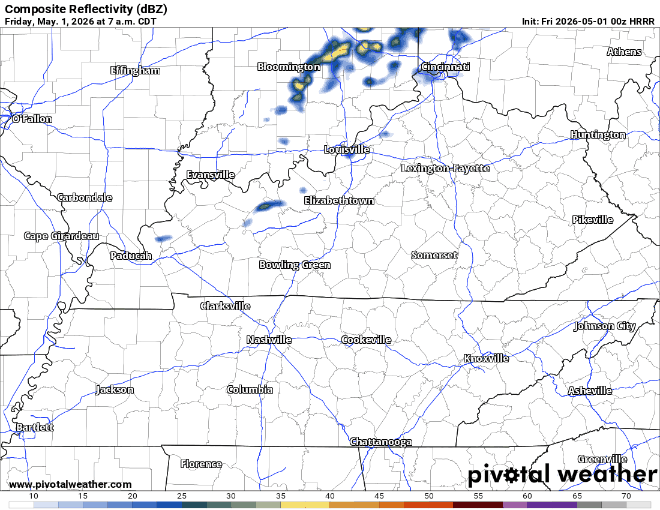
Regardless, we’re looking at a cooler, below normal day, with highs only in the middle and upper 60s. We should be in the middle 70s for May 1!

Mostly cloudy skies with light showers will continue through the overnight hours. Overnight lows are quite cool for early May, with temps settling back into the middle 40s. That’s right, middle 40s!
Horsing Around: Saturday and Sunday

Yeah, alright. We’re being told there’s a big day of horse racing up to our north for the day on Saturday. The good news is that we (and they) will enjoy dry weather during the day on Saturday, the only issue will be that temperatures will continue to stay below normal.

So if you’re heading up to the track or just hosting a party on the patio, make sure that you’re prepared for highs only making it into the lower 60s…at best for our Saturday.
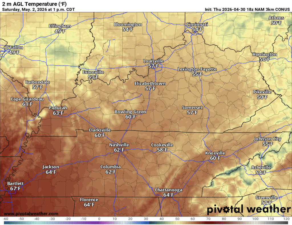
That’s despite the mix of sun and clouds during the day, we’re looking at yet another cool Derby Day.

Cool and dry air in place will keep things chilly (by early May standards). Clear skies will allow lows to fall back into the upper 30s and low 40s.
An even better weather day on tap for Sunday as our weak area of high pressure starts to push off to the east. That keeps the sinking air in place, but switches our prevailing wind from the cooler northwest direction, to a warmer southerly direction. That, combined with plentiful sunshine, should help boost the mercury a bit into Sunday afternoon. That sunshine should help get temperatures back into the upper 60s to near 70º for afternoon highs. A wonderful afternoon for activities outdoor or otherwise!

With the milder air pushing back in, despite the clear skies, lows will be closer to normal, falling into the upper 40s to near 50º or so. Though, enjoy it now, because more active weather looks to move in as we start the first work week of May.
Showers and Storms Return: Into Next Week
Part of the reason for our cool air late last week has been a persistent trough centered across the southern part of Canada. This upper level low will serve as a focusing mechanism for multiple systems passing by on the northwesterly flow, which should bring us chances for rain.

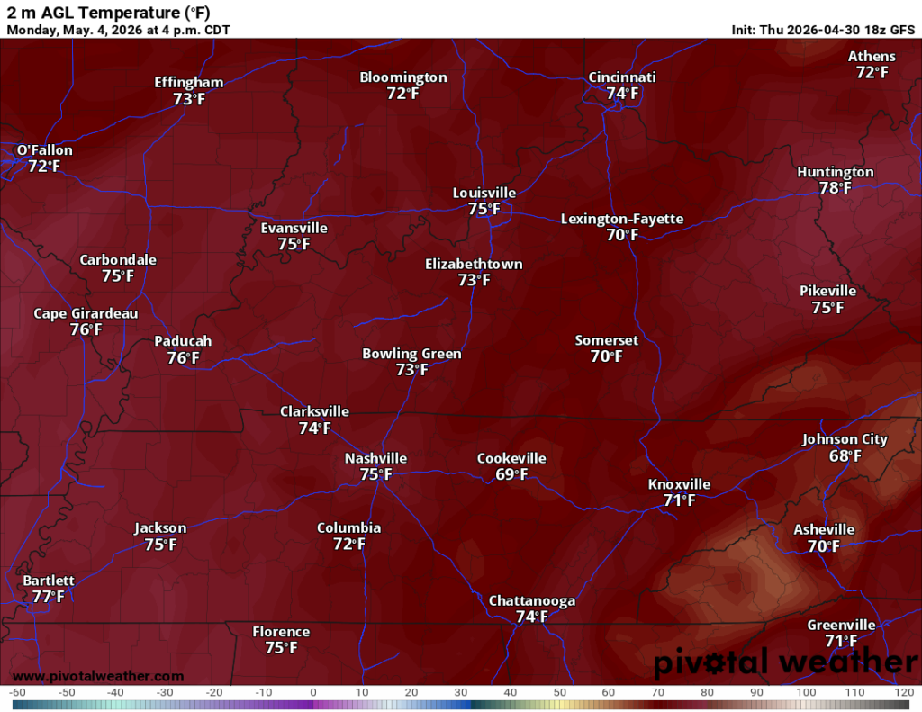
As we head into Monday, we’ll watch the first of those systems try to push into the region. This front will attempt to bring some warmth and moisture up from the south, but it won’t be quite enough. Despite the weaker flow, we’ll still get highs up into the middle 70s as we watch showers and storms trying to push through.
We’ll do the whole thing again on Tuesday as another system tries to scoop some more moisture up, but it’s not going to have an easy go of it.
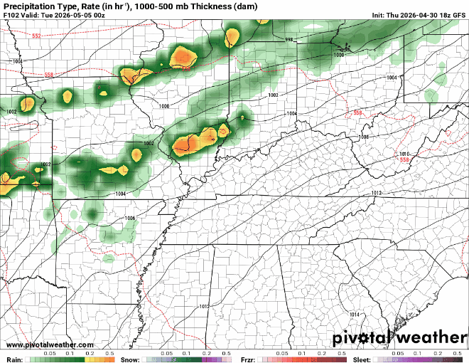
I can’t rule out some spotty showers or storms, but otherwise, we’ll see highs back near normal, back into the middle 70s during the afternoon hours. Low to mid 50s look to be the target low temp for Tuesday night as another system getting going across the southern plains starts increasing the moisture and throwing some clouds our way.
Heading into the middle of next week, we’ll have to keep an eye on the potential for even more showers and storms, some of which could be strong. Early indications are the wind energy may be in place, just waiting to see if we can get the storm fuel up to snuff. One would think with highs in the upper 70s, it would be there, but models aren’t so sure. It’s something we’ll watch closely as we head into next week.
That’s it for me for now! You can always keep up with the latest on all of our social media platforms. Have a tremendous day and a great weekend!