

Good Monday morning, WABBLES! The month of March is finally underway, and despite the calmer conditions we’ve had to close out February, more active weather returns to kick things off. With multiple large-scale systems possible over the next four weeks, we’re keeping an eye on the skies with our first opportunity at seeing some rain and scattered thunderstorms Tuesday night into Wednesday morning. We’ll dig into all the latest details together in today’s forecast blog!

Today’s Forecast
Compared to the midweek, Monday’s forecast is looking quite a bit more relaxed! Folks across WABBLES should expect to see high temperatures top out around the mid-upper 50s this afternoon, with bright blue skies and ample sunshine available all day. Cloud cover will increase overnight tonight as we drop down into the low-to-mid 40s, and by Tuesday morning we’ll be looking a lot more overcast as our next storm system approaches from the west. But despite our looming incoming weather, our Monday looks great! Get outside and enjoy some of that warm March sunshine before it’s too late!

First Week of March Forecast?
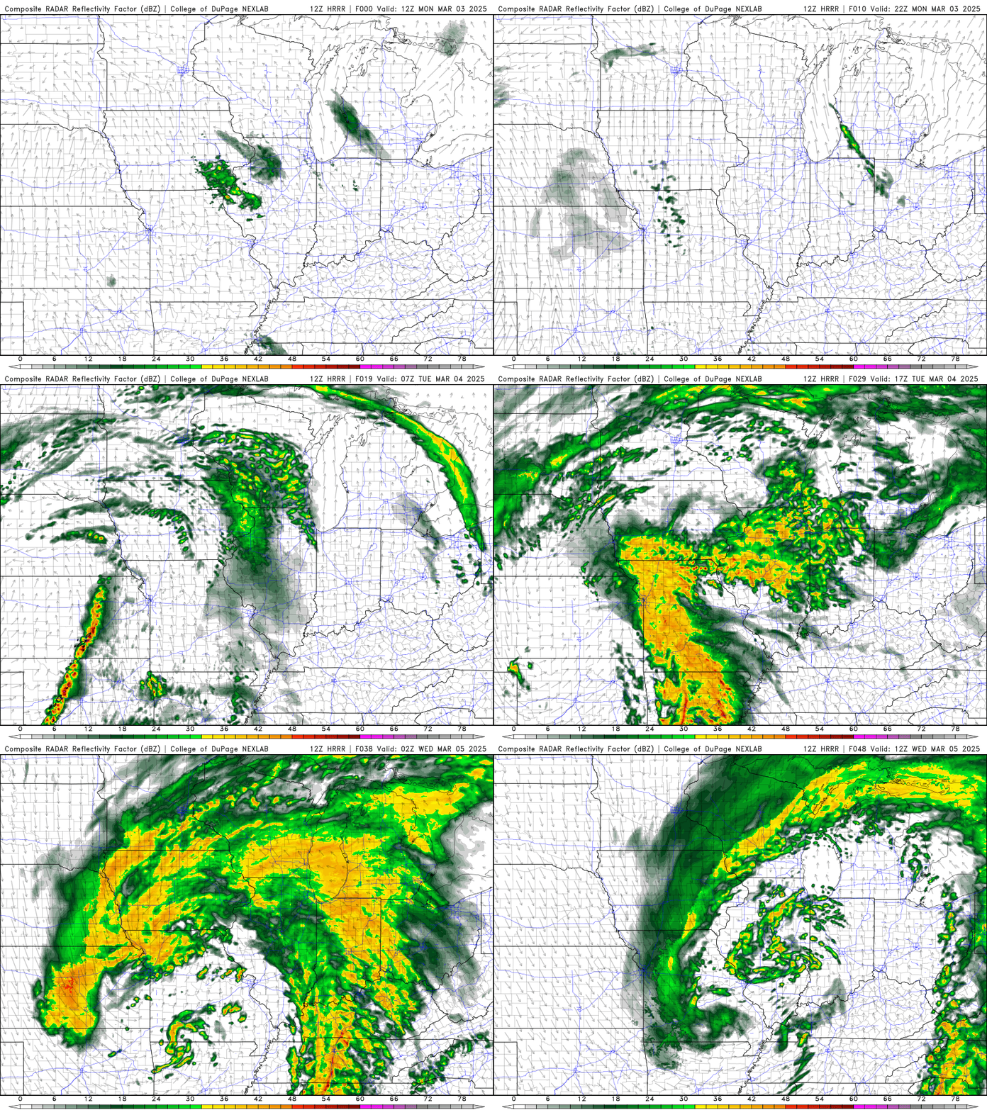
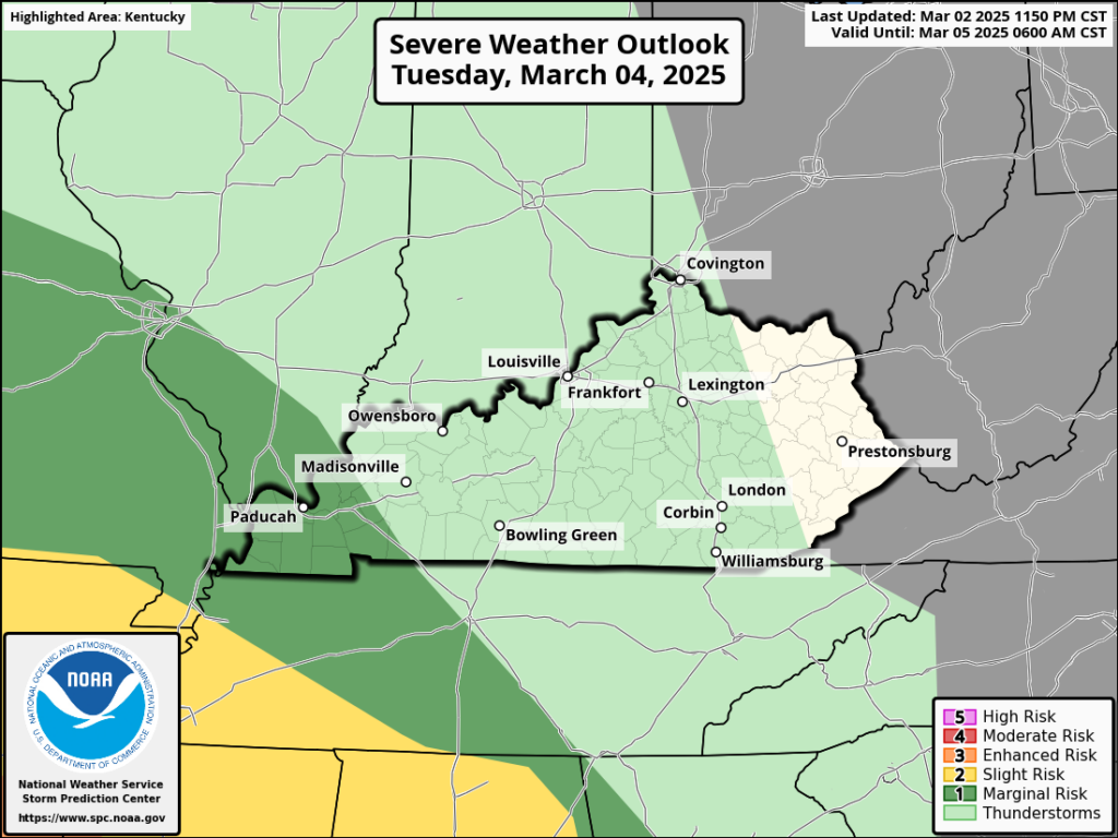
Unfortunately, conditions do deteriorate a little bit as we get into the midweek. Our next big weather system will take shape over the southern Great Plains around midnight Tuesday, and slowly progress eastward towards WABBLES throughout the day. The bulk of the severe weather associated with this large midlatitude cyclone is currently expected to remain off to our south, but heavy downpours, strong winds and some small hail may be possible late Tuesday night as this strong system arrives in WABBLES.
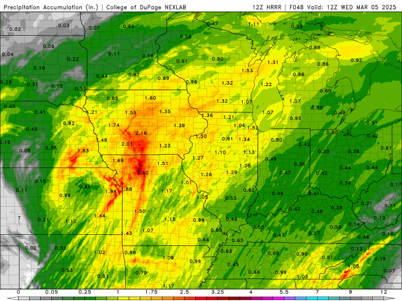
The good news is that we’re hopeful we shouldn’t see any significant flooding concerns with this system after all the rain we had back in February. The bulk of the precipitation with this system will occur far off to our west, so folks across WABBLES should expect to see around a half inch of rainfall between now and when the majority of this disturbance moves off to our east on Wednesday morning.
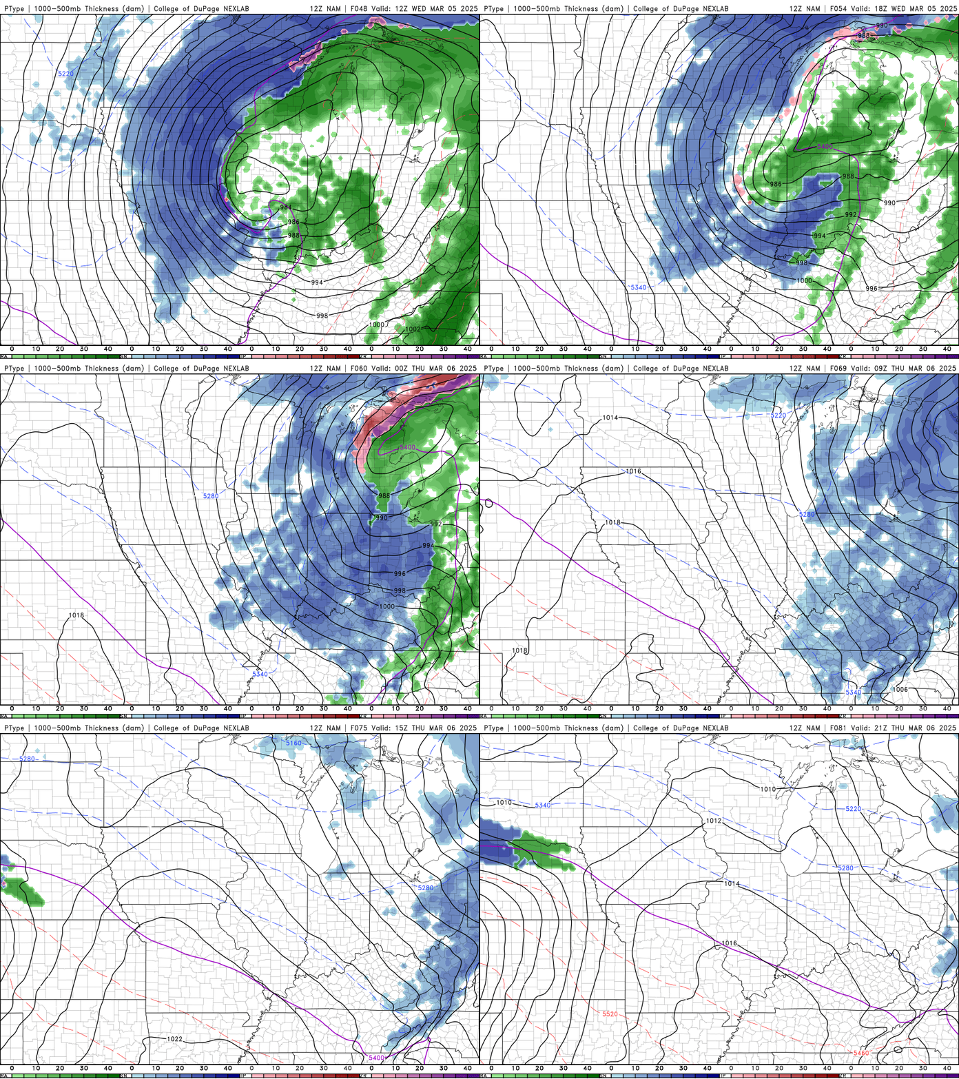
And if things weren’t exciting enough, some of us may even see some snow showers Wednesday night into early Thursday morning as the system fully exits WABBLES! With temperatures dipping near freezing as the cold front passes through, any lingering moisture may end up falling as wet snowflakes overnight. Unfortunately for those of us who already miss winter, nothing is expected to stick at this time, as our rain-soaked pavements won’t quite be freezing at this point, but don’t be shocked if you see a bit of wet snow before you head to bed Wednesday night!
All this to say… we’re looking forward to a pretty active March. Once this midweek system departs, we’ll have about a day and a half of calmer conditions before a second disturbance arrives to cause trouble in WABBLES. Rain returns for the weekend, setting us up for a pretty hectic next few weeks! The Climate Prediction Center has caught on to the same idea, so it’s no surprise WABBLES has been included in an area of above average precipitation expected through the next 8 to 14 days.

That’s about all we’ve got for you today, folks! Keep those rain jackets and umbrellas nearby, because we’re in for a busy start to spring across the region. No need to worry, though: we’re here at wxornotBG to be with you every step of the way! Before the rain starts, make sure you’re keeping up with us on Twitter, where we post frequent updates on the WABBLES daily forecast. Otherwise, keep dry out there y’all, and stay weather aware!