


It has been a soggy week around WABBLES as our active pattern rolls along. We had a bit of a break yesterday, but another system is here to knock on our doorstep and give us another soaker as we head right on into the weekend.
Easing Into the Weekend: Friday and Friday night
We’re watching a trough of low pressure pivoting into the area early this Friday morning. That’s interacting with the Gulf moisture we’ve had streaming into the region late this week to produce showers as we head through the morning and into the afternoon.

Conditions aren’t really right for severe weather, but we could see some heavy rain at times. This looks to be especially true as we head into Friday night. So if you have Friday night plans, make sure they include umbrellas, boots, or coats. Or some combination of the three. Just be yourself.
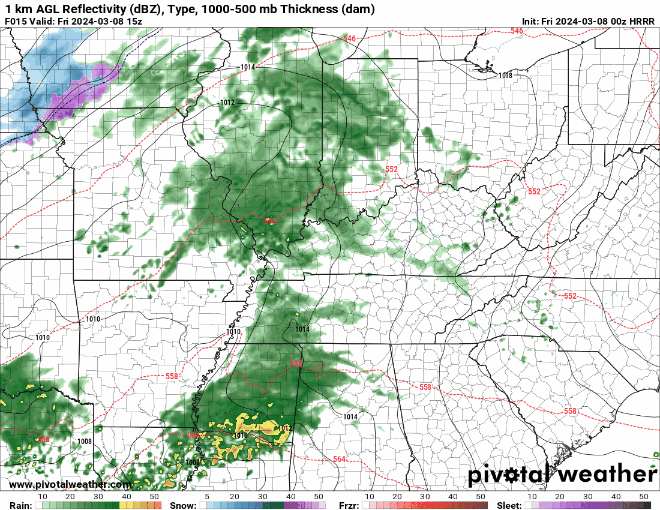
Highs stay somewhat mild for this time of year with highs in the middle 60s during the daytime hours. Clouds and showers overnight only drop us back into the lower to middle 50s for a nighttime low.
The Weekend: Saturday and Sunday
Bit of a half and half look as we head through the bulk of the weekend.

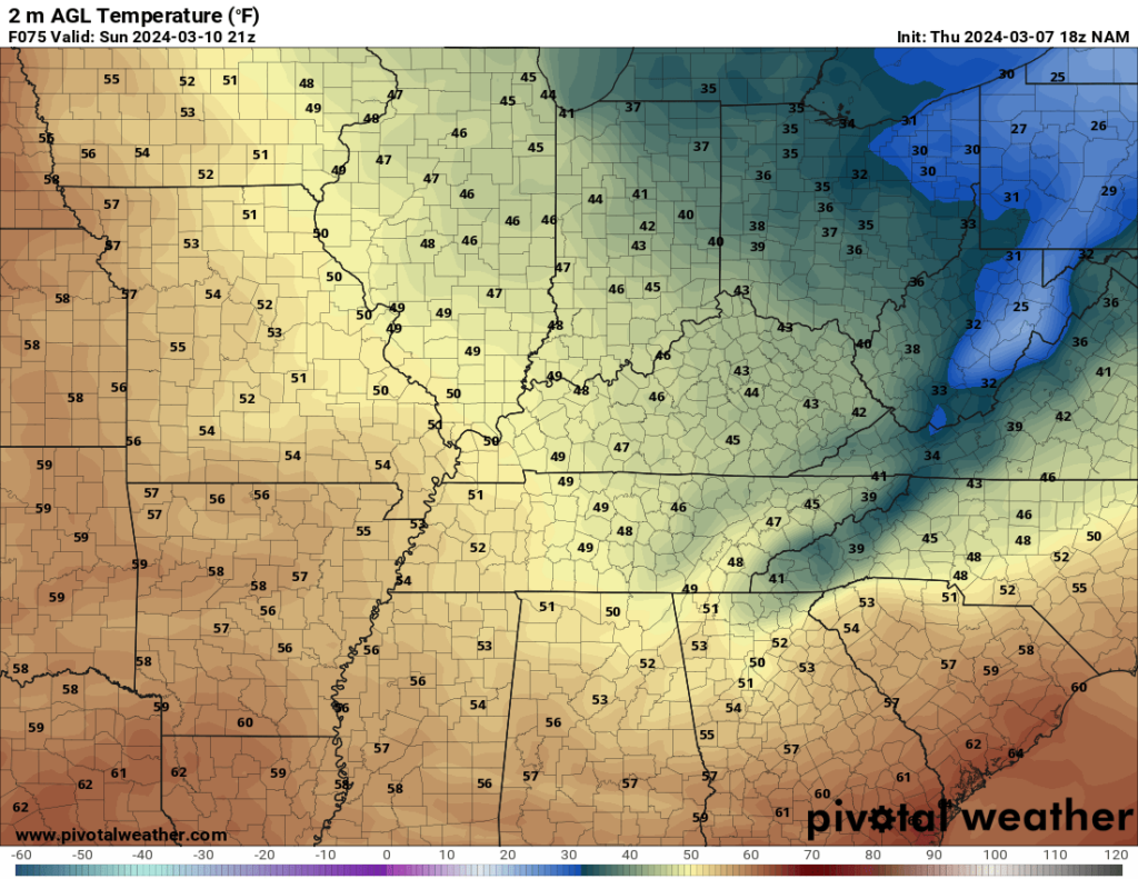
We’ll keep the showers around as our frontal boundary is interested in taking its sweet time to push through the region. I can’t rule out some periods of heavy rain or even a little bit of thunder with these, but again no severe weather is expected. Daytime highs stay mild as well, as we top out in the lower to middle 60s. Yes, that’s even with the clouds and the showers in place. Overnight, we’ll start to clear the rain out, but clouds will hold steady. Even so, we’re back into the middle 30s overnight.
By Sunday, things are looking nicer around WABBLES…but we’re also looking cooler.
You can thank high pressure settling into the region and those northwesterly winds keeping us cooler than we’ve been recently. Highs only make it into the lower 50s at best as we roll through the end of the weekend. Clouds continue to clear out overnight as lows slip back into the lower 30s.
Beyond the Weekend: Into Next Week
Another week to go with the flow, at least to start.
We’re taking a more straight up west to east flow across the eastern third of the nation for the early parts of next week. That should keep us dry, but also warming up…so excellent for the second week of March!
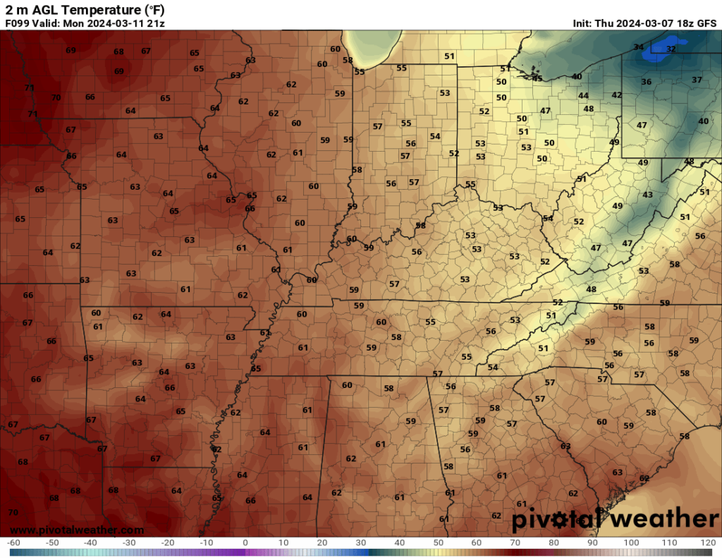
Oh, yes, improving temperatures are expected to continue as we head toward the middle of next week. Sunshine will help us get into the upper 50s to near 60º on Monday, with clear skies overnight keeping us seasonably cool near 40º. Even better on Tuesday as highs yet again flirt with 70º or so! We may start seeing a few high clouds try to sneak back in, but dry skies continue with lows in the middle 40s overnight.
We may see some showers try to sneak in late next week, but that is certainly still up in the air. For now, prepare for some soggy conditions as you head out tonight.
That’s it for me for now! You can always keep up with the latest on all of our social media platforms. Have a tremendous day and a great weekend!