

Good Tuesday Morning to everyone out there across WABBLES. I hope everyone enjoyed the beautiful weather yesterday because the next couple of days likely won’t be as nice.
Severe Storm Chances
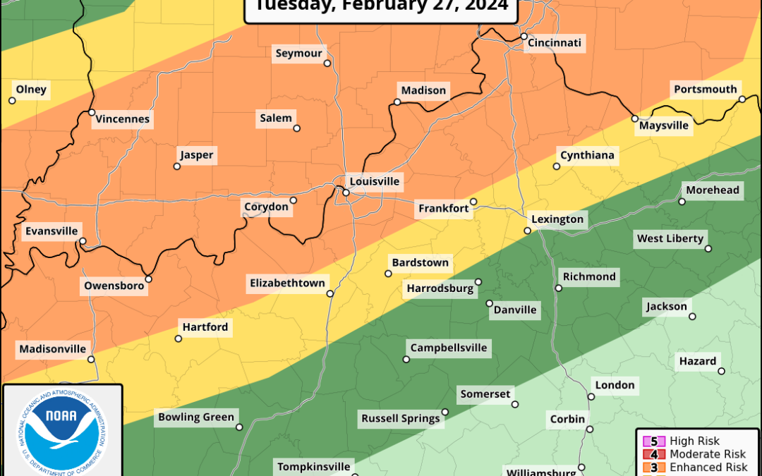
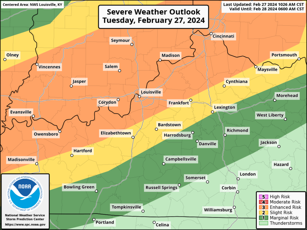
The SPC has WABBLES in a Marginal (level 1/5) to Slight (level 2/5) Risk. The primary hazard will be for the usuals: damaging winds, hail, and brief tornadoes.
In terms of a model analysis, they are still rather all over the place with the overall evolution of this system which makes for a very tricky forecast. This is especially the case for areas north of WABBLES in Illinois and Indiana.

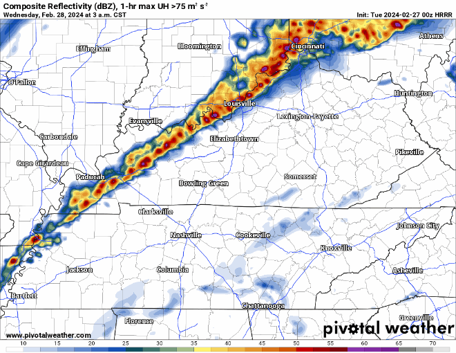
Thankfully, although still a little disagreement still exists, models seem to be more consistent with our potential threat across Kentucky. The best idea right now is for a weakening squall line to move through WABBLES in the 4:00-8:00am timeframe with large hail being the main threat, but damaging winds and tornadoes cannot be completely ruled out.
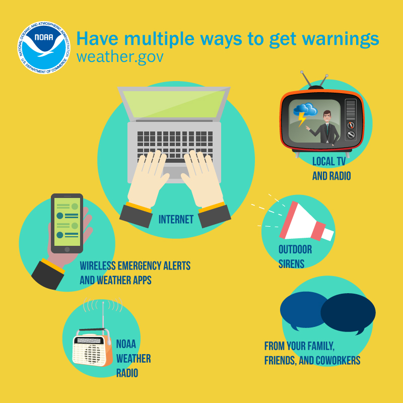
With this timeframe it is essential to have multiple ways to receive warnings, regardless of how low a chance. Cell phones and weather radios are the best with the COWS being the last resort.
The analysis of our predicted environment is where things get interesting in tricky. I am very confident in a line of “activity” moving through WABBLES. Whether or not it is in the form of gusty showers, thunderstorms, or strong to severe storms is the million dollar question.

We will undoubtedly have enough of a lifting mechanism to get things going in the form of the cold front, that I am confident of.

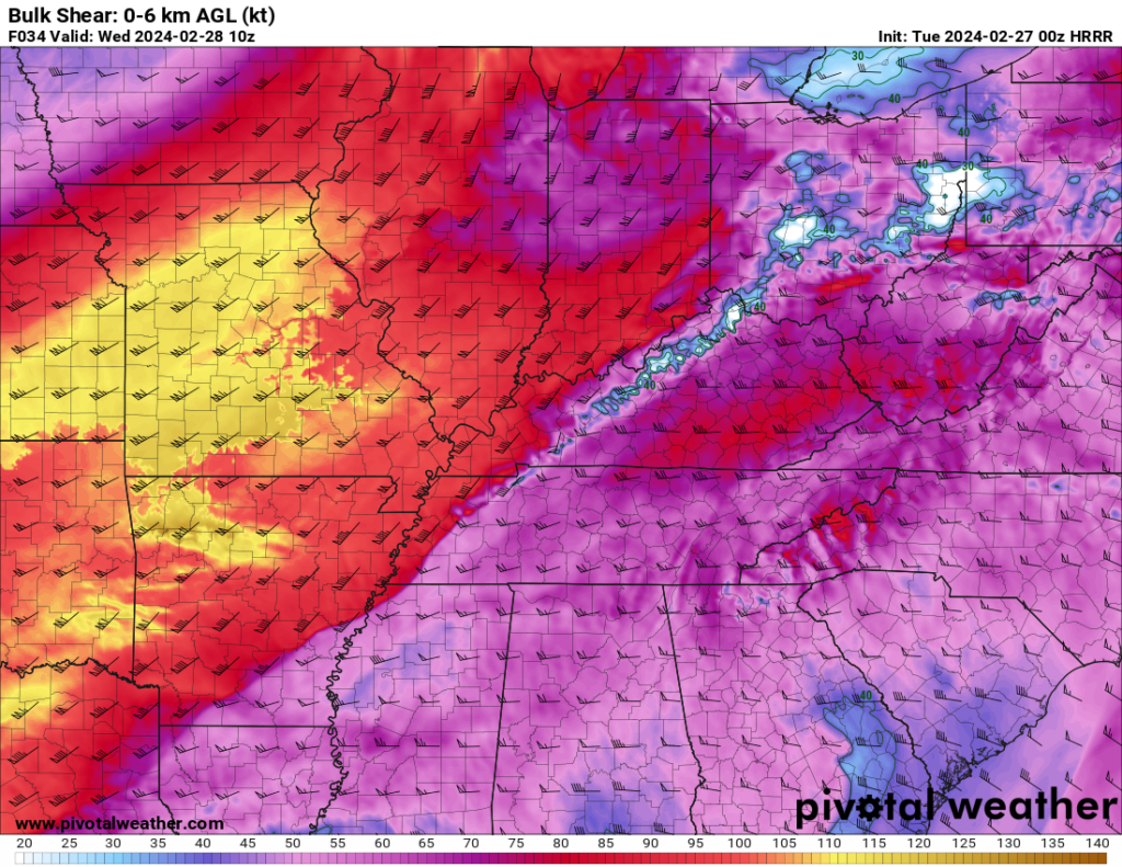
Our wind shear will also be sufficient for strong to severe weather with 0-6km bulk shear in excess of 50 to even 60kts. This is an impressive, but not uncommon in the colder months, amount of shear. But, without the next ingredients, it doesn’t mean much.
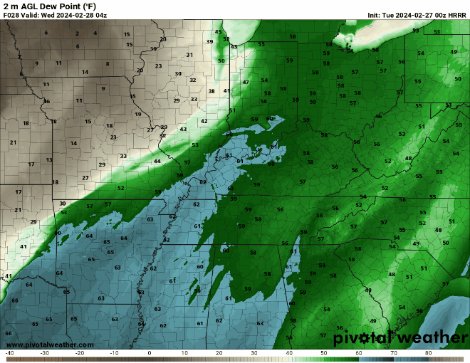
In the hi-res model runs a situation where we get a brief surge of >60 degree dew points just before our activity in question moves through WABBLES. This, in theory, will provide an atmosphere capable of holding and producing more instability.
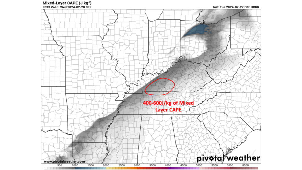
Looking at an actual instability parameter, models are depicting ~400-600J/kg of ML CAPE through WABBLES. This is sufficient for a severe weather risk in late February, but it is right on the line of being barely enough and if we don’t see those >60 dew points, those numbers are likely overdone.
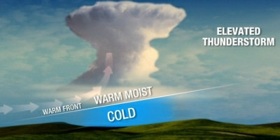
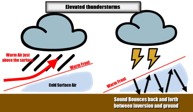
Even if we get sufficient CAPE, there is still another big obstacle (almost literally) storms will need to get through to have a solid chance at being severe. That obstacle is the fact that these storms will likely be elevated in nature which typically “shields” the surface from seeing damaging winds and kills tornadic and overall severe potential.
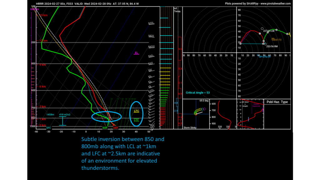
A look at a forecast sounding over WABBLES explains this a little bit better. So, even if we get all other ingredients to produce severe weather, they will then need to break through the stable layer near the surface to really have a chance at being severe. This is certainly possible with the strongest parts of the line, but overall have a low probability of happening.
The biggest impact with elevated thunderstorms is the volume, as the thunder is typically much louder compared to other thunderstorms, and hail. Hail isn’t dependent on storms mixing in close to the ground and isn’t uncommon with strong elevated thunderstorms.
In Conclusion:
- Expect a line of weakening thunderstorms in WABBLES between 4:00-8:00am Wednesday Morning.
- Thunderstorms will likely be elevated leading to hail being the main threat and non-zero severe threat (damaging winds/tornadoes).
That will be all for today, folks! This is a very dynamic and ever changing forecast so I strongly encourage everyone to visit our social media accounts @wxornotBG for the latest on the situation.
Have a blessed day!