

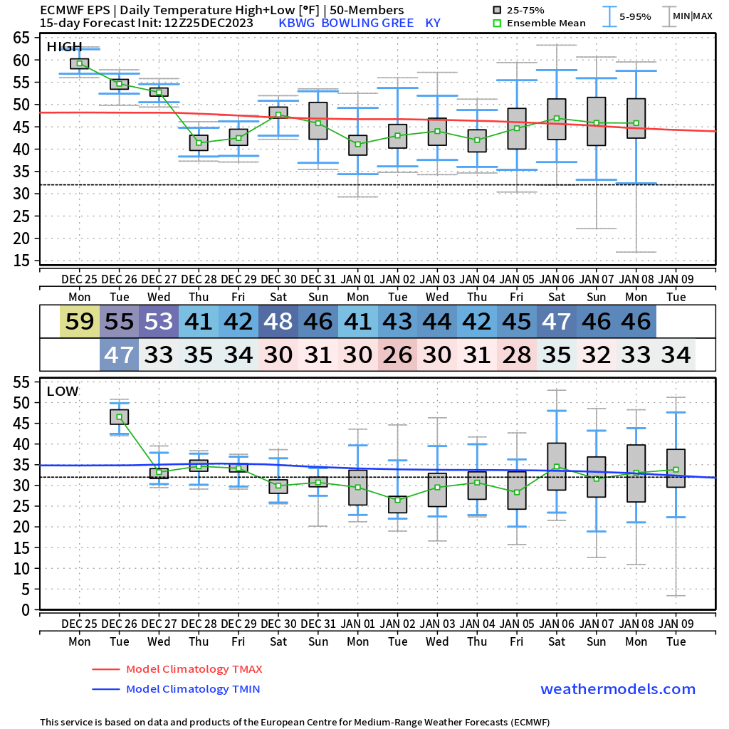
Happy Tuesday to everyone out there across WABBLES! I hope everyone had a great Christmas, even with the warmth and rain. The weather looks to stay interesting and turn cold as we get close to 2024 with an active pattern setting up.

Short Term
The weather today looks to remain very boring with more warmth (highs in the mid 50s) and stubborn low level clouds. Serious rain chances should remain off to the east of WABBLES.
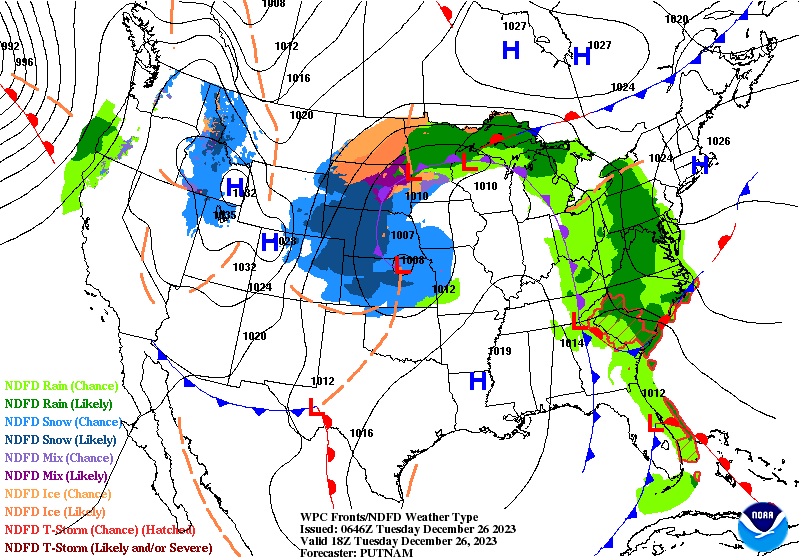
Wednesday should be very similar to today with highs in the lower 50s and scattered clouds. Wednesday night, however, showers will begin to move in from the west.
Thursday – Friday
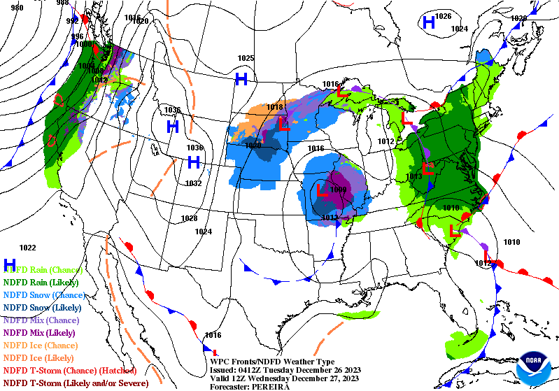
Thursday and Friday will serve as the best chances for impactful weather this week. Another cold front will pass through WABBLES which will bring rain and some chances for wintry precipitation to mix in.
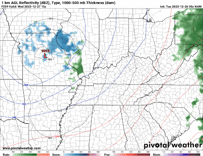
The wintry side of this front is still uncertain, confidence is fairly high that areas of WABBLES will see snow. But, temps during the day will be well above freezing both days leaving Thursday night hovering around freezing.
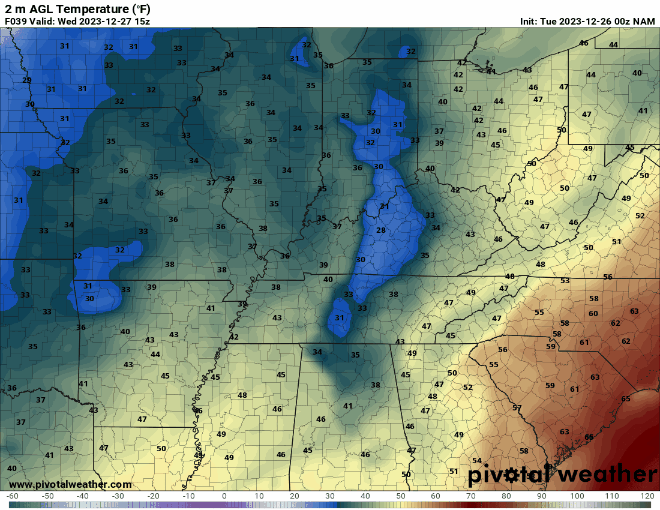
Any accumulating snowfall will likely be the result of snow showers overnight or in very heavy pockets of snowfall during the days. At this point, impacts look to stay minimal with temperatures as high as they will be.
Exact details will become more clear over the next 36 hours and that will help determine exactly how impactful this system will be.
Long Range PAttern
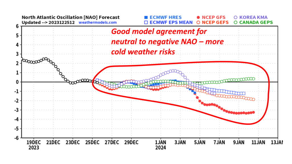
The long range discussion will mainly be about the cold pattern flip coming up as we move into January and any storm threats.
Starting off with teleconnections, the NAO continues to show a neutral to negative pattern over the next couple of weeks. Several models are hinting at a dip further into negative after the 5th timeframe. This is consistent with a colder pattern.
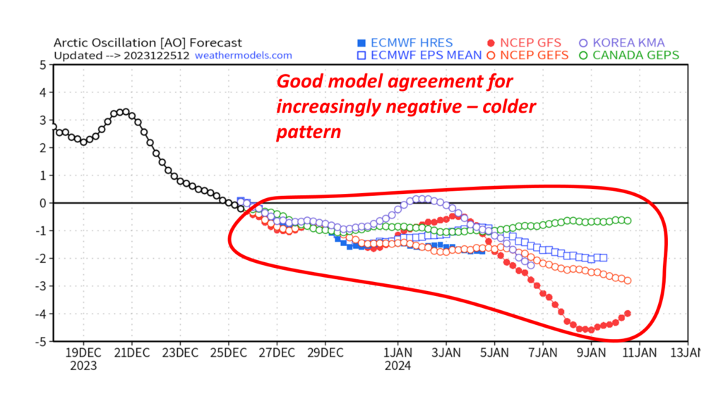
Looking at the Arctic Oscillation (AO), conditions look to gradually become more negative over the next few weeks. This and the NAO point towards a setup in the Atlantic to support a cold weather pattern for WABBLES.
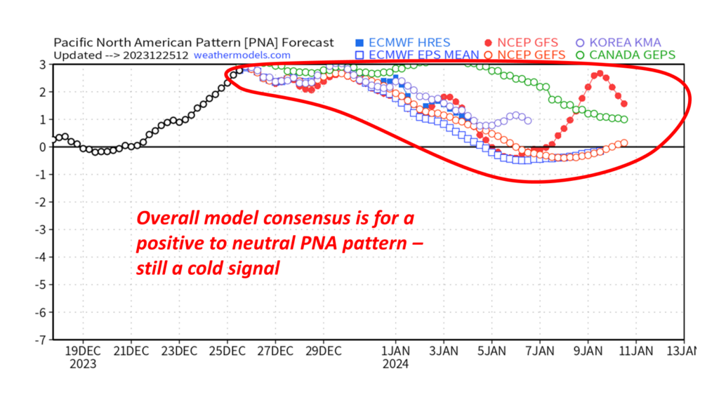
Switching to the Pacific, the PNA should remain in its positive phase (cold phase) until the new year where most of the models have it transition to more of a neutral to barely positive phase. Overall, still a cold signal but that dip towards neutral is concerning for the longevity of a cold weather risk.
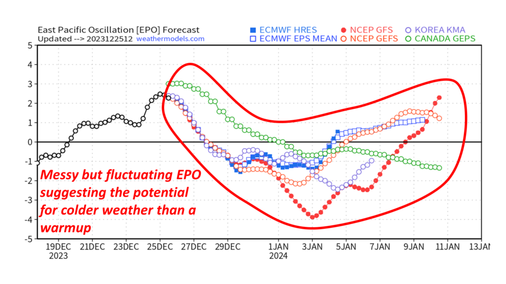
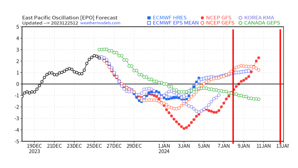
The Eastern Pacific Oscillation (EPO) is a bit interesting with the models having an erratic solution, but a fairly noticeable pattern. That pattern being a transition to its negative phase (cold phase) just before new years and lasting until about the second week of January.
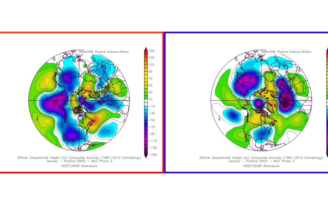
Finally, looking at the MJO, it appears that we will definitely be in the cold phases (phases 2 & 3) to start January. The question is how long we will remain in those cold phases.
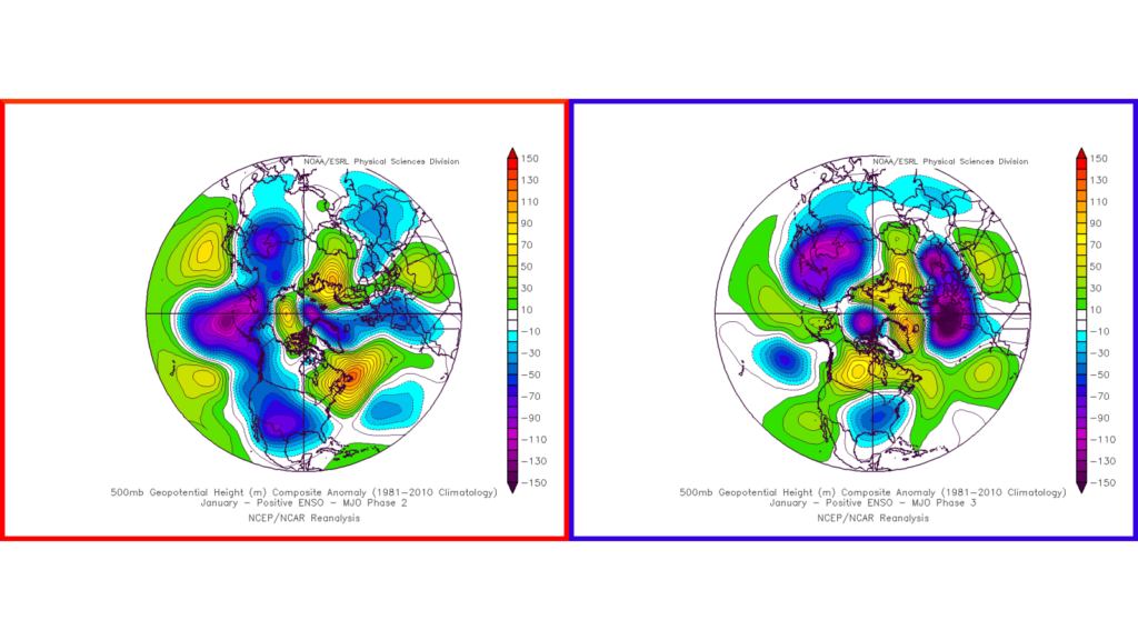
The European model is suggesting we move into the warm phases of the MJO as soon as the 10-12th of January. The American model is suggesting a slower solution where we don’t move to the warm phases until around the 14-16th of January.
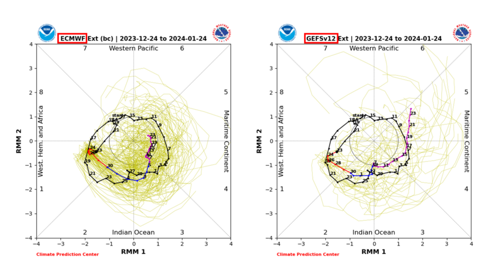
The Pacific Teleconnections suggest the European is on the right track with a quicker warmup in January. The Atlantic teleconnections don’t quite agree but generally if the teleconnections aren’t all giving a colder solution, it isn’t likely.
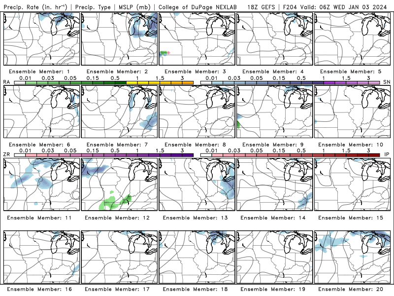
Switching over to the storm tracking side, models have been hinting at some sort of disturbance, or disturbances, around the 4-10th of January. This is in our expected timeframe of cold air, so the potential for this system to have a wintry side of things is justified.
Deterministic models don’t quite have a grasp on what this could look like, but almost every ensemble member of the GEFS has activity around WABBLES in the above timeframe. One of the problems, however, is that they’re all erratic in terms of threats and timing.
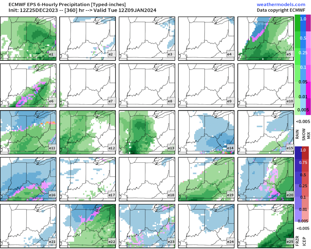
The majority of the EPS ensembles also support activity in the above timeframe. This ensemble, too, is erratic with timing and threats. But, it is a good sign that something is brewing with our pattern change.
In Conclusion:
- I am still confident a cold pattern is coming, but unsure how long it will last – likely warm up around mid-January.
- Ensembles are hinting at activity between the 4th and 10th of January – unsure if this is one system or more – potential for wintry weather with this system or systems.
That will be all for now folks! I hope everyone had a great Christmas and enjoys the rest of the day. I encourage everyone to visit us at our social media accounts @wxornotBG for the latest weather updates.
Have a blessed day!