

Happy Tuesday Morning my friends! I hope everyone around WABBLES is having a great week so far and that everyone is enjoying the welcome to Fall. Fall temps will continue through this week along with some late week rain on the way.

Beautiful Fall Weather
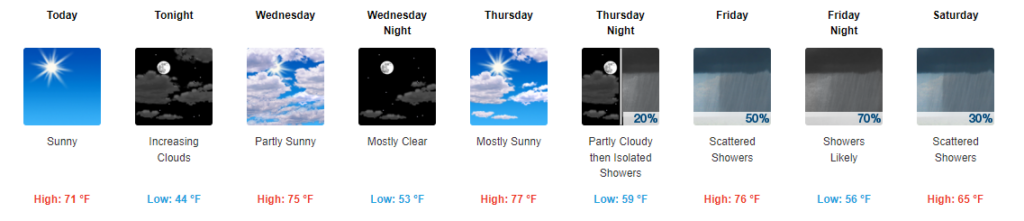
The start of our forecast is quite easy and quite nice for those that love Fall. Today will feature clear skies, thanks to high pressure, with highs just breaking into the low 70s. A beautiful day to get outside and around WABBLES.
Tomorrow will feature slightly warmer temps with highs in the mid 70s and increasing clouds as our high pressure begins to exit the region. Still, an overall great day for Fall lovers in WABBLES.
Thursday should be our warmest day of the week with a warm front approaching from the southwest. It will be the warmest day, but not by much with highs still hovering in the mid-high 70s. Clouds will be present as well, but not overwhelming.
The Return of the Rain
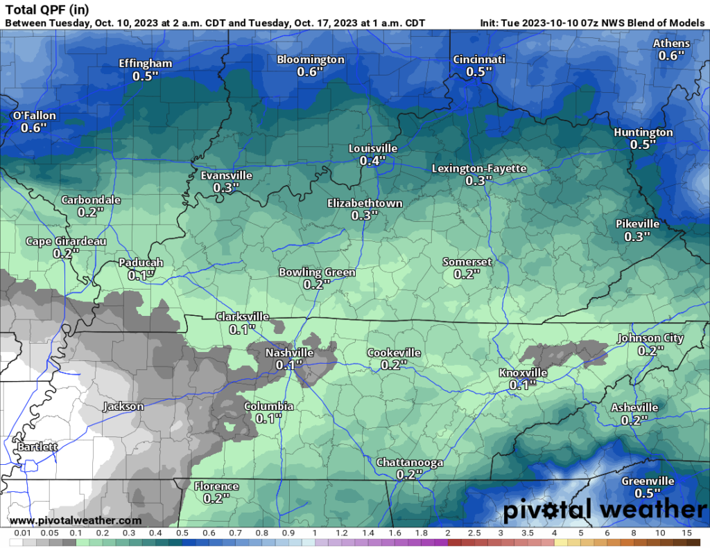
Starting Friday, a system will be moving through the Midwest with an attached cold front stretching down into WABBLES. This cold front will bring some rain chances for Friday into Saturday.
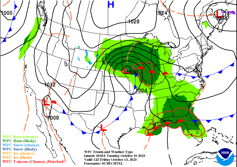
Currently, it is not looking like our rain chances will provide us with a WABBLES washout with models well under .5″ and a few below .25″ of rain. This rain will be annoying at the most it looks like.
More cold Weather to Come
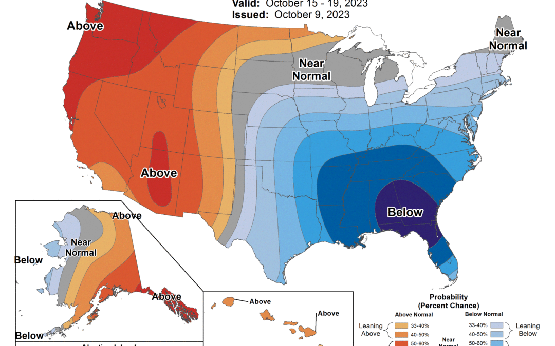
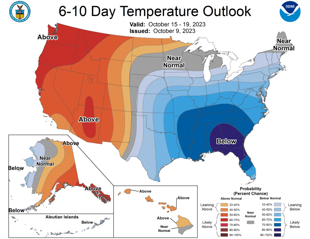
To end out this blog, lets take a look at the temperature outlook by the CPC for the 6-10 day timeframe. All folks that love colder weather are going to be in love with this outlook as below average temps are almost a guarantee at this point.
That will be all for this blog my friends! I hope everyone has a great rest of the week and enjoys the upcoming weather. As always I highly encourage everyone to visit us on our social media accounts @wxornotBG.
Have a blessed day!