

Good morning to all you fellow WABBLErS! Buckle up for a weather rollercoaster as we take a look at your forecast over the upcoming days. We’ve got plenty to talk about, including severe weather chances, flooding, and finally…sunny, quiet conditions!
Today through Thursday: Stormy Skies
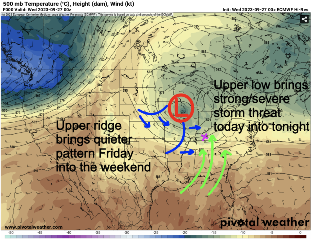
An upper-level low to our north is set to send numerous rounds of showers and storms through the region starting today, lasting through much of Thursday. It’s like a never-ending game of weather whack-a-mole!
Outside of the activity, conditions will be warm and muggy under partly sunny skies.
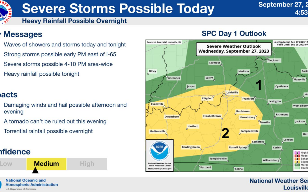
Severe Weather Risk: This Afternoon into Tonight (3pm – 10pm)
Pay close attention this afternoon into tonight as there’s potential for severe weather. From 3 pm to 10 pm, we’re in the danger zone. Our primary concerns include damaging winds that can topple trees and large hail that could make you rethink your choice of a parking spot for your car. There’s also a low-end tornado risk not to be taken lightly.
Flooding Concerns: Late Tonight through Thursday
Once the severe showdown is over, our focus shifts to potential flooding concerns late tonight through Thursday. This is thanks to the possibility of “training cells” across our community. The HRRR model below, valid from 6am today through 1am Friday, illustrates the “training cell” concern nicely:
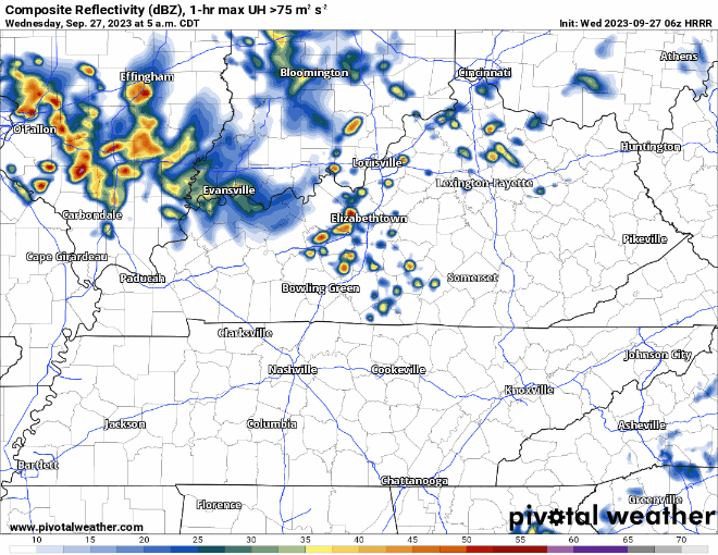
Think of it as rain showers/storms regenerating to our west, then marching in a single file eastward, causing rain to pile up quickly in locations they hit repeatedly. It’s essential to stay weather-aware and be prepared for the possibility of flooding. Total rainfall amounts will vary greatly, and could range anywhere from 0.5″ – 3+” before it is all said and done.
A Welcome Change: Friday through the Weekend
After Thursday’s weather drama, a shift is on the horizon, as we’ll be hopping off the weather rollercoaster. An upper-level ridge will work in tandem with high pressure at the surface, bringing a prolonged period of sunny skies and stable weather conditions.
Get ready to soak up the sun! Highs will settle in the low 80s, providing the perfect backdrop for outdoor activities. It’s like, the best weather for picnics and outdoor adventures. Overnight lows will dip into the mid to upper 50s, making for comfortable sleeping weather.
In summary, WABBLES is in for a weather rollercoaster for the remainder of this week. Today through Thursday, brace yourselves for numerous rounds of storms, including a severe weather risk and potential flooding concerns. After that, the skies will clear, and we’ll be treated to a stretch of sunny days with highs in the low 80s and refreshing overnight lows in the mid to upper 50s. Stay weather aware and updated with us @wxornotBG!