

Top of the morning to ya, WABBLES. As quiet weather continues here, Hurricane Idalia has strengthened to a Category 4, just as it’s making landfall on the west coast of Florida this morning.
We’re not expecting any major impacts out of this Tropical Cyclone, however, it’ll be worth keeping eyes on.
Cool And Comfortable
A reinforcing jolt of cooler, less humid air is on the docket today into tomorrow. This is thanks to the passing of a moisture-deprived cold front.
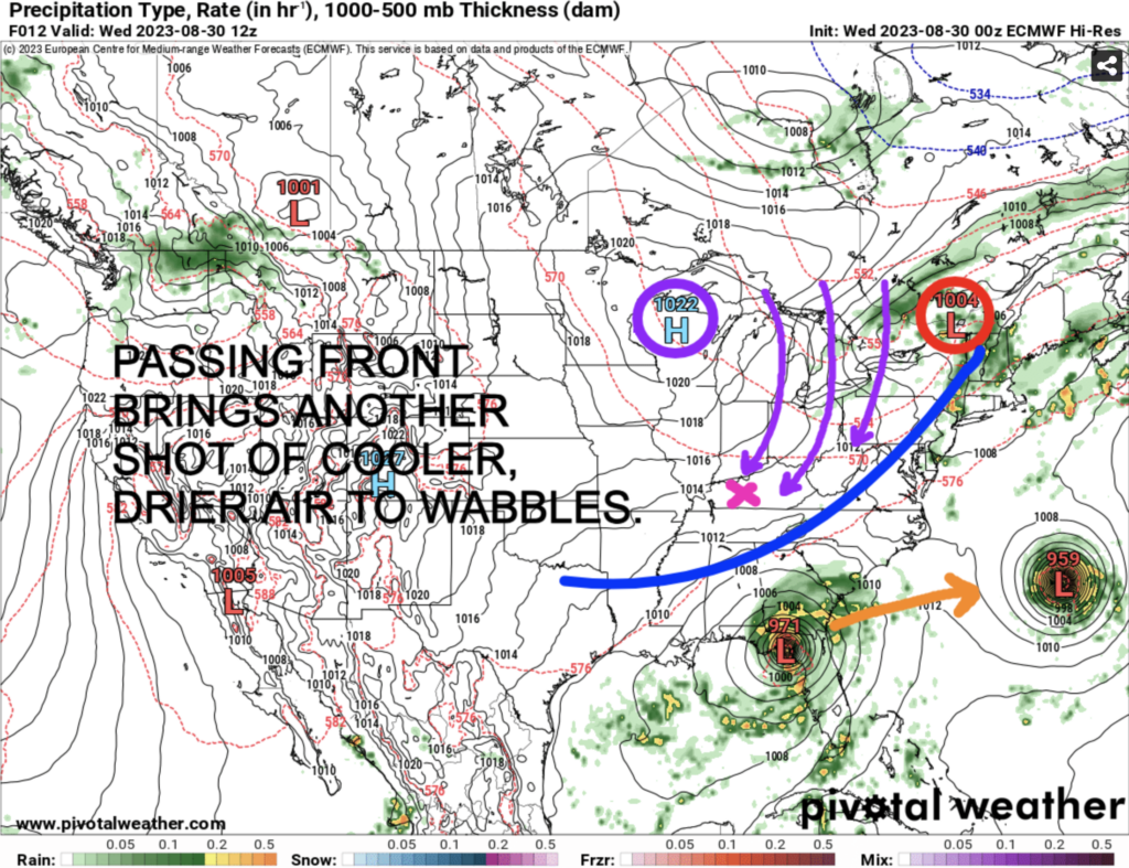
High pressure on the south side of the Great Lakes will churn a northeast breeze across WABBLES, making for picture-perfect conditions to enjoy the outdoors. High temps will be trapped between the upper 70s and low 80s both today and Thursday.
Please note that we may have to deal with periods of broken cloud cover, with the outer bands of Hurricane Idalia churning up into the lower Ohio Valley.
Heat, Humidity Returning
That area of high pressure will orient itself just southeast of us as we progress into Friday, and continue through the long Labor Day Weekend.
The good news is that our weather pattern will remain quiet. The bad news is that winds will turn out of the south, ushering in a hotter, more humid airmass throughout this time frame. Check out the upper ridge building into the region, illustrating the return of the heat:
Highs will jolt to the mid and upper 80s Friday afternoon, before making a run at the low 90s through the entirety of Labor Day Weekend. With dewpoints creeping back to the low 70s, some heat indices may push the mid/upper 90s.
Overall, not a bad forecast at all, considering it’s late August. Soak in the Vitamin D, and stay safe if you have any plans over the upcoming days. Stay up with the latest, as always, at @wxornotBG!