

Good morning to all of you across WABBLES, I hope everyone is having a wonderful morning so far. We had a stormy day across the region yesterday and excessive heat coming up.

Here come the 90s
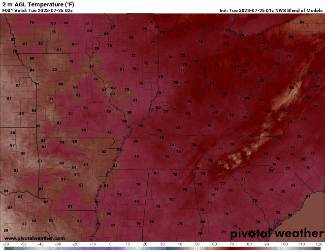
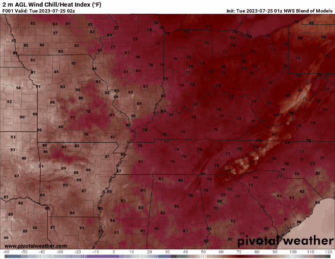
Starting as early as this afternoon, we will be seeing highs in the mid to upper 90s across WABBLES. This will last well into this weekend and gradually get hotter day by day.
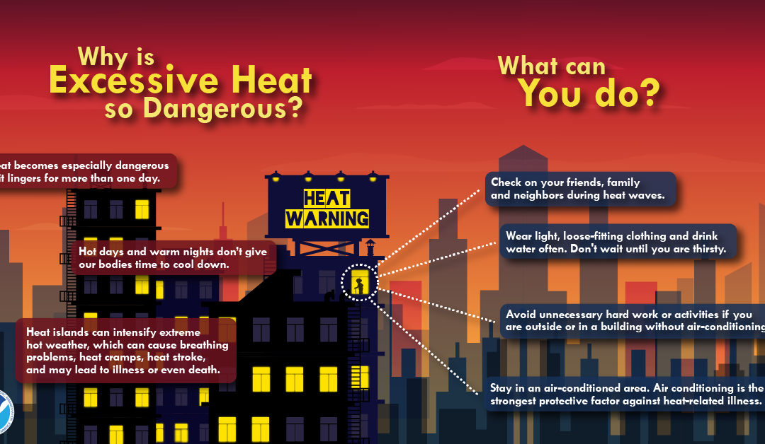
This heatwave will be, by far, the most impactful weather event we will see this week. So, it is important we talk about safety and when to get out of the heat.
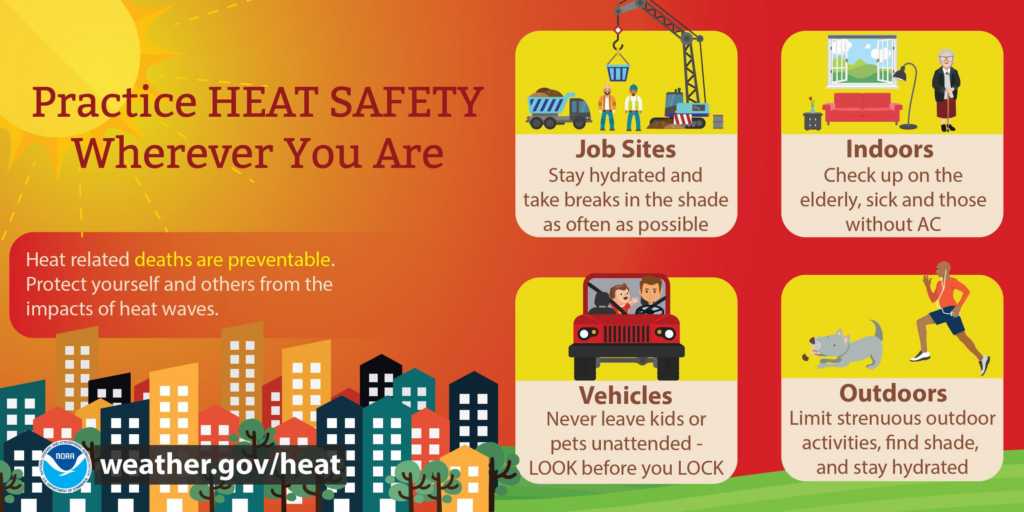
Outdoor activities can still be enjoyed, but it is important to limit how much you spend in the heat. Additionally, everyone needs to be sure to stay well hydrated to prevent heat illnesses.
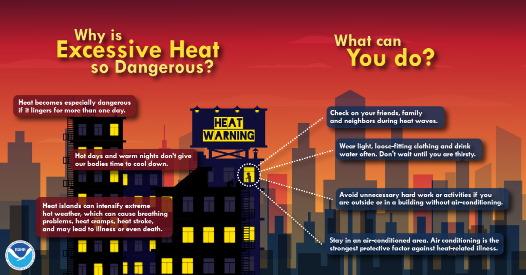
While actual temps will easily reach the mid to upper 90s this week, heat indexes will also break into the triple digits. This certainly will not be the worst heatwave in WABBLES history, but it’s still worth taking seriously.
Scattered Storms
Although we will be on the edge of a high pressure regime this week, temps and moisture content may get high enough to trigger a few pop up storms everyday.
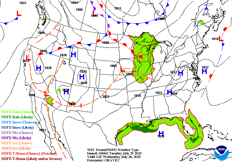
These should remain rather isolated and not be too strong, so an organized possibility for severe weather is not expected. These should remain the “garden variety” storms, should they develop.
With all that being said, folks, I hope everyone has a safe and enjoyable week out there. As always, for the most up to date information, I encourage everyone to visit our social media accounts @wxornotBG.
Have a blessed day!