

Good Sunday Morning to all of you across WABBLES! I hope everyone has been enjoying their very toasty weekend so far. I wish I was writing this blog with more fun news of quiet weather ahead, but such is not the case with the likelihood of strong to severe storms today and into tonight.
Current Conditions
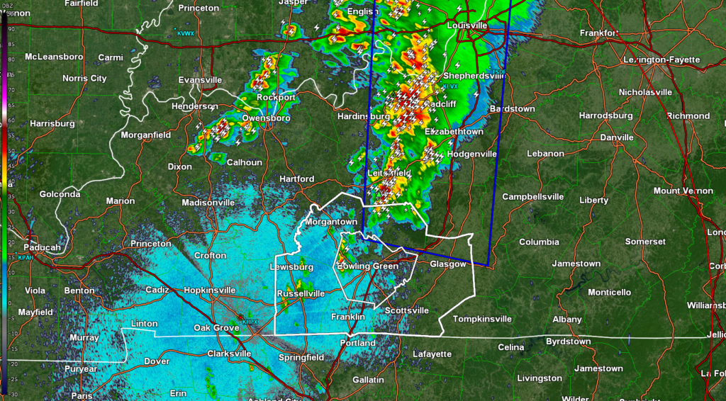
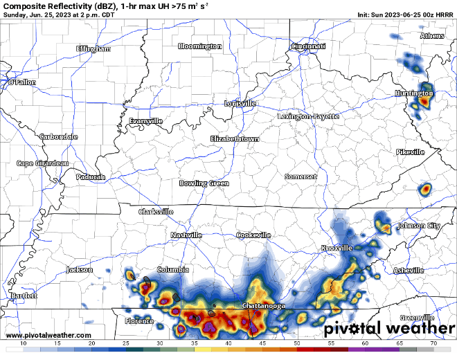
We are currently experiencing a few rumbles of thunder around WABBLES as we have the first round of storms for today well off to our north. These should scrape by and not have too much of an impact on WABBLES and be sub-severe.
What to Expect
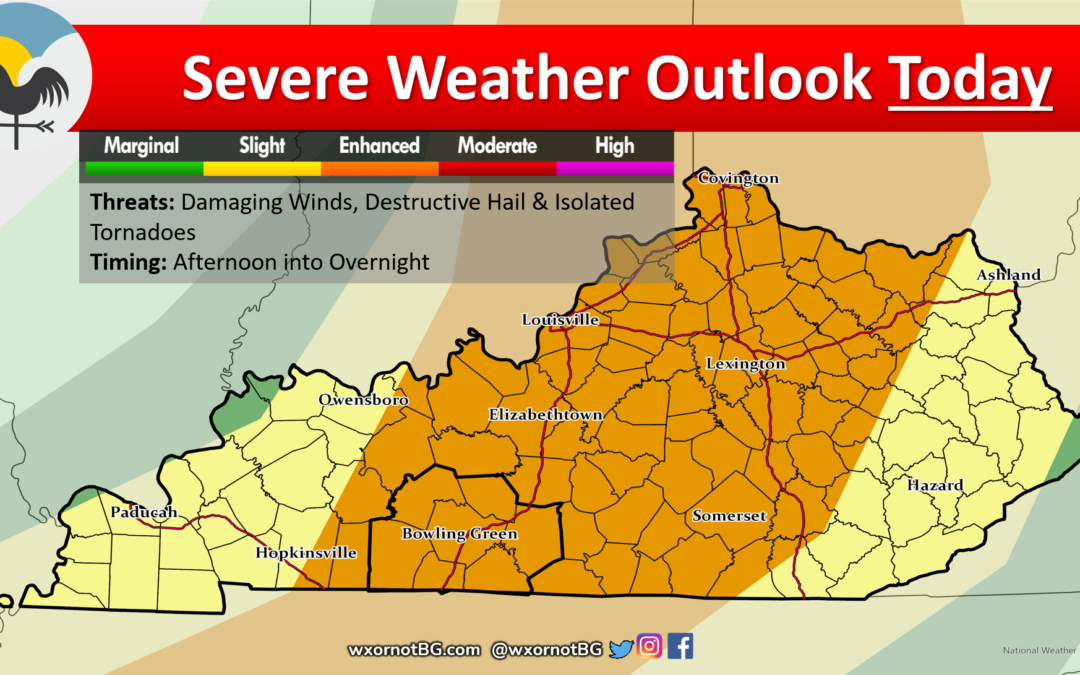
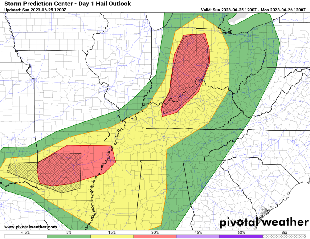
Starting off, the Storm Prediction Center has all of WABBLES in the middle of an Enhanced Risk (Level 3/5) for severe weather. The primary concerns for this event are for very strong to damaging wind gusts and destructive hail. Although not quite as large of a worry, tornadoes cannot be ruled out.
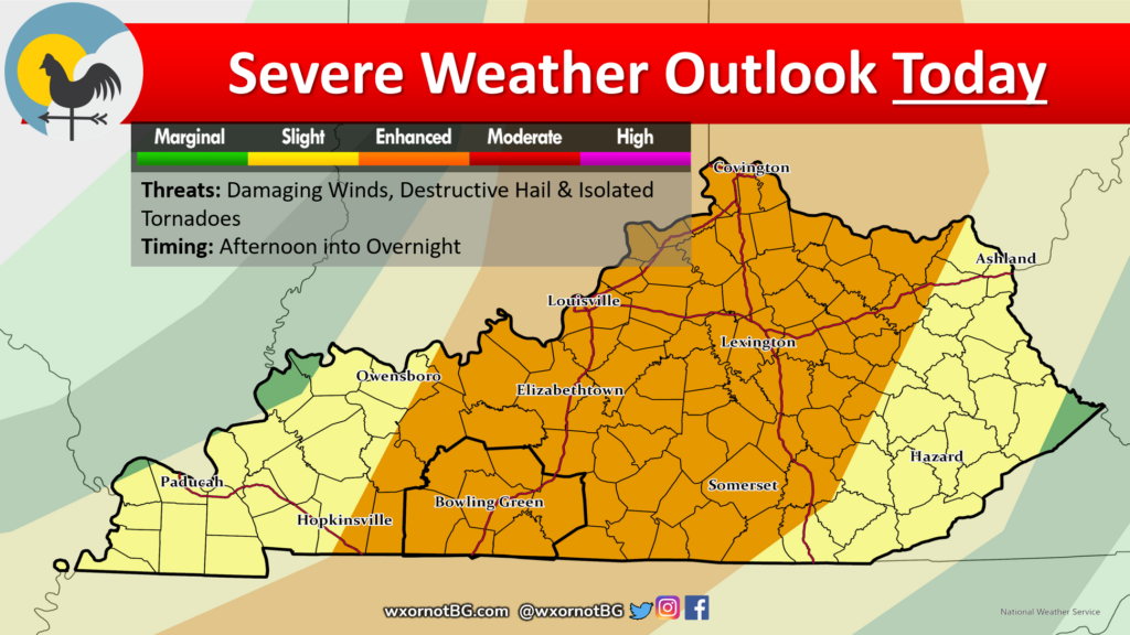
Model guidance has been a bit scattered in terms of exact timings for things to kick off. Using the knowledge of how setups like this usually play out leaves me to believe that the biggest threat window would be from the afternoon into the late evening.
Meteorological Discussion
Taking a deep dive into the meteorology behind this, we see an interesting setup is about to take place.
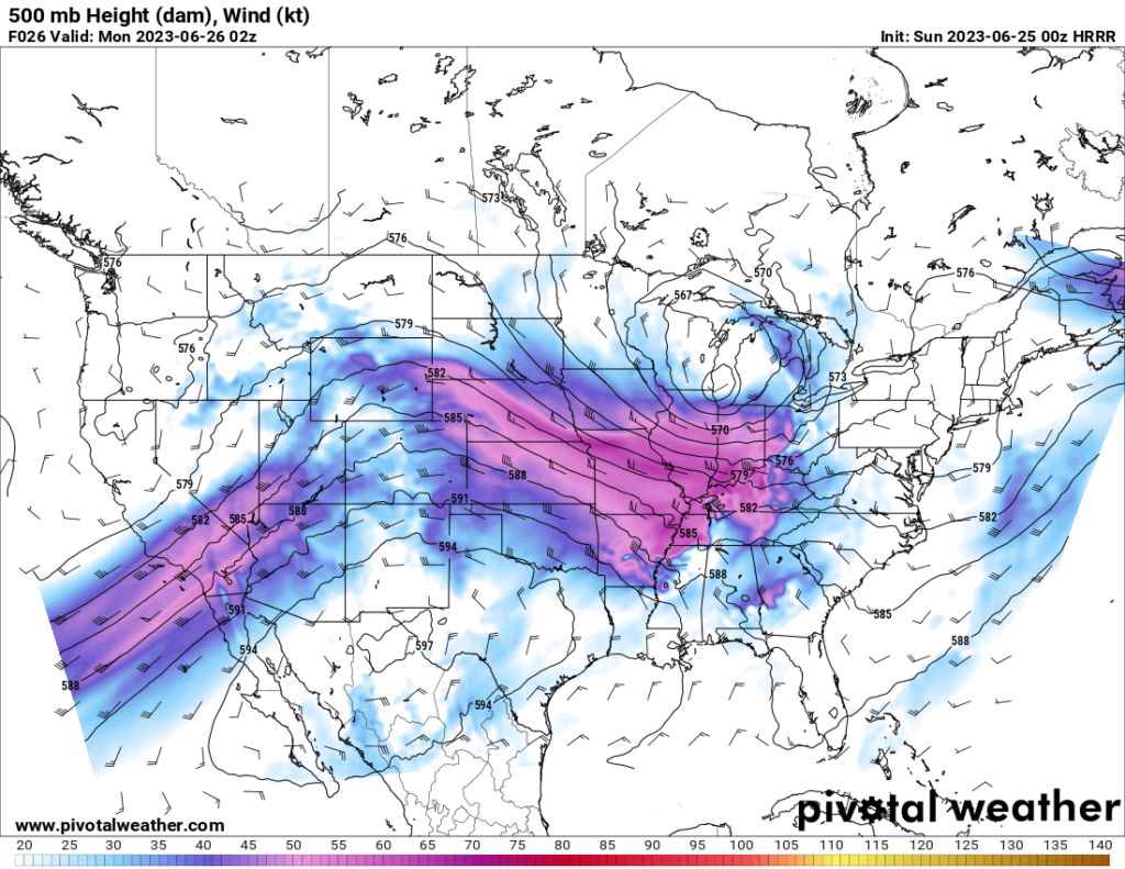
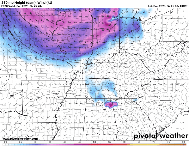
First and foremost, the jet stream has made a return which will be providing both structure and vertical motion to support storm development/initiation and growth. Although this jet stream is nothing like it is during Winter, it is more than enough for a summertime severe weather threat.
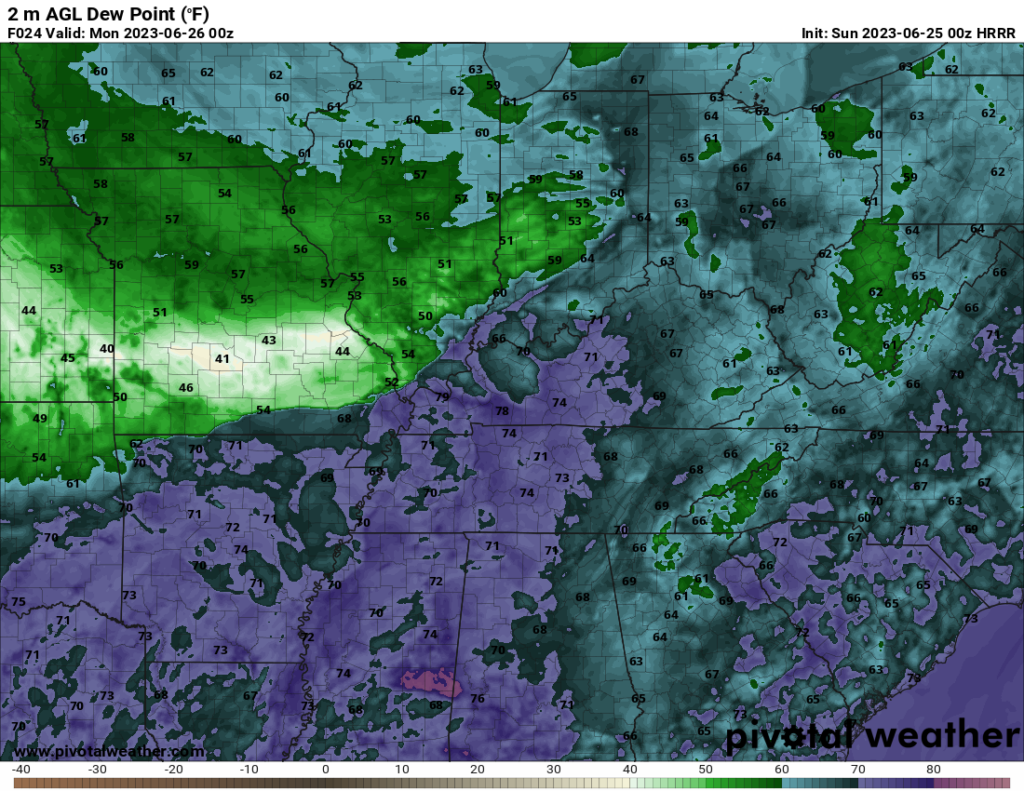
The temps are about what you’d expect for early summer, and the moisture for this event is going to be plentiful to give us a rich and soupy airmass. Perfect for storms and severe weather.
Our instability product, CAPE, looks to paint a picture of an extremely unstable airmass providing storms with enough fuel to cause some serious problems.
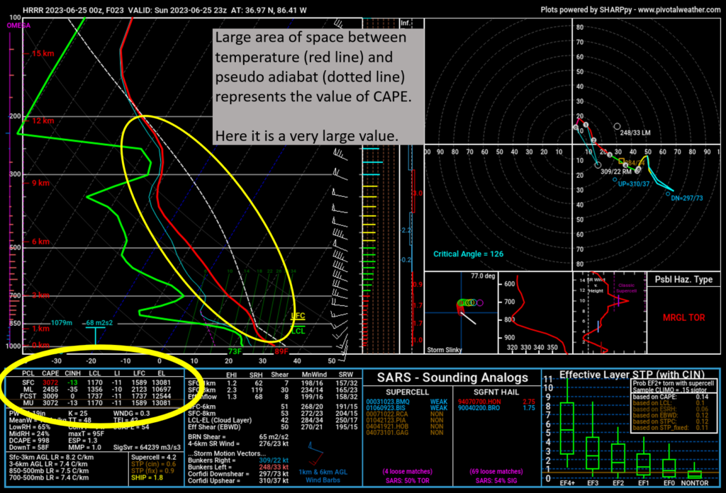
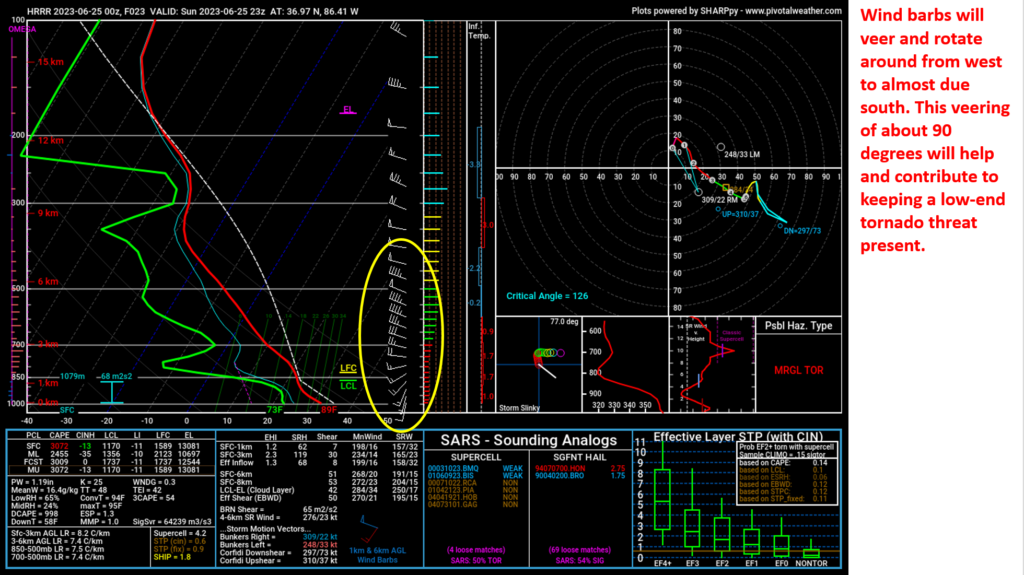
That wind shear and absurd instability will work together and result in an atmosphere that is capable of producing some very large and subsequently destructive hail. Thankfully, the greatest threat for very large hail will remain well north of WABBLES leaving us with a more of an isolated threat for large and destructive hail.
The low Level Jet that will be intensifying as the evening progresses in conjunction with the soupy unstable airmass will leave us with a more substantial threat for damaging winds. This is what I believe will be our biggest danger tonight.
As these storms approach, they will likely be in a messy cluster. This storm mode doesn’t lend itself well for an increased potential of tornadoes. However, given the veering wind profile in the lowest section of the atmosphere alone, they cannot be ruled out.
Conclusion
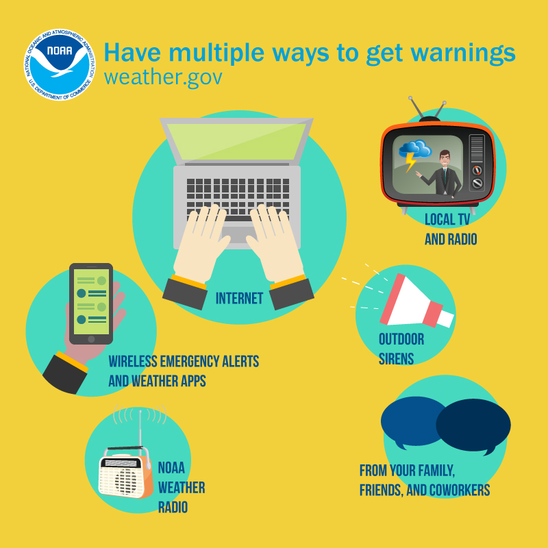
All in all, be prepared for some disruptive weather this afternoon and into the overnight. Have a plan in place with multiple ways to receive warnings (sirens do not count) and know where to go in the event a warning is issued for your location.
Keep it tuned here and especially on our social media accounts, @wxornotBG for the latest information as this evolves. Stay safe my friends!