



Hope you’ve made it through our last winter storm okay and were able to dig out despite the positively gelid temperatures throughout the region. While we look to remain tremendously cold as we finish out the month of January, it at least looks like we won’t have another wintry mess to contend with.
Still Freaking Frigid: Friday and Friday Night
Despite it not bringing much in the way of wintry weather, our old friend the mid-week clipper did at least have the decency to bring us another re-inforcing shot of cold air. How thoughtful!

Despite waking up to some early wispy snow showers, I wouldn’t expect much in the way of further accumulation, even though we remain in the deep freeze. At best, highs look to reach the lower 20s, but many of us may get stuck in the upper teens…again.

To paraphrase a local band, there ain’t no rest for the frigid, as temperatures yet again tumble overnight. Despite increasing high cloudiness from our south and east as another winter storm tries to take aim on the east coast, lows for us should sink precipitously back to around 10º or so, with some sinking below by a couple of degrees. Even light winds will make it feel closer to 0º or even a few degrees below out there.
No Better to Finish January: Saturday and Sunday
Another weekend of calendar transition is upon us, as hard as that is to believe.

Despite flipping into the final month of meteorological winter, Mother Nature’s cold clutches will continue to keep us in their firm grip to start the weekend.
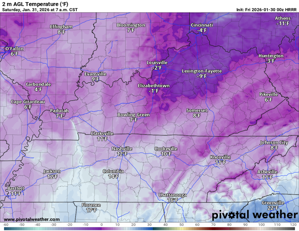
As the disturbance to our south and east continues to gain strength and looks to head up the eastern seaboard, We’ll start the day with at least a few clouds hanging around out there, though we’ll still see some sunshine to get the day started…not that it’s going to make it feel any better.

Despite the increasing sunshine through the afternoon, temperatures will not respond much. Yet another afternoon with highs peaking in the teens. Maybe to 20º if you’re in the city…maybe.

Despite a few more clouds sneaking in overnight, low temperatures will continue to plummet thanks to light northerly winds dominating the weather picture. Lows are back into the middle single digits. You know, a cool (no pun intended) 20º below average.

Those clouds on Saturday are a harbinger, potentially, of maybe another few flurries as we finish out the weekend with yet another moisture-starved clipper system diving into the region as part of the northwest flow pattern.
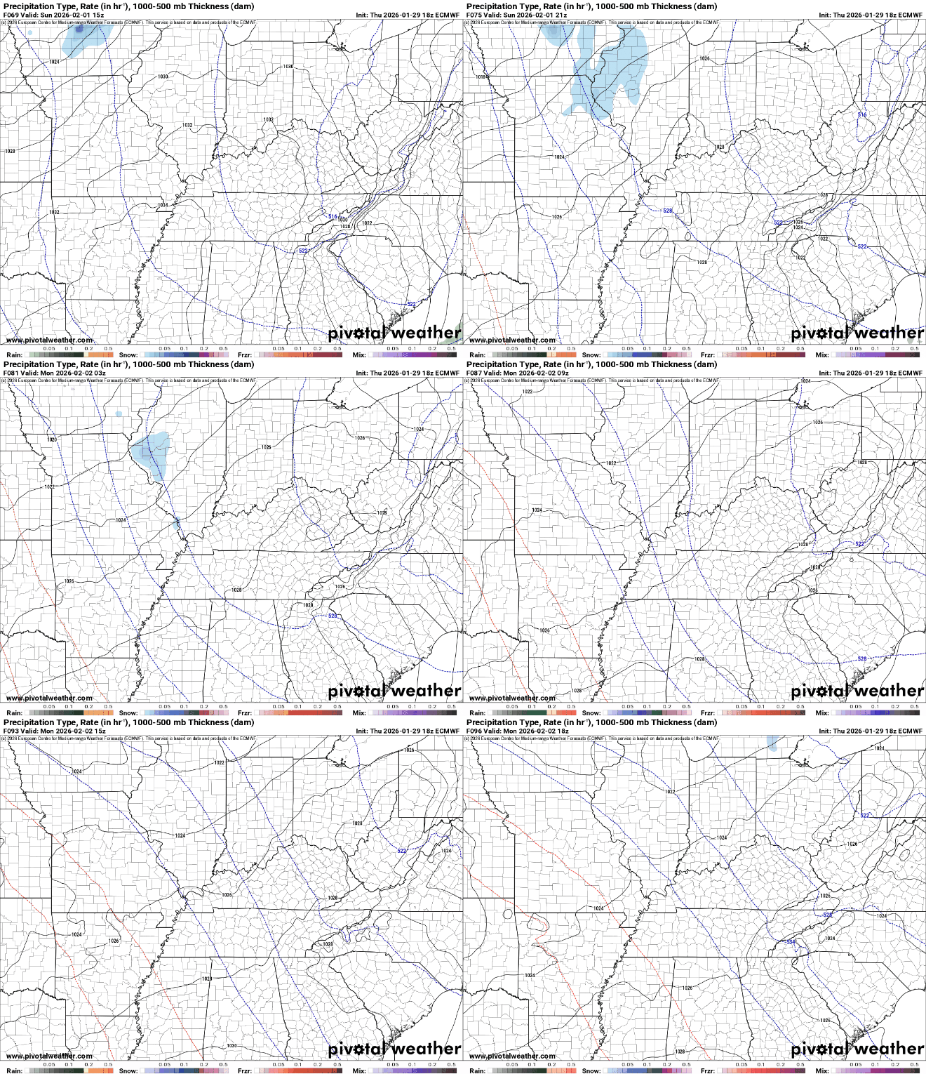
They wouldn’t amount to much, but the system will attempt to bring some somewhat milder air up from the south and west in a noble but feeble attempt to advect some useful moisture. However, that “somewhat” warmer air will have highs surging…up into the middle 20s. Little victories, right?

The double-digit domination continues overnight as clouds and the aforementioned feeble flurries will have lows back up in the lower teens. Well, I said double-digits, I didn’t say comfortable.
Heat Wave: Into Next Week
Well, heat waves are rather subjective this time of year and the temperatures to start next week are no exception. While it would appear that highs will be undoubtedly warmer that we’re dealing with, and they may feel downright balmy compared to the face-hurtingly cold air we’ve dealt with this week, we’re not exactly talking “warm.”
We’ll be under the influence of some semblance of southerly flow, which should combine with sunshine to get us…gasp…ABOVE FREEZING!
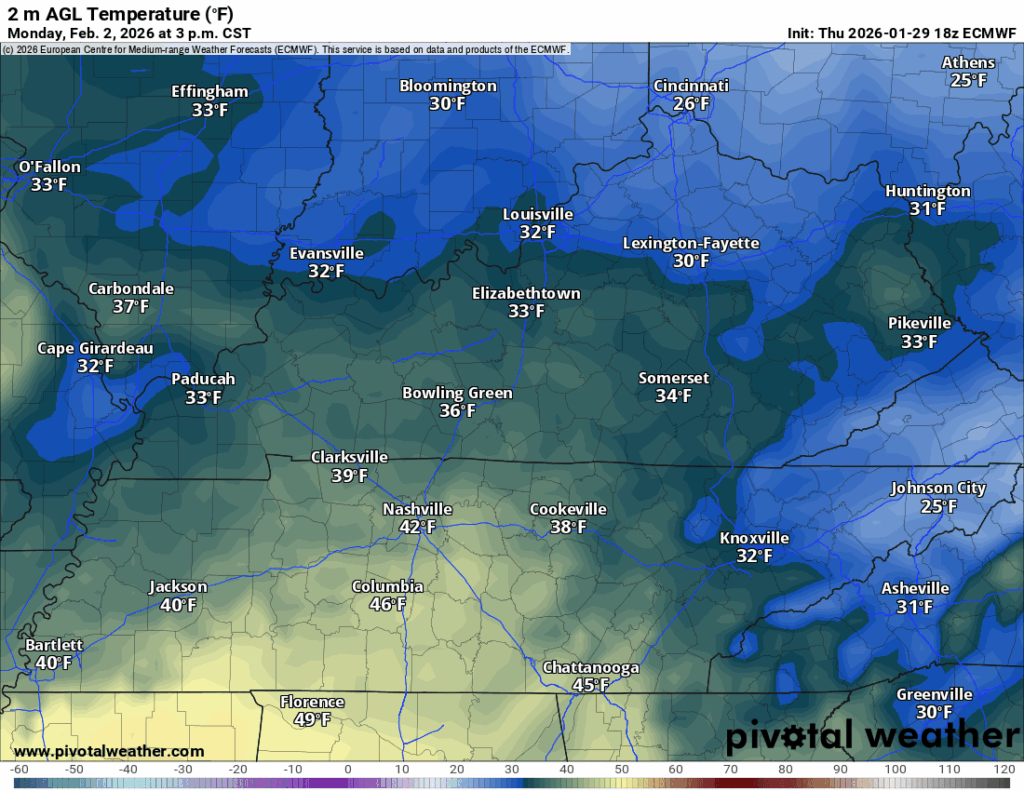
I can hardly believe it myself! Now, while we’ll be above freezing, it won’t be terribly above freezing, with highs topping out perhaps a couple of degrees above 32º for daytime highs. Some clouds drifting by overnight may also keep us from getting too bitterly cold overnight, with lows in the lower 20s, perhaps upper teens in our outlying spots.
More of the same on Tuesday, helping those temperatures get a sneak back up into the middle 30s for the afternoon hours. I mean, it ain’t much but it may help us thaw out a bit under more sunshine. Again, we’ll take all we can get!

By midweek, models are hinting toward perhaps another system trying to work on in. While it doesn’t look like a major issue at this time, it’s something we’ll continue to keep an eye on because it’s, of course, still winter.
That’s it for me for now! You can always keep up with the latest on all of our social media platforms. Have a tremendous day and a great weekend!