



The signals have been hinting for a while that the second half of January could be cold and stormy. This looks to come to pass as we head into this weekend as a system could bring us quite a wallop of a winter storm. Winter Storm Warnings remain in place for much of the weekend.
Setting the Stage: Friday and Friday Night
Part of what’s fueling this little shenanigan is a gargantuan high pressure making its way down from Canada.
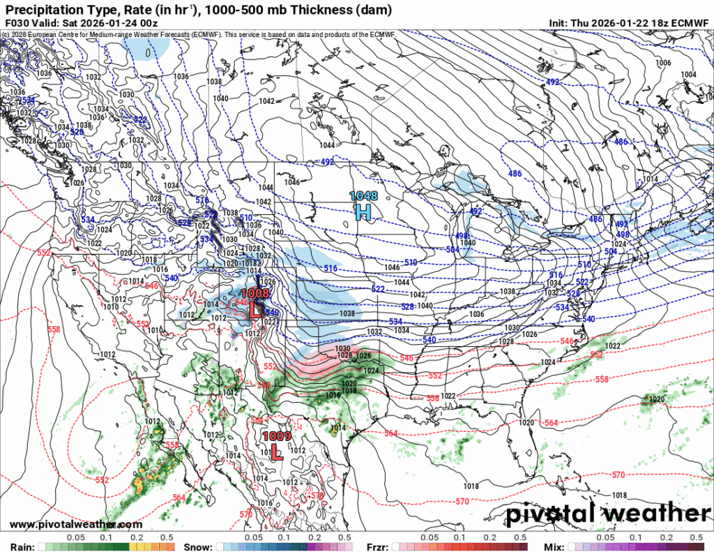
As a forecaster at NWS Mobile called it earlier this week, “the Nick Saban of high pressure.”

That high pressure will start to nose into the region during the day on Friday, which will help tank our temperatures to set the stage for a wintry mess working in. During the day, highs should get up into the lower and perhaps middle 30s as clouds increase ahead of our system.
Overnight, though, our system starts to scoot in late Friday night and into the day on Saturday. The arctic air filtering in will drop temperatures quickly into the teens during the overnight as snow starts to increase.
Sorry Folks, WABBLES is closed!: Weekend Winter Storm
Snow lovers have been waiting all winter for this one as it looks like WABBLES will be taking a pretty good hit from a potent winter storm.

Basically what’s happening here is that an active subtropical jet to our south is transporting moisture up into the region. That interacts with the arctic air from the high pressure moving in. A faster moving segment of the jet called a “jet streak” promotes lift and thus, will result in snow developing and pushing through parts of the region.
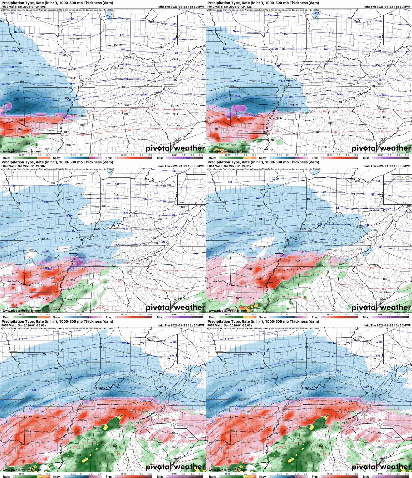
Our big question remains exactly how the temperature profiles shake out with this particular system. Either way, no matter who much snow, sleet, or even freezing rain that we see, it’s likely that we will see major impacts from this winter storm.
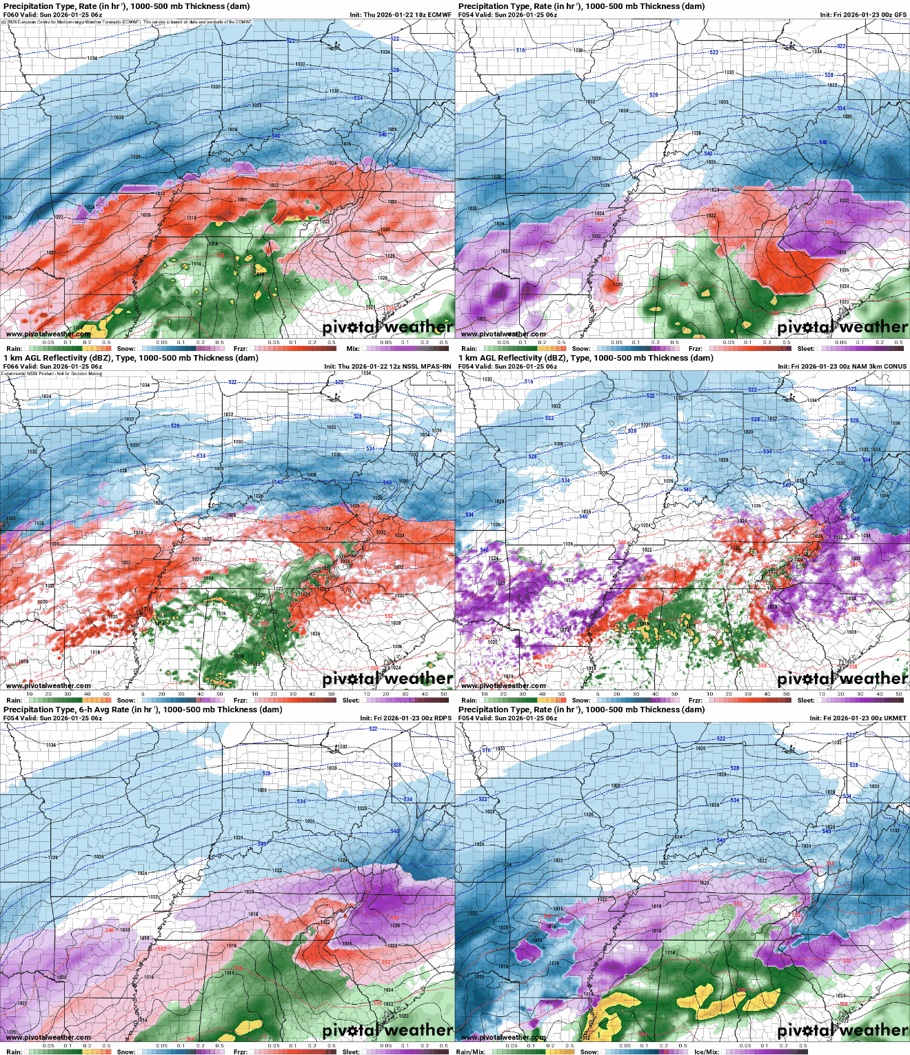
Highs suffer as a result of the arctic air coming in, with surface air temperatures not making it much above about 20-25º during the day. As scattered snow chances continue during the overnight hours, temperatures are going to absolutely and brutally plummet, down into the middle teens for overnight lows.

The wintry mess will look to continue as we remain socked in with snow and muck on the ground. Anything that falls during this time is going to stay on the ground for a good long while, thanks to highs only making it up into the middle 20s during the day. Skies will attempt to clear in the wake of our storm, and if they do, with snow on the ground, it will get painfully cold overnight.

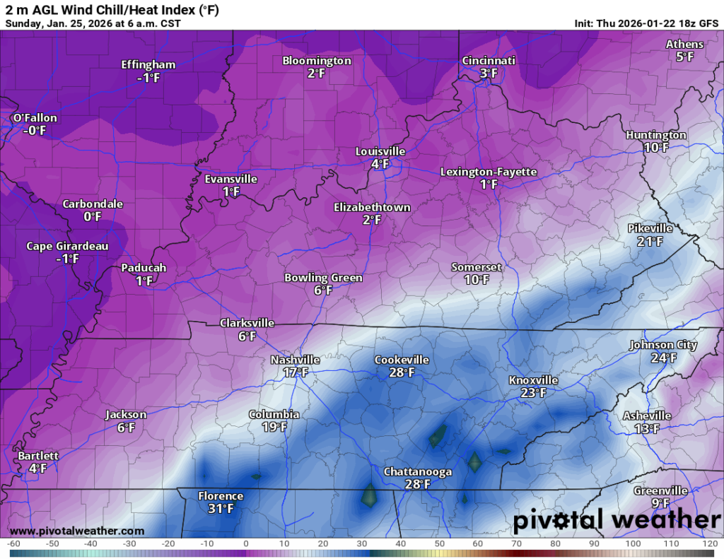
Overnight lows Sunday night look to collapse into the single digits, potentially close to zero as we head away from the cities. Wind chills will sink not far from zero.
A Cold Week Ahead
While snow does look to move out late Sunday and into early Monday, arctic high pressure will continue to settle into the region. Combine that with likely some snow and mix on the ground, that is going to equal a week that looks brutally cold.
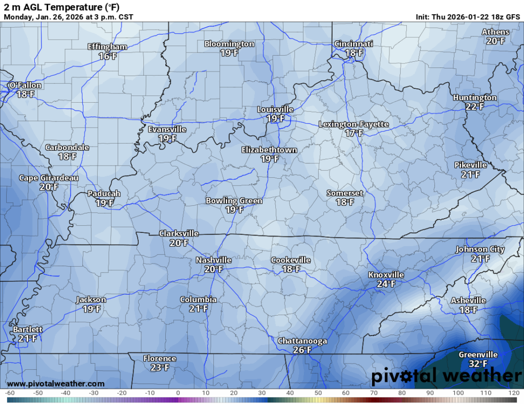
Highs on Monday are yet again going to struggle to get out of the teens, perhaps into the lower 20s. So, anything that fell during the weekend is going to be around for awhile. Especially because the quiet, sinking air of an arctic high remains overhead. That will keep lows plummeting into the single digits on Monday night.
We’ll try to make things somewhat more tolerable through next week, but it’s likely we’ll stay below freezing for quite some time. It’s still winter and some models are saying perhaps we’re not done with the shenanigans just yet…but there’s still plenty of room for movement on that one as we head into January’s last week.
That’s it for me for now! You can always keep up with the latest on all of our social media platforms. Have a tremendous day and a great weekend!