



Much of the WABBLES region continues to hold in a moderate drought according to our latest drought monitor. And while some showers may start to creep back in this weekend, it may not be enough to put a dent in our dry pattern.
Keep on Keeping On: Friday and Friday Night
Our record player continues to need servicing as we head into the close of our work week.

The elongated ridge of high pressure in the plains will continue to bring warm weather to the region as we head into the afternoon hours. Plenty of sunshine combined with light southerly winds will once again have high temps soaring up into the lower 90s throughout the region.
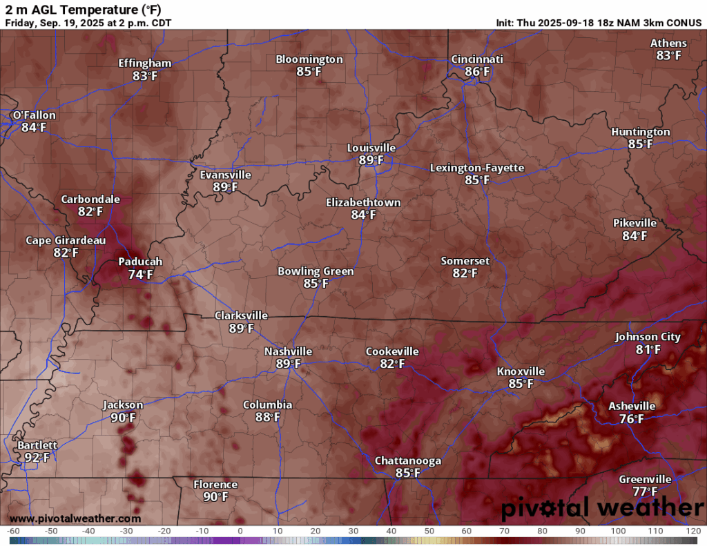
If you’re a fan of summer weather, I would take the day to savor the warmth, because changes are afoot as we zoom on past the weekend and into the back half of the month.
Before that, though, we’ll enjoy another warm, perhaps slightly muggy evening for high school football with temperatures slowly falling through the 80s and into the 70s as Friday Night’s Lights kick on. Clouds will be on the increase into the overnight hours…and we may be able to squeeze out a shower?

Overnight lows should settle back into the lower to middle 60s throughout the region.
A Shift in the Stagnant Pattern: Saturday and Sunday
As we look ahead to a well-deserved weekend around the region, our attention turns to the west as a low pressure system cut off from the jet stream will try to head in our direction.

At first, it should throw some clouds our way as we head into the day on Saturday. However, we’ll likely still see plenty of sunshine as we work through the afternoon. That should drive highs up into the upper 80s to near 90º or so as our first weak feature moves toward the area.
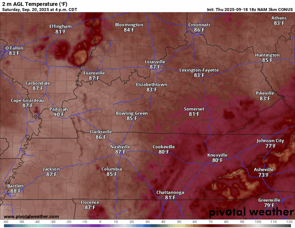
While we’ll have a bit of forcing in the region, we won’t have a ton of moisture for it to take advantage of. So clouds will be possible, perhaps a shower or two, but I think many stay dry into the afternoon hours. Clouds and the possibility for a couple of showers will linger with us into the overnight hours as lows only settle back into the middle 60s.
By Sunday, we’ll be watching another spoke of energy head our way from our upper midwest swirlybird.

That next spoke of energy will indeed allow for a bit more lift than on Saturday, so despite our lack of deep moisture, we’ll likely see a couple more showers and perhaps even a thunderstorm or two bubble up in the heat of the afternoon.
And heat we’ll have. Highs look to be back into the lower 90s. With that new slug of moisture moving in, it will likely feel quite summer-like at night as well, with lows only making it back into the middle and even upper 60s.
Switching It Up: Into Next Week
The dominance of this upper ridge is going to start to break down as we head into the new work week. Though, while we can tell you generally how the pattern’s going to evolve…the specifics are gonna be a bit tricky.

See, our weather will be influenced by a cut-off low pressure. This essentially means that it will be cut-off from the main flow of the jet stream, which continues its summertime residence up into Canada. That means it’s going nowhere fast.
However, models are going to have a tough time sniffing out exactly how it’s going to evolve on a day-to-day basis. At the same time, generally we know that in a pattern like this that things will stay rather as they have been, only we’ll increase the chance for scattered showers and storms.

No day looks like a washout, but everyday looks to feature a chance for some scattered rain and storms. Get one of those over your house and it will be a bit cooler, but highs should consistently top out in the upper 80s to lower 90s, with lows in the 60s overnight.
Overall, quite summerlike as Mother Nature officially flips the calendar over to fall.
That’s it for me for now! You can always keep up with the latest on all of our social media platforms. Have a tremendous day and a great weekend!