

WABBLES has experienced perhaps the finest August week in a long time, with beautiful sunshine, comfortable temperatures, and rock bottom humidity. Trends that look to continue just in time for the holiday weekend.
Slightly Warmer: Friday and Friday Night
It’s been a wonderful week throughout the region, with temperatures in the lower 80s and very comfortable humidity. While the lower humidity and sunshine will continue, we’ll likely see a slightly warmer day to close out the work and school week.

I mean, it’s nothing extreme, but we’ll likely see highs make it into the lower to middle 80s during the daytime hours. And believe it or not, that’s slightly below average!

By the time the players suit up and take the gridiron in the evening, we’ll be pleasantly and quickly falling through the 70s and into the middle 60s during the game…so it’s not out of the question you may need to grab a light sweatshirt or coat if you’re headed to the ballfield Friday evening. We’ll be back into the upper 50s thanks to that dry, dry air and clear skies overhead.
Labor Day Weekend: Saturday through Monday
Our current trends continue right on into Saturday once again.

High pressure remains in place, which will keep sunshine and mild temperatures in place during our Saturday afternoon. After starting in the lower 60s, we’re back into the lower and middle 80s during the afternoon, with that comfortable humidity again.

As afternoon turns to evening, and the Tops look to take the field against North Alabama, we’re back falling through the 70s and 60s during the evening as the cool, dry air works back into the region. Overnight lows are back into the upper 50s and lower 60s with that dry air.
We’ll attempt to switch the pattern up a little as we head into Sunday and Labor Day itself. Some models are attempting to bring another front up into the region by then, however, not every model is on board.

Either way, there’s not a whole lot of moisture in the air, so at this point, it appears that rain (that we are increasingly in need of!) will be scarce and the comfortable air will continue.

Highs will once again get up into the middle 80s for the afternoon, with at least a few clouds roaming about the WABBLES community. More of the same into the overnight hours, with lows back into the upper 50s, hovering around 60º.
For Labor Day itself? You guessed it.

Well, somewhat. The general pattern looks to stay in place as we head into the holiday on Monday. However, with the core of the high pressure beginning to shift off to the east, we’ll watch temperatures start to come up a tad.
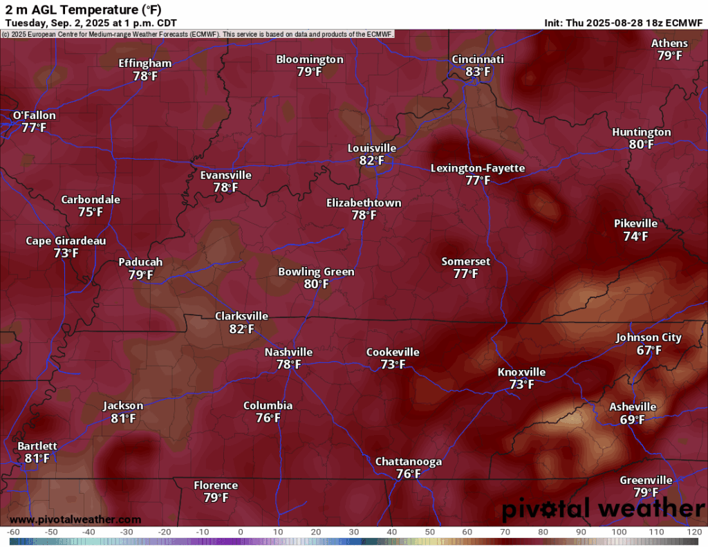
After a weekend with temperatures in the lower 80s, we’ll start to see those highs creep back up into the middle and upper 80s for our Labor Day.
As we head into next week, we’ll settle back into a more normal late summer pattern, though still with little rain in sight.

Afternoon highs as we head for Tuesday and Wednesday will start to edge upward into the upper 80s, which is actually normal for this time of year. Dew points will creep up too, though not to the level we were dealing with just a couple of weeks ago. Toward mid-week, another front could bring us at least a chance for a few showers before another shot of some comfortable air pushes in.
That’s it for me for now! You can always keep up with the latest on all of our social media platforms. Have a tremendous day and a great weekend!