


It has been a torrid weather trend around WABBLES for the last week or two with tremendously hot and humid weather. However, a nice cold front will bring us a nice change of pace as we head into this weekend and beyond.
Kicking it Off: Friday and Friday Night
While we have some nicer weather working our way, we’re still not quite done with the humidity yet.

While we wait for the relief of a late summer cold front, it looks like it will be another hot and humid day as we prepare for night one of high school football!
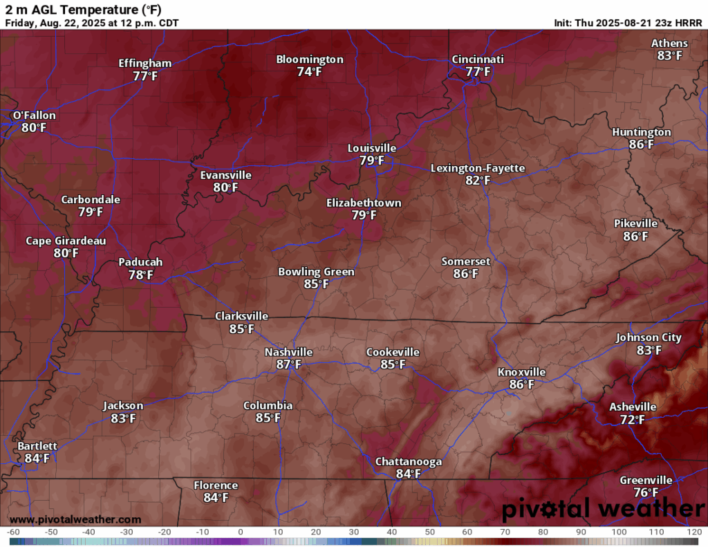
While we’ll be behind the first cold front from the week, it won’t have a lot of oomph behind it. After a brief dip in dew points behind it, we’re back to a more familiar heat and humidity on Friday afternoon as highs climb up into the middle and upper 80s once again, with heat indices in the lower 90s.

As we prepare for the kickoffs around the region Friday evening, we’ll slowly cool things down into the 80s during most of the evening’s action, so it will be a warm and muggy week one for area high schools. Overnight lows are back in the lower 70s with the muggy air in place.
Cold Front Incoming: Saturday and Sunday
That’s not just the hot weather you’re feeling as you step out the door on Saturday, that right there is FOOTBALL FEVER.

Saturday is what us college football diehards call week 0 of the season and yet again, our WKU Hilltoppers will be taking the field during the evening hours as conference play gets going early this year!

Before we get there, though, it looks to be another toasty go of it as we head into Saturday afternoon. Temperatures look to get back up to near 90º or so. However, we’ll be watching a cold frontal boundary trying to sink into the region that will absolutely bring comfortable weather back to the region.

We’ll keep an eye out for a chance for a shower or storm during the day, but there’s not a ton of moisture in the air, so many will stay dry.
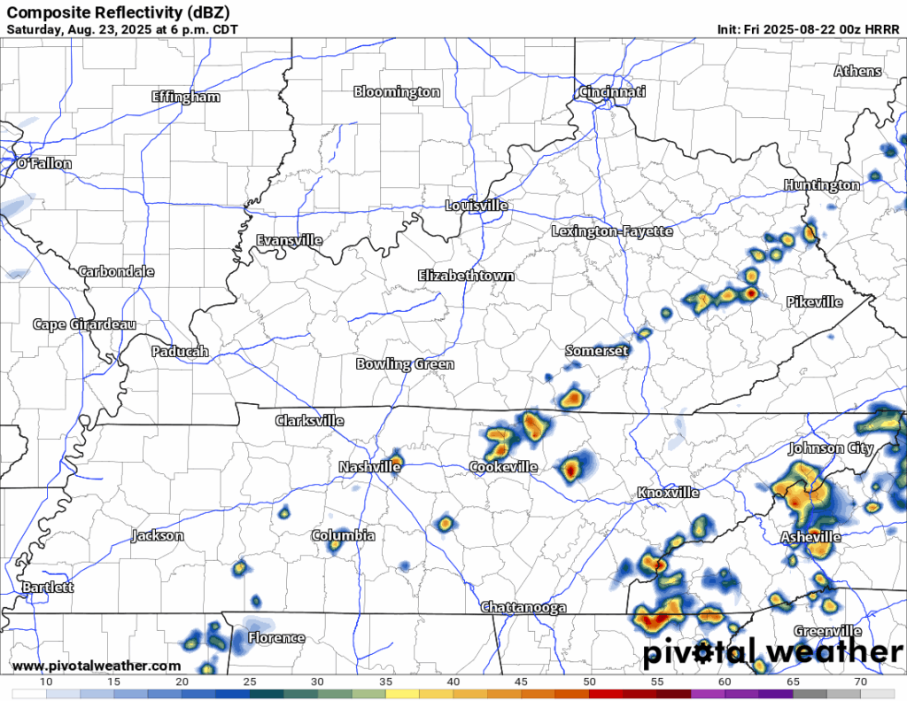
The cooler and less humid weather will lag behind the front a little bit, so things will remain a little muggy into Saturday night. Lows will remain in the upper to perhaps middle 60s in our cooler spots.
The improvement arrives on Sunday.

Sunshine looks to be in place as we head through the day, which should help boost temperatures into the middle and upper 80s, but dew points will only make it into the 60s, so it will feel much nicer during the afternoon.
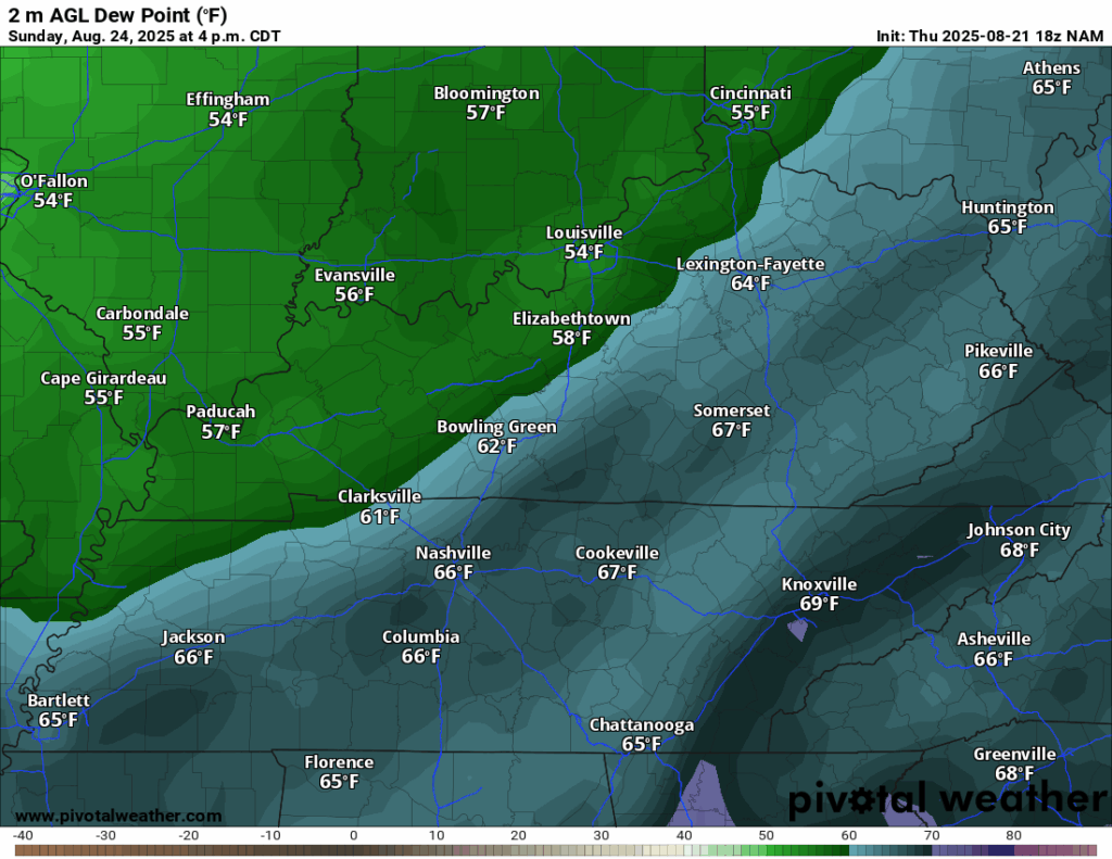
Drier air will continue to scoot in as we go into the afternoon, which means that while temperatures will be on the warm side, it won’t feel nearly as miserable as it has recently. We’ll make it feel even nicer Sunday night, as lows fall back into the lower 60s. No, you’re not dreaming…that’s the first whiff of fall.
Feeling Like Early Fall: Into Next Week
This summer has been hot, humid, stormy, and altogether unsatisfactory. However, that has led us here. Comfort is back.

High pressure originating not from the hot, arid plains of the southwest, but the cool Canadian prairies will settle into the region by Monday. That means not only sunshine, but mild air and low humidity not seen in a couple of months around these parts.
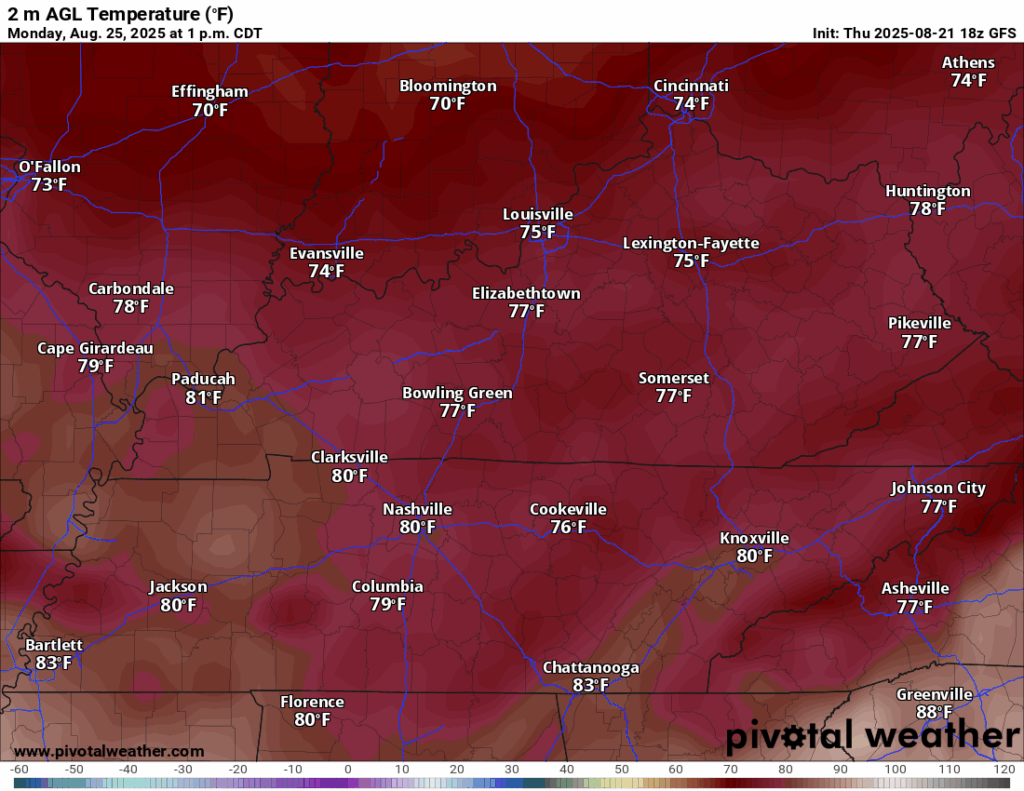
Dew points will stay in the middle and upper 50s, which is incomparable for this time of year. Pair that with highs only in the lower 80s, and you’ve got the perfect combination for an outdoor lunch, a trip to the grill, or even tossing the ol’ pigskin around the yard. I mean, the vibes are immaculate.

Overnight lows will start their long creep toward crisp, with clear skies allowing lows to fall back into the middle 50s, with low 50s not out of the question in some of the more outlying areas.
This trend continues for the next several days as Canadian high pressure holds firm. That means plenty of sunshine as we head toward Tuesday and Wednesday. And trends even suggest we’ll be continuing that into late week as well, if not slightly warmer by the weekend.
That’s it for me for now! You can always keep up with the latest on all of our social media platforms. Have a tremendous day and a great weekend!