



WABBLES has been dealing with a rather anodyne weather week this week, and that trend looks to continue as we head into the weekend.
Dodging Scattered Showers: Friday and Friday Night
A ridge of high pressure remains the dominant weather feature across the east central part of the nation, but it looks to be juuuuuust a bit outside of our region.

That will leave us open to some weak disturbances in the flow from the north and west. That will combine with highs in the upper 80s to near 90º and seasonable humidity to spawn perhaps an isolated shower or thunderstorm as we head into the afternoon.
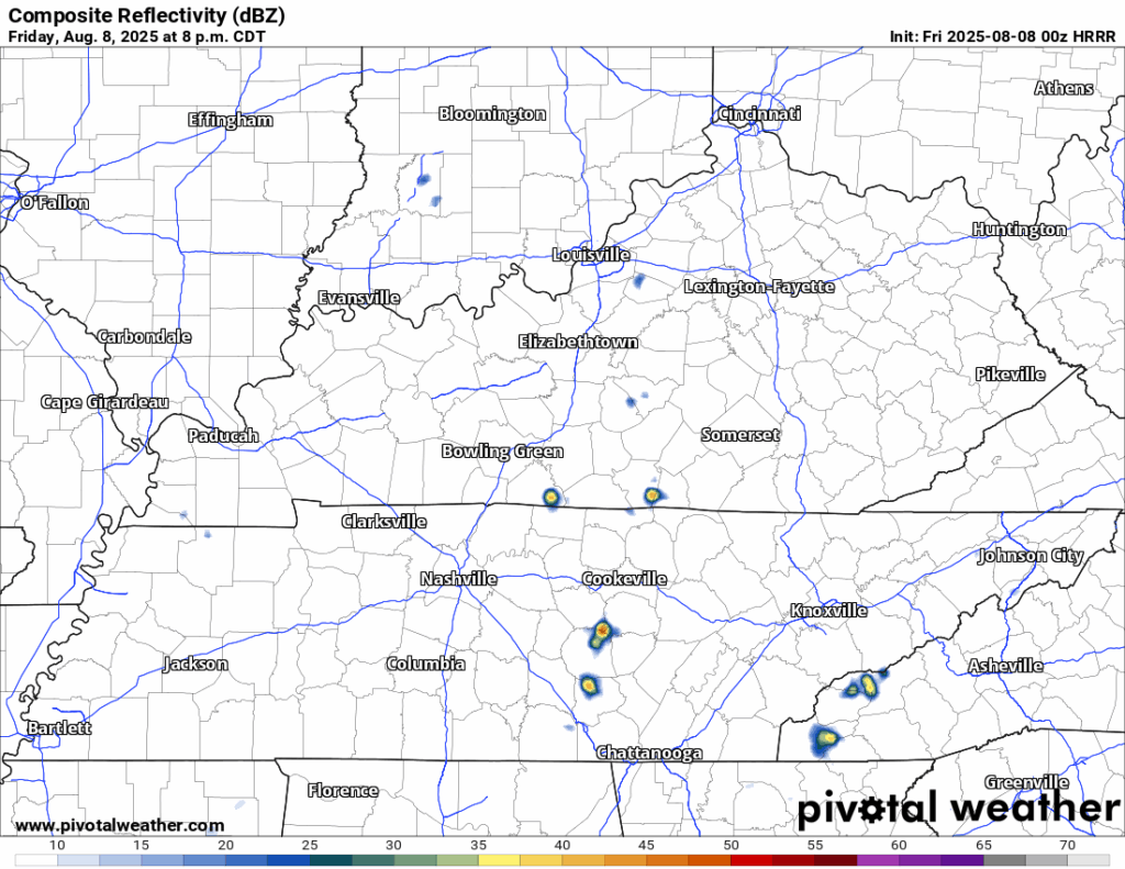
Severe weather doesn’t seem to be an issue, but some brief gusty winds and heavy rain will be a possibility with anything that pops up. Most things should diminish as we head into the overnight. Partly cloudy skies will continue as things stay mild and muggy, with overnight lows back in the upper 60s to near 70º.
More of the Same: Saturday and Sunday
The weather pattern is gummed up pretty good, so we’ll continue to see morning and afternoon sunshine only slightly marred by a few afternoon pop up showers and storms. Rinse and repeat.

Mostly to partly sunny skies are likely as we head into the morning and afternoon hours as we wait for the next ripple in the pattern to work on through. This should allow highs to yet again get back up into the upper 80s to right around 90º. That should allow a couple of showers or storms to bubble again. Perfect weather for our folks in Butler County to get their FREE weather radio! (Details below)
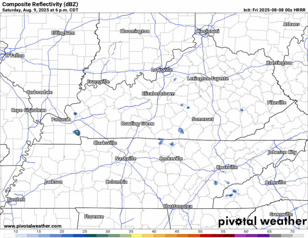
Anything that does pop will have the opportunity to drop some heavy rain, though they should fall apart once the sun sets, as we settle back to around 70º with skies clearing.
Sunday looks like the same old, same old.
Morning sunshine will help soar temperatures back up into the upper 80s to near 90º yet again.
The next weak wave will scoot through in the afternoon, bubbling up a couple of more isolated showers and storms in the afternoon.
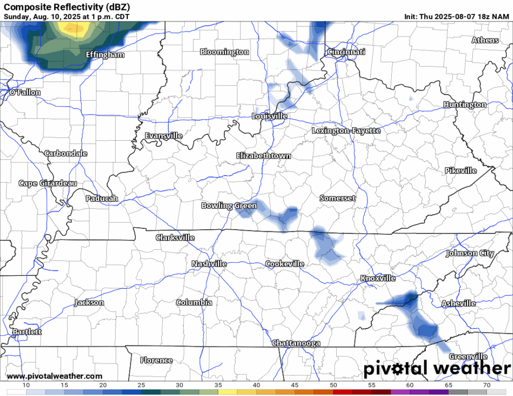
Just like the last couple of nights, we’ll again see showers and storms start to diminish with the setting of the sun as lows start to fall back into the lower 70s.
Keep It Going: Into Next Week
The weather pattern looks to stay rather on the stagnant side as we head into the new work week and back to school for many area students!

Monday will feature more of the same as we continue to stay stagnant with partly cloudy skies giving way to more potential showers and storms.
Highs look to peak up in the upper 80s and into the lower 90s, with those typical August humidity levels making it feel like closer to the middle 90s. Scattered storms once again fade with the setting of the sun, lows stay back in the lower 70s.
By Tuesday, we’ll be watching another disturbance trying to move toward the area, but guidance has continued to slow it down.
We’ll have plenty of fuel for thunderstorms as muggy highs in the lower 90s will continue unabated across the WABBLES region. As such, any storms that do pop could provide us with more heavy rain and perhaps the opportunity at some gusty winds as well.
We’ll continue to watch the potential for an increase in showers and storms toward the middle and late week timeframe as temperatures continue to stay on the toasty side in the lower to middle 90s.
Wait, What Was That About Weather Radios?
In partnership with the Butler County Fiscal Court, Butler County Emergency Management, and all Butler County Emergency Services, NOAA Weather Alert Radios will be distributed to Butler County households. This initiative is aimed at keeping everyone informed and safe during severe storms that may impact our area. NOTE: These weather radios are available to BUTLER COUNTY RESIDENTS ONLY. You will need proof of Butler County residency to be eligible.
The event is Saturday, August 9 from 8am through 6pm at your nearest fire station. If you are unable to pick up your weather radio on Saturday, they will be available starting Monday (should supplies last) at the Butler County Courthouse, 110 North Main Street, Morgantown, Ky.
Editor’s Note: Butler County residents who receive a NOAA Weather Alert Radio should tune to the Bowling Green transmitter at 162.400 MHz. More information can be found here.
That’s it for me for now! You can always keep up with the latest on all of our social media platforms. Have a tremendous day and a great weekend!