



WABBLES is now officially two-thirds of the way through Meteorological Summer and it has been a scorcher of a season. Thankfully, as we flip those calendars toward August, it looks like we’ll get at least some brief relief.
I Didn’t Know Lower Humidity Existed Anymore: Friday and Friday Night
It’s been hotter than the devil’s foot on fire in a wool sock that is soaked, I mean completely doused in kerosene and set ablaze.
Following the abundantly stormy midweek around the region, we’ve finally gotten a cold front to push through the region. And thank goodness.

This cold front means we’ll be dealing with much less humid conditions working into the region through the day. Our dew points will finally start to tank as we get the weekend underway.
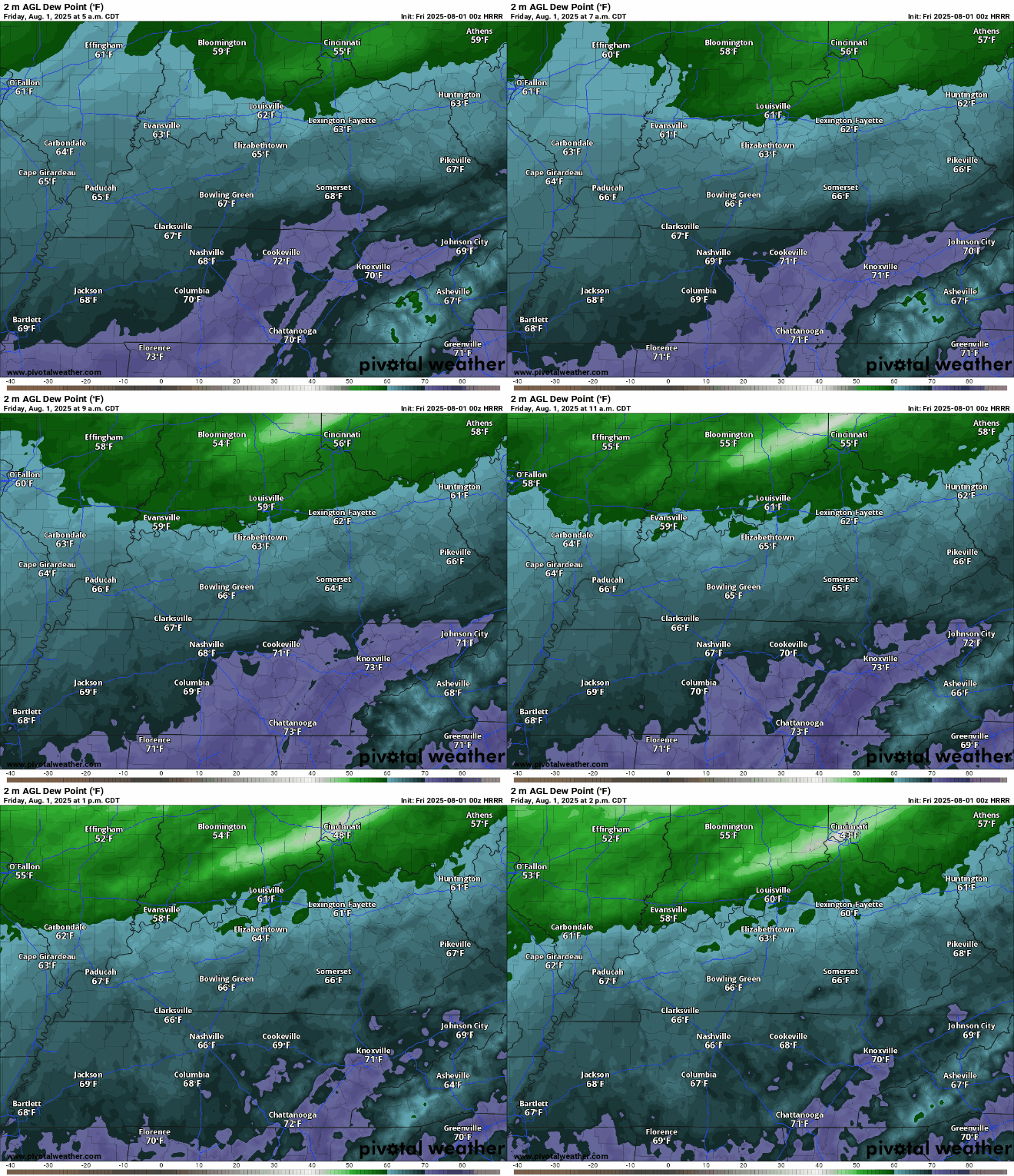
Dew points will fall back into the middle 60s and eventually lower 60s as we work through the overnight hours as any showers that managed to bubble during the day should begin to diminish past dark. Lows are back in the middle 60s overnight.
Sweet Relief: Into the Weekend
With the frontal boundary south of us, that gives permission for Canadian high pressure to attempt to build into the Great Lakes and Ohio Valley. And that means one thing.

Plenty of sunshine as some slightly below average air starts to work into the area. With dry air in abundance, dew points will stay in the lower 60s, which is so very comfortable for the first weekend of August.

Highs in the middle 80s will combine with those tremendously comfortable (for early August) dew points for an immaculate day in the great outdoors. Overnight, things look nice as well, as clear skies and dry air will allow for overnight lows to dip back into the middle 60s.
By Sunday, the southern heat dome will attempt to fight back into the region, starting a trend of slightly higher humidity values.
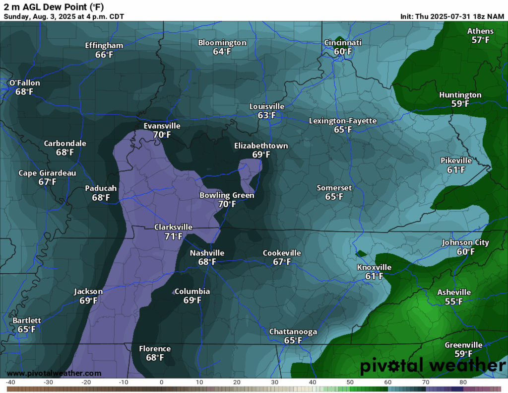
However, we’re not all the way back under the influence of the heat dome yet, which means that temperatures should stay under control, with highs only making it into the middle 80s.

Additionally, as we sit in between ridges of high pressure, the heat and humidity should allow for some good ol’ fashioned heat-of-the-afternoon pop-up showers and storms.
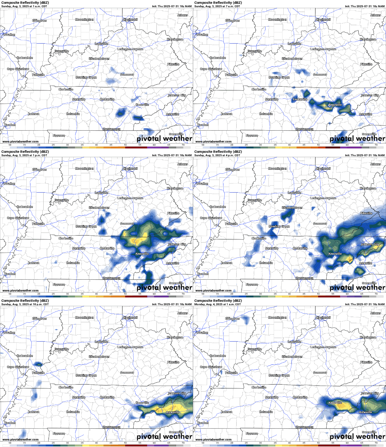
Anything that does pop will likely have some heavy rain with it, but should diminish as we head into the overnight hours. Though, it will be muggier overnight with lows in the upper 60s.
Back to Normal: Into Next Week
Things are looking back to normal as we head into the first work week of August.

The high pressure to our south and west will continue to try to build back into the area as we head into the day on Monday, setting the stage for a day similar to Sunday, with sunshine, upper 80s, higher humidity, and a few scattered afternoon storms.
We’ll continue to ease back into a familiar summer pattern as we head through the bulk of the next week or so. While heat and humidity will be on the way back, it doesn’t look anything like what we’ve been dealing with recently.

Toward Tuesday and Wednesday, we’ll watch showers and storms bubble up during the afternoons, but highs will not be off the charts. We’ll still wind up near normal, with highs in the middle and upper 80s, with dew points near 70º. So, warm and muggy, but not currently looking like this week’s aggressive nonsense by any means.
That’s it for me for now! You can always keep up with the latest on all of our social media platforms. Have a tremendous day and a great weekend!