

Happy Tuesday Morning people around WABBLES! It is a dreary day out there with plenty of rain from last night, but, the rain is ending around WABBLES. Additionally, we have a look into the long range pattern going into December.
Today & Wednesday
The bulk of the rain will be ending today, except for a few areas of drizzle this evening. The high will remain around the low 60s, but be slowly falling throughout the day as well around WABBLES.
Chances for drizzle will linger into tomorrow as well along with temperatures being much colder. Highs will likely stay in the mid-upper 40s.
Thanksgiving Day Forecast
Conditions will improve quite a bit for Thanksgiving with highs warming up into the mid 50s and mostly sunny skies as high pressure begins to build in across the whole area.
Long Range Pattern
The details for the long range pattern going into the first half of December are as cloudy as always. BUT, here is the meteorological analysis of where things stand.

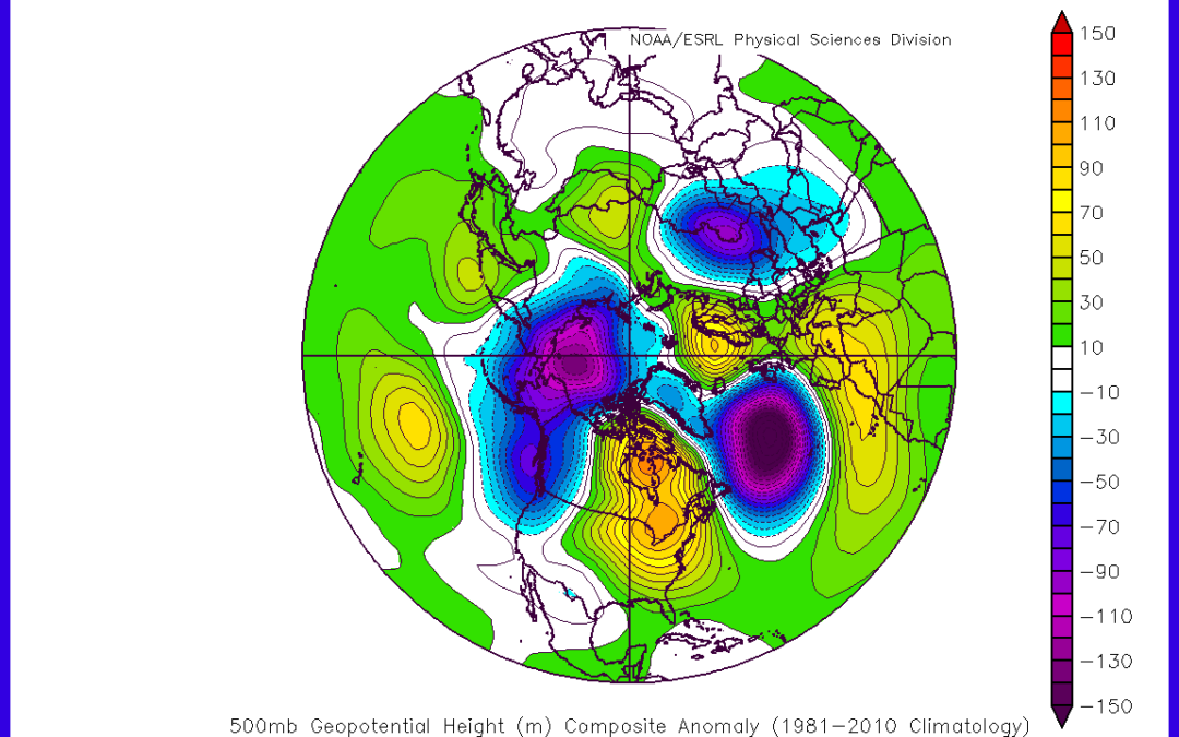
Starting off with teleconnections, we have our NAO forecast. Going into Thanksgiving, the NAO will be going neutral with a few models suggesting a stronger dive negative, but that likely won’t be the case.
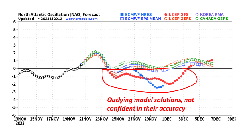
Rather, the majority of models and ensembles suggest a neutral to slightly positive NAO going into the first half of December. This means impacts, if any, to WABBLES would be minimal or warmer than average temperatures.
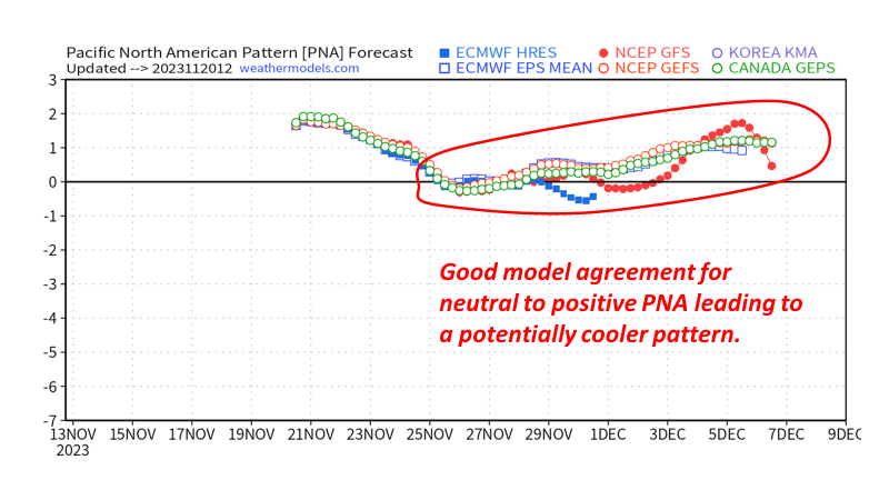
Switching to the PNA, the models are in overall agreement with a neutral-turning-positive solution. A neutral PNA won’t offer a lot of impacts to the pattern around WABBLES, but the positive phase will aide in trying to get below average temperature probabilities into December.
Another teleconnection we can look at for long range forecasting is the Madden Julian Oscillation (MJO). The MJO has 8 phases that revolve around each other at varying strengths and times. The phases, when combined with the state of El Nino/La Nina and the month of the year can provide a long range insight.
Currently, we are in a MJO phase 1 and should be transitioning into phase 2 over the next couple of days. Closing out November and going into December we look to go into phases 3 and 4.
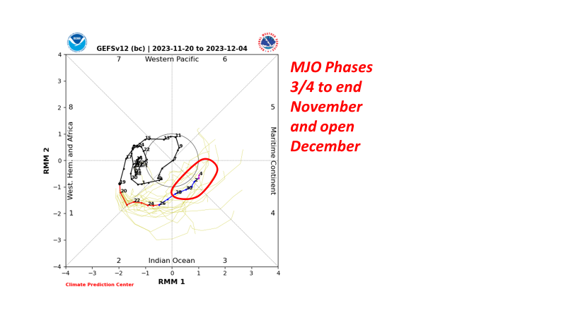
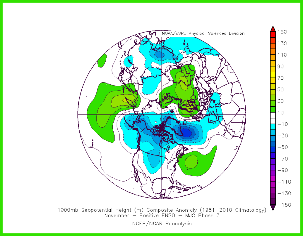
We should remain in phase 3 up until December 1st-ish which correlates to lower heights and colder temperatures for the central US. For WABBLES, however, that should leave us at normal to maybe just below average temperatures.
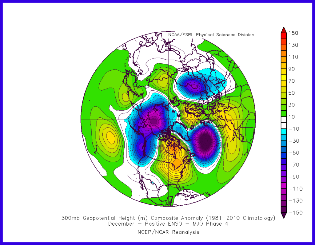
As we start December and transition into phase 4, we see heights and temperature tendencies increase by quite a lot. It is unclear for how long we will remain in a phase 4, but as long as we are, above average temperature chances will remain very high.
In conclusion:
- Average to just below average temperature chances to close out November.
- Teleconnections mostly support a warmer than average pattern going into December.
- Unsure how long that warmer pattern will last into December.
- Storm frequency unclear as well.
- Currently a snow-lover’s nightmare.
That will be all for today folks! I hope everyone out there has a great Thanksgiving and enjoys the time with friends and family. As always, follow us on our social media accounts @wxornotBG for the lastest weather trends.
Have a blessed day!