

Training Storms: Flooding Woes in Western Kentucky
Today’s WABBLES weather will be impacted by the ongoing flooding situation across western Kentucky. They’ve received absurd amounts of rain overnight, resulting in several water resues and flash flood emergencies being issued. They are expecting some locations to receive a total of 8-10″ before it’s all said and done.
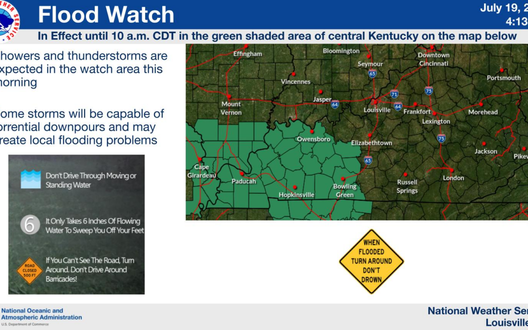
This has prompted a flood watch in our region as well, until 10 am this morning:
This is in response to the potential eastward trek toward our area. It’ll be conditional, with us drying out by lunch time. Any sun that breaks out could spur redevelopment of storms this afternoon.
Stay weather-aware and be prepared for potential flooding, just like Bill Murray’s character bracing for the repetitive day ahead. Anyone else tired of this pattern yet? If I could, I’d treat it like Ned:

Mesoscale Convective Systems: Storms on the Horizon
As we head into tonight through Thursday, be prepared for the possibility of Mesoscale Convective Systems (MCS) impacting the region. These systems are like the “Avengers” of storms, packing a punch with potential for strong to severe storms.
This should be something we’ve grown accustomed to here recently, given roughly 457 of them have moved through so far this summer. Take a look at the latest HRRR model, valid over the next 36 hours:
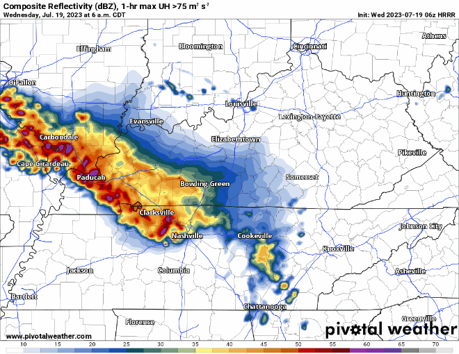
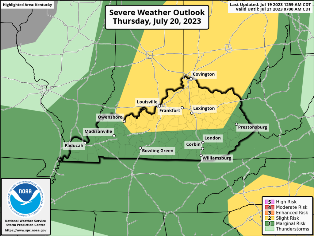
Some of these storms could become strong to severe. Just like we’ve been experiencing, damaging wind, large hail, frequent lightning, and flooding will be our primary concerns. Here’s the latest severe weather outlook overnight into Thursday:
Passing Cold Front: Cooler Days Ahead
Friday brings a passing cold front that will lead to a much quieter, cooler weekend. It’s like a retreat to a peaceful oasis after the stormy battle. Picture yourself as a serene beachgoer, enjoying the cooler temperatures and savoring the tranquility of the weekend ahead.
Sunshine should dominate, with northwest winds holding highs between the low and mid 80s. It should be glorious, in comparison to what we’ve been dealing with.
In summary, WABBLES is facing the aftermath of training storms and potential flooding, similar to the movie “Groundhog Day.” Be prepared for the possibility of Mesoscale Convective Systems bringing strong to severe storms tonight through Thursday. Remember to stay weather-aware and take precautions. But fear not, a passing cold front on Friday will usher in drier, slightly cooler days to enjoy this weekend.
As always, stay up with the latest right here —> @wxornotBG.