")
Good Monday morning, WABBLES! After a messy few weeks of weather, we are finally starting to see temperatures and conditions return to typical late-spring fare. As we enter into the third week of April, prepare for some much warmer and much sunnier days; but not for long, as showers and storms will likely return to the region late Tuesday into Wednesday. How hot will it get here in WABBLES? And how long will those forecasted showers and storms last? We’re breaking it down together, in today’s weather blog!
Today’s Forecast
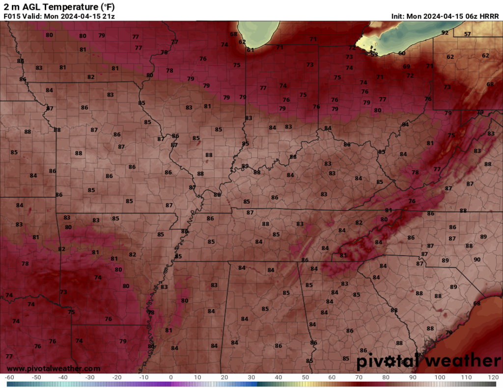
The slow warm-up that started late last week finally reaches its peak today, as we’re expecting to see highs nearing the mid-80s this afternoon after a long period of cooler weather! Bright sunshine will last through most of the day, with increasing cloud cover into the evening bringing just a tiny chance to see some light rainshowers overnight into Tuesday morning. Lows will reach the low-to-mid 60s after sundown tonight, but a gentle breeze keeps things comfortable going into the rest of the week. Today’s definitely the day to finish up any outdoor plans or tasks you might’ve started over the weekend before you lose the sunshine!
Showers Start Again on Wednesday
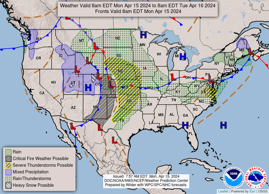
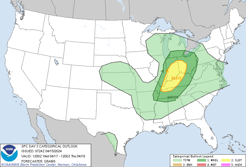
Foul weather returns to WABBLES beginning Tuesday evening, as our next wave of showers and storms looks to push in during the overnight hours into Wednesday morning. The Storm Prediction Center has highlighted most of our WABBLES region in an area of Slight Risk (2/5) for Wednesday, mainly in concern with a low pressure system that’ll start spinning its way across the CONUS beginning with the Great Plains this afternoon. Right now, the storms attached to this cold front do not look overwhelmingly severe and have actually downtrended in intensity over the last 24 hours; however, there are still several days before these showers are expected to push in, so the forecast could change at any time.
Our short-range convection-allowing models (or CAMs) haven’t yet been able to accurately model this weather setup, as we are just slightly too far out from their initialization threshold to start seeing any noteworthy storm development, but please keep an eye on our social sites over the next 24-28 hours to see all the latest updates, especially Twitter. When we get new low-pressure systems working their way into WABBLES, we put out continuous updates on expected intensity and timing, so if you don’t already follow us over there, make a point to do so today!
The above GIF is a hint at what we’ll likely see more of from the models through Tuesday evening; a long line of showers and storms, some possibly severe, as they work across the Midwest and Ohio Valley overnight into Wednesday. We don’t have any specifics on hazard type at this time, but we’re just bringing it to your attention so that none of us are caught unawares as we go into the midweek!
Make sure you’re keeping up with us as much as possible so that if we do start to believe that we’ll see more significant weather on Wednesday morning, you’re the first to know about it. We love serving our WABBLES community more than anything else in the world! Until next time, we’ll see you again soon, and take care, y’all!