")
Good Monday morning WABBLES! It may be the first day of April, but the severe weather that’s on its way into our region is certainly no joke. You’re going to want to pay attention as we break down the storm threat for the next 48 hours, because unfortunately, all hazards are on the table here in WABBLES. How long will the storms last? When will they arrive? And how bad will it get here in Southern KY? We’ll answer all of these questions and more in today’s weather blog.

Today’s Forecast
But first, we’ve got to break down today’s conditions before we dive into the messy stuff. We aren’t expecting any severe weather to move in until after midnight this evening, so our Monday will mostly be dominated by overcast skies and very warm temperatures. Many of us will see highs in the low-80s this afternoon as the bubble of warm air fueling our coming storms continues to grow over the region.
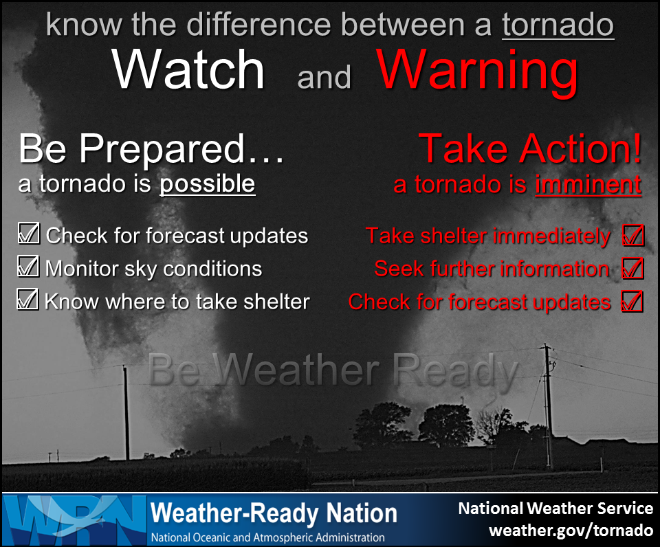
Today is certainly the day for you to ensure that you and your family are prepared in the event of significant severe weather impacting your household. Remind your friends and loved ones what to do in case of a weather warning such as a severe thunderstorm or tornado, and locate those safe places in your homes, businesses, and schools that are available and safe for you to shelter in during an emergency. Preparedness is key, folks!
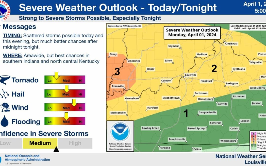
Severe Storms: When, Where, and How Bad?
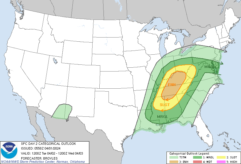
It’s time to break down the important stuff, so listen up! The Storm Prediction Center has issued two different convective outlooks for today and tomorrow, highlighting the WABBLES region in an area of both Slight (2/5) and Enhanced (3/5) storms for Tuesday specifically.
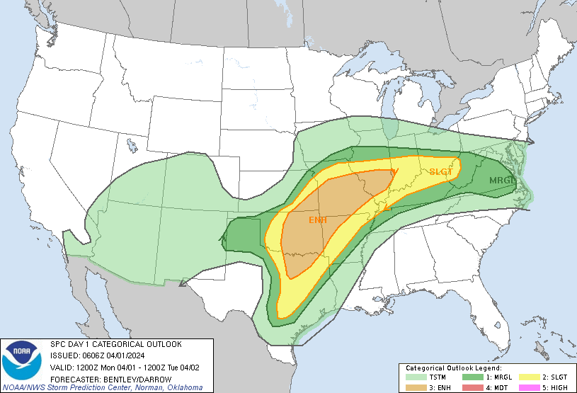
The number one thing we’d like to emphasize for this system is uncertainty. Less than 24 hours before the storms are expected to roll in, our severe weather models still disagree on exactly how these storms will play out in WABBLES. What we DO know is that severe weather will most likely begin in Southern KY around the early morning hours as the warm bubble of air ahead of the low pressure system lifts northward. However, what happens next still ends with a big question mark.
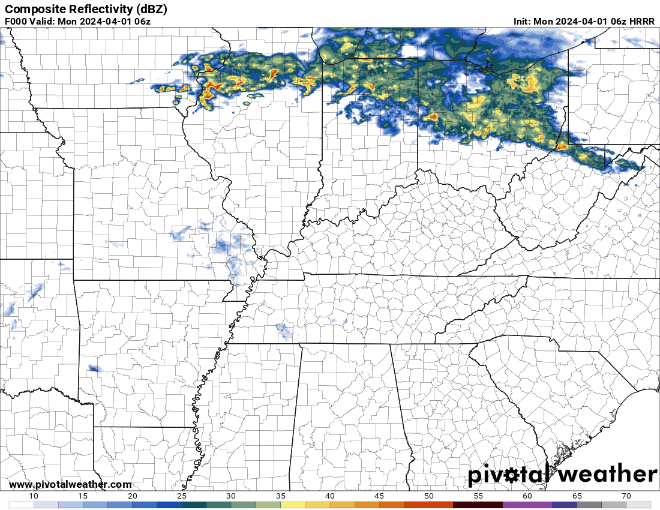
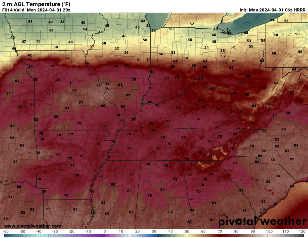
The HRRR, one of our two best convective models (shown above), seems to believe that we’ll see continued storm development in WABBLES during the day on Tuesday with very few breaks for conditions to recover ahead of the cold front that will usher all the storms out on Tuesday night. While this means more storms for our region lasting the entire day, they will likely stay weaker, as the more storms that trail over a localized area, the less energy they have to be significantly severe.
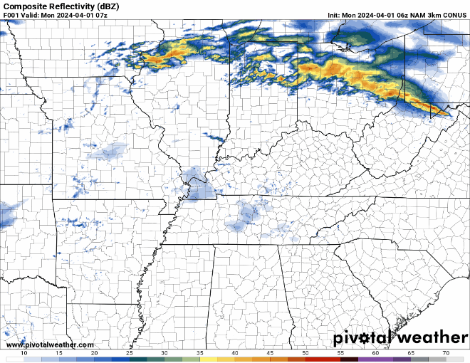
The NAM hi-res, our second convective model (shown above), displays a curious lack of severe storms near WABBLES throughout the day Tuesday until a broken line of storms develops overtop of us in the late afternoon and evening hours. While overall there are fewer storms to be seen in this mode, more severe storm energy will likely be available to this line, as the hot and moist air mass over WABBLES is assumed to remain untapped until this line reaches our area, making these storms more intense and potentially more dangerous.
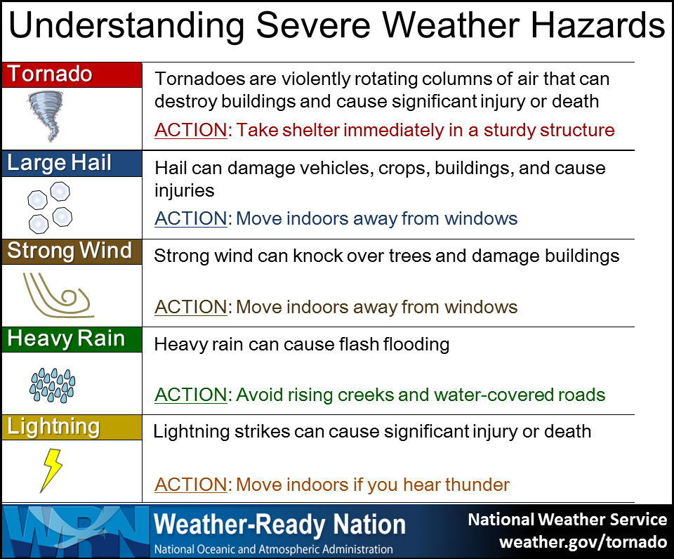
At the end of the day, the point we’d like to hammer home the most is that regardless of the mode that these storms take Tuesday morning and afternoon, all hazards remain on the table. While it’s not a guarantee that anyone in our region will see them, it’s possible that dangerous winds, hail, flash flooding, and even tornadoes may impact WABBLES over the next 24-48 hours. Our job is to ensure that y’all are educated and prepared to handle it when those significant weather events arrive, so you’ve got to be weather aware this week!
The best thing you can do to keep up to date on the latest weather information for our area is follow WXornotBG on all our social media sites: Twitter, Instagram, and Facebook, though we’re largely most active on Twitter and will continuously post updates as the forecast changes in real-time. Staying tuned to the blog here is also a great idea, as we increase our post frequency in the face of incoming severe weather so that friends all across WABBLES have an accessible hyperlocal forecast right at their fingertips.
That’s all for now, folks. Please take care today as you go about your daily activities, and continue to prepare yourself and your loved ones for the weather that will likely cause some issues for us tomorrow. We’ll be here every step of the way to walk you through it as the storms roll in, so stay safe and keep in touch!