")
Good Monday morning, WABBLES! It’s time to get up, because we’ve got an exciting day of weather ahead. Gusty winds and some showery storms later this evening will close out our Monday and carry us into Tuesday as a slow-moving cold front progresses eastward across the region over the next several days. How strong will those showers and storms be? And will we get another blast of potent cold air once all the rain’s departed from our beloved WABBLES region? We’ll go through it all together in today’s weather blog!

Today’s Forecast
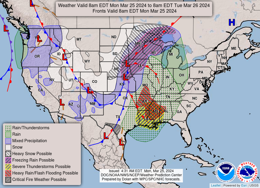
As mentioned previously, our Monday evening will end off with winds so blustery that the National Weather Service office in Louisville has issued a Wind Advisory for the region beginning at 7:00 PM this evening and lasting through 5:00 PM on Tuesday. But before the gusts make their way into WABBLES, we’ll be up in the mid-60s for high temperatures today, with a generous helping of cloud cover keeping most raw sunshine at bay.
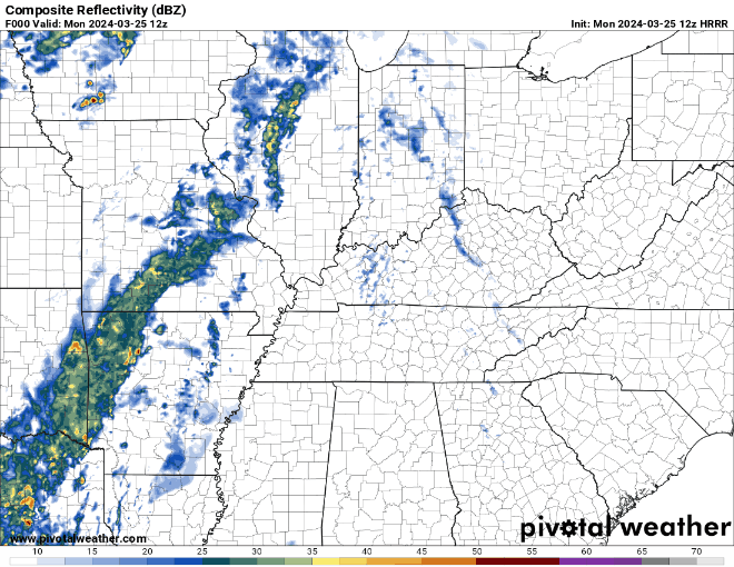
Most of the precipitation we’ll be experiencing tonight will be attached to the small warm front ahead of its slower-moving colder counterpart to the west. Because of this, we can expect no extreme drop in temperatures until Wednesday at the earliest, and even then, we’re only expecting to drop into the upper 50s for a day or two before recovering to more normal springtime high temps at the end of the week.
Are any Severe Storms Up to Bat?
Not necessarily! We aren’t expecting the wave of rain that will push in this evening to pack enough energy to become incredibly disruptive. However, while we aren’t planning on seeing things like big hail and tornadoes, it’s much more likely that the attached strong wind gusts will cause more problems for our WABBLES friends. Winds tonight will get very strong at the surface as the low pressure system moves through, so anything from patio furniture to outdoor toys could become projectiles in the right situation. Try and bring as many of those possible projectiles as you can inside before you head to bed tonight, lest everything you don’t tie down gets swept away while you’re asleep!
Other than the very strong winds, there isn’t too much to be worried about with the line of showers and storms moving in overnight. There may be some rumbles of thunder and pockets of heavy precipitation embedded in the line, but there’s no attached hail or tornado threat to be considered alongside our more prominent wind threat. We’ll be back to sunny spring skies and more seasonable temperatures by Wednesday, so just hang in there, folks!
Until then, make sure to keep up with us on our Twitter page as well as here on the blog, so that you’re getting consistent updates as new forecast data comes in every single day. Our next forecast blog will go up on Wednesday, so keep an eye out for it on our other social media sites as well, such as Facebook and Instagram! Have a lovely March Monday today everyone, and we’ll see you back here again soon!