")
Good Monday morning, WABBLES! Winter’s last stand has arrived in Southern Kentucky, as biting wind chills and near-freezing temperatures settle into the region over the course of the day today. As our WKU friends partake in some of that Spring Break-ing, we’ll stay cool and dry to start the week while temperatures slowly recover to a more normal spring-like feel through Friday. But how long will the winter chill last? And when does precipitation return to the forecast? We’ll go over it together in today’s weather blog!
Today’s Forecast
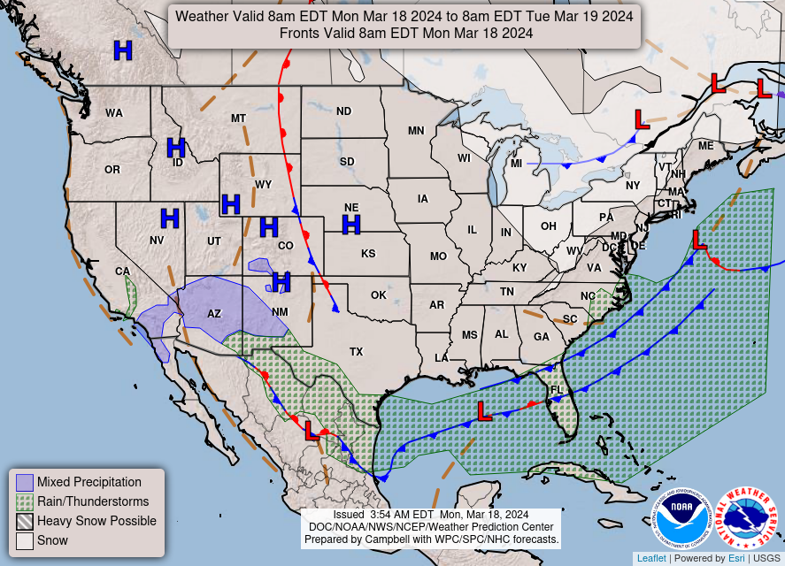
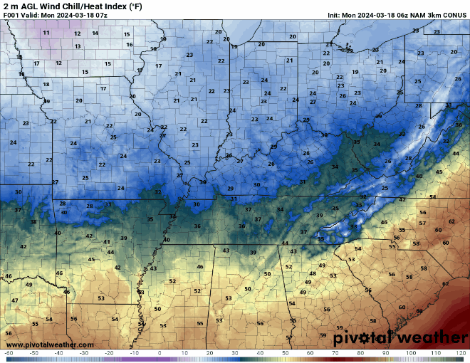
Today’s big headline, of course, is the serious chill that’s pushed its way into our area out of the northwest over the last 24 hours to remind us folks in WABBLES of exactly how cold late winter can get. While today’s high temperatures around the mid-40s don’t sound so bad on paper, the real kicker is the strong breeze that’s paired with the cooler weather, as our wind chill temperatures will feel much lower over the course of the day today. You’re not going to want to spend too much time outside after sundown, because those gusty winds combined with lows expected to hit the mid-20s overnight will have us all feeling positively frigid this Monday evening.
So… How Long Will the Cold Last?
Not too long, thankfully! With no significant low pressure systems expected to impact our region for the next several days, we’ll have ample time with clear skies and sunshine to help us recover to a more seasonable spring-like feel. Lingering high pressure over WABBLES will ward off any possible precipitation, at least until the end of the week, when the opportunity to see some brief showers will return to the region. Most of us will see high temperatures back in the low-to-mid 60s by Wednesday, so the spring-like feeling will eventually return for families and students who may be Spring Break-ing it here in WABBLES this week!
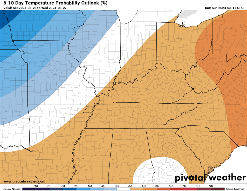
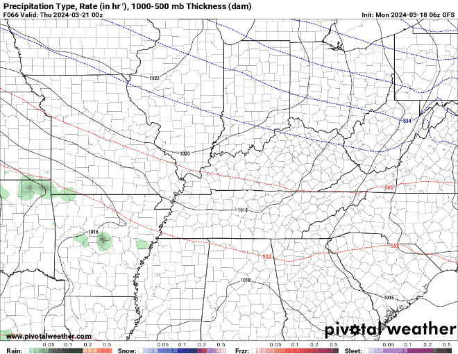
As for the precipitation chances mentioned earlier, a few of us will likely see scattered showers Thursday night and lasting into Friday, as we’re currently getting signals for a new system that’ll be moving into WABBLES by the end of the week. As we’re a few days out, nothing is completely nailed-down; but at this moment we’re just expecting run-of-the-mill rainfall that’ll more than likely remain sub-severe. The associated showers will likely linger through Friday night and potentially into early Saturday morning, so keep it in mind and make sure the rain jacket isn’t too far off before you head outside later this week!
That’s all we have for you today, WABBLES crew! Make sure to stay warm out there while you’re out and about, if you can. Bundle up and remember that the cold won’t last forever – or savor it, if you’re one of those folks that’s already missing our wintertime weather. We’ll be back here again on Wednesday with a new edition of the WXornotBG weather blog, but until then, make sure to keep up with us on our Twitter page, where we love to give consistent updates on the forecast over the day for all y’all lovely folks. Until next time, we’ll see you soon, and take care!