")
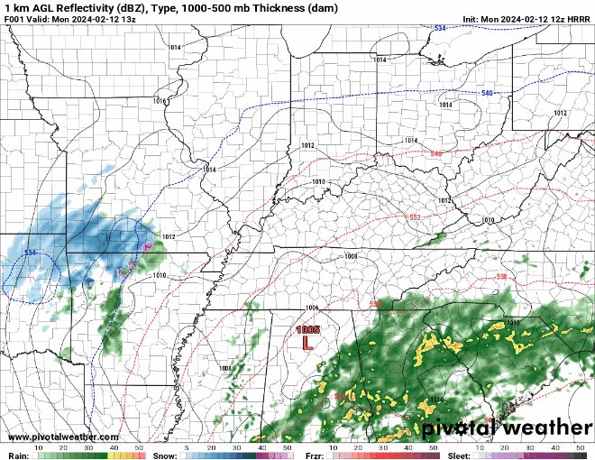
Good Monday morning, WABBLES gang! We’ve got a pretty tricky forecast setup today, as it’s likely we’ll be wet through dinnertime before transitioning into messy wintery precip after nightfall. Just about everything is possible today; we could see some sub-severe rumbles of thunder this afternoon before temperatures drop enough to rapidly change the precipitation type into sleet, or possibly large, wet snowflakes. We’re going to go through all the details and impacts together right now, so that you’re as informed as you can be going into this afternoon!

Today’s Forecast
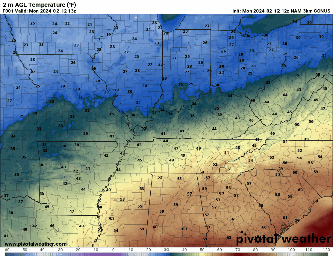
We’re starting off the morning with temperatures hanging out around the mid-40s, which will climb into the low-50s over the course of the day before temps plummet below freezing after sundown. The low pressure system moving through WABBLES is centralized to our south, which lines us up on the backside of the comma-head portion of the cyclone and will funnel much cooler air into the WABBLES region as it moves eastward. However, the question is how quickly temperatures will drop in our area once the low pressure system pushes out, and whether or not any wintery precipitation that develops will stick on our flat surfaces, as we’ve been warmer than average in the area over the last week or so.
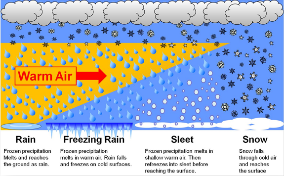
Cold, Wet Rain or Freezing, Snowy Mess?
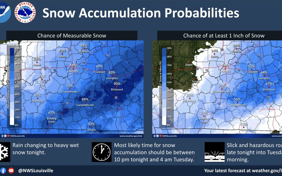
We wish we had a more definitive answer for you, but we can definitely give you an insight into what our local impacts will look like! The rain-wintery precip changeover is currently expected around 9 PM Central this evening, but at that time only the eastern region of WABBLES will likely be seeing temperatures low enough to produce any legitimate snowflakes. Our western counties, namely Logan, Butler, Simpson, and most of Warren will likely continue to see rain or transition into freezing rain around 10 PM, and could also see a shot at some wet flakes before the system moves out of the region around midnight.
In all honesty, it is NOT LIKELY that any of our WABBLES counties other than extreme eastern portions of Edmonson and Barren will see any measurable snow accumulation at this time. The rest of our area is much more likely to see a mix of freezing rain or wet sleet as the low pressure system works eastward; as a result, our primary concern will be with messy road conditions Tuesday morning, as any wet winter-adjacent precipitation will likely fully freeze during the overnight and early morning hours. But nothing is out of the question, at this point! Be ready and willing to adapt to all scenarios: wet rain, slick winter precip, or even some pretty heavy snow.
No matter what, everyone in the WABBLES area should be weather aware this evening and be prepared to take it easy during the morning commute on Tuesday. Please pay very close attention to our Twitter page as you go throughout the day and into the night tonight, as we’ll be posting frequently to keep you all updated on the latest changes to the forecast as they happen. Stay dry out there today, friends, and we’ll see you back here on Wednesday for another forecast blog. Take care!