")
Good Monday morning, WABBLES! We are back again with an update on the dry pattern that’s been keeping us warm and comfortable to start off our February. For those of us who appreciate our outdoors adventures this time of year, you’re going to want to get out there and enjoy it before the weekend, when rain chances finally return to the region! How long will we stay dry? And when do those rain opportunities begin moving in? We’ll discuss it together, in today’s weather blog!

Today’s Forecast
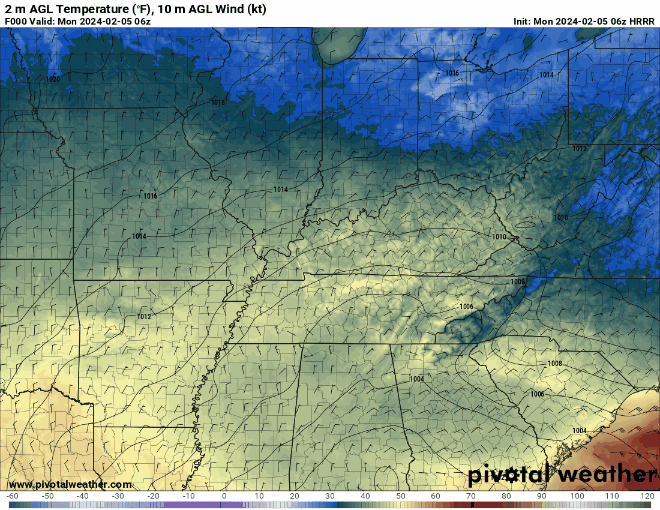
We stay sunny, clear, and a bit breezy on this delightful Monday, as high pressure throughout the WABBLES area will staunch any significant cloud development throughout the day. We won’t exactly reach the 60s, but most of us will see high temperatures linger around the upper-50s through the afternoon and into the evening, where clear and cloudless skies will help us cool off back into the lower-30s after sundown.
A light wind out of the north will be present throughout the day and continue into about Wednesday before our precipitation chances move in Thursday and Friday, ending our dry streak. Overall, it’s a gorgeous day today, so feel no shame in getting outside and having some fun with it, if you can!
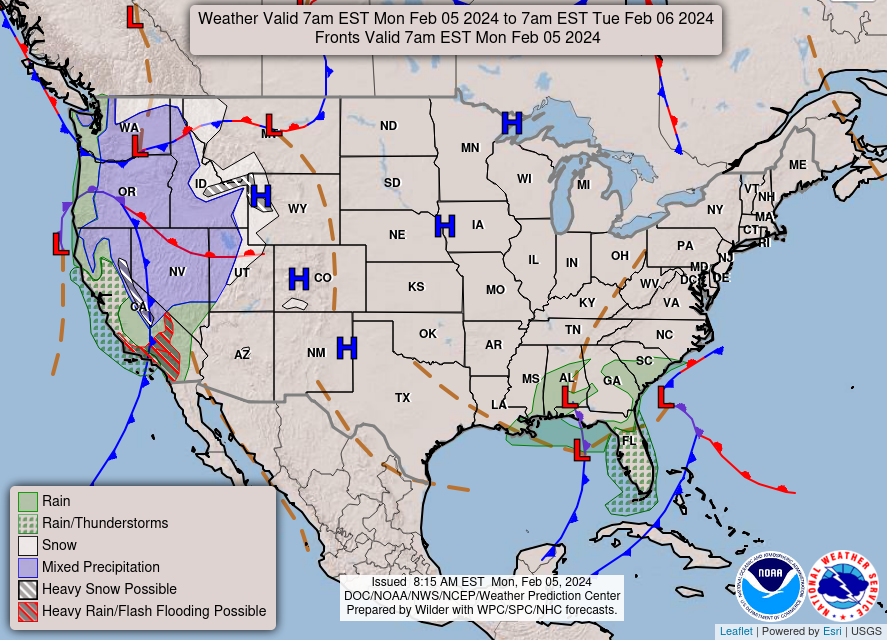
So… We’re Ending the Dry STreak?
Sure looks like it! We’re currently tracking a few very messy-looking low pressure systems that would likely bring several days of scattered showers or consistent rainfall to WABBLES beginning on Thursday and lasting throughout the weekend. Rain first moves in very late Thursday evening and becomes more consistent on Friday and Saturday, where an area of low pressure to the south will continue to funnel moisture up into the region.
With most of this moisture being propelled by warm fronts out of the south, we’ll actually warm up a little bit locally when these showers move in until late Sunday night, when a new cold front will push both the warmth AND the rain right out of WABBLES. But before then, temperatures may rise into the mid-60s and only drop into the upper-40s for lows beginning on Thursday night and lasting throughout the weekend. But savor it while it lasts, because this time next week we are back into the 40s and 30s for daytime temperatures!
That’s about all we have for you today, WABBLES! Try to enjoy the warmth and dry weather today while you can. We’d love to hear about how you’re spending your outdoor time if you do end up getting outside before the rain moves in! Send us your pictures over on the WXornotBG Twitter page; we really enjoy keeping up with all our WABBLES friends! Tune in here again on Wednesday for the latest update on our rain chances this weekend, but until then, stay safe out there! We’ll see you soon!