")
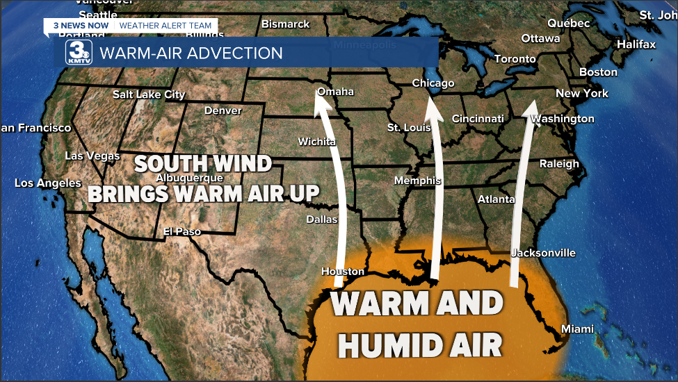
Happy Monday morning, WABBLES crew! After a long and exhausting week of sub-freezing temperatures and troublemaking snow, a significant warm-up arrives in our region starting today. Our return to more standard winter conditions begins with a sharp south wind advecting warmer air into Southern Kentucky; however, this will set us up for some wet weather as we go throughout the rest of the week. Just how warm will we get? And when will the incoming precipitation make its way into WABBLES? All that and more, in today’s weather blog!
Today’s Forecast
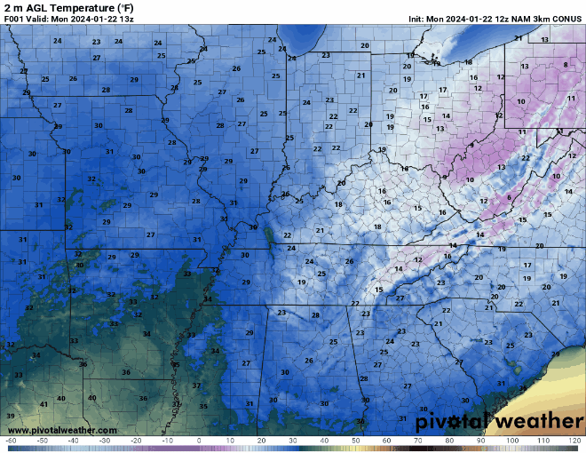
Our week’s anticipated warm-up begins with high temperatures peaking out around the mid-40s this afternoon for the first time in quite a while. We’ll stay sunny and dry with a breeze out of the south carrying along with it that much warmer air, and what snow and ice is left from this last week will likely end up melting sometime today. Tonight, we’ll only dip into the mid-30s for a low, which is much higher than some lows that we saw this weekend which were in the single digits! The magic of warm fronts, folks!
Okay, so Warm-Up: Check. What About Precipitation?
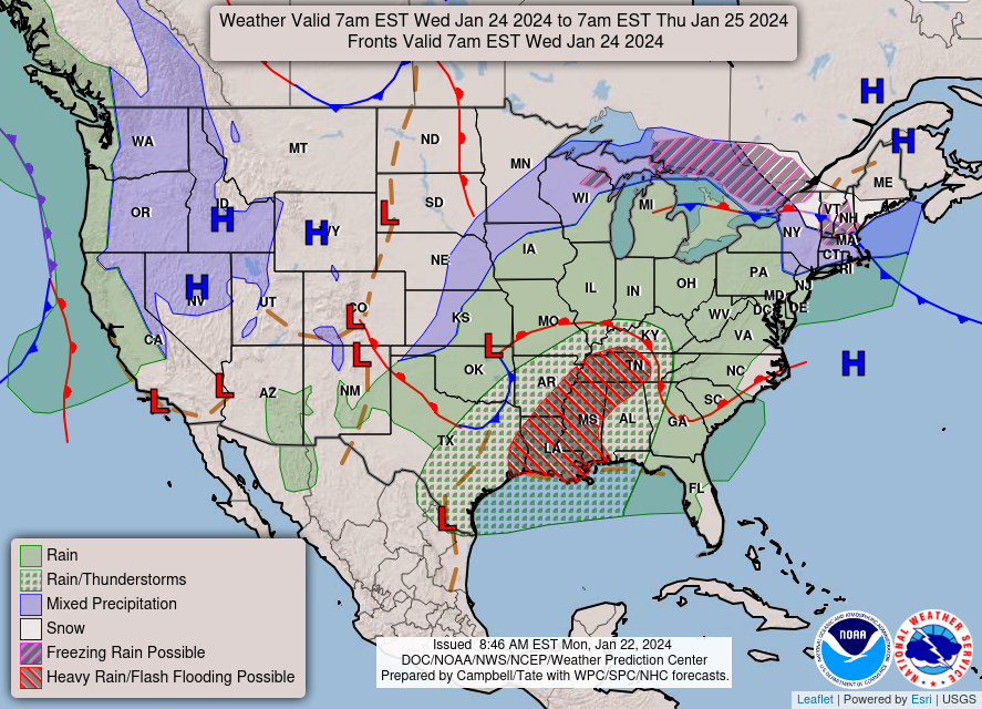
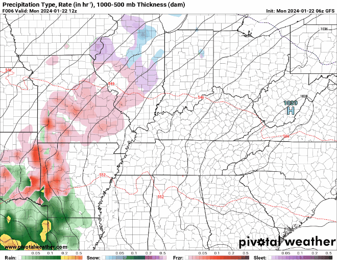
You read my mind! As with any strong frontal system and temperature gradient in the wintertime, warmer-than-average temperatures inundating a region serve to be a good setup for wet weather in the future. The basic reasoning behind this is that the source region for most of our warmer air is the Gulf of Mexico, and the air near the Gulf is typically rife with moisture coming off of the Atlantic waters there. This moisture-packed, much warmer air mass will usually drop that moisture in the form of rain once it comes into contact with a cold front, of which there are many this time of year, as we’re still in the thick of a hearty Southern Kentucky winter.
All this to say, though our incoming WABBLES warm-up is much appreciated, it will usher in a much wetter period of weather this week. A steady stream of moisture from the Gulf will keep us soggy and showery beginning late tonight and early tomorrow morning, and these waves of precipitation will last at least through Thursday night, with occasional sporadic breaks in-between. Trade that hat and mittens in for a pair of rain boots and an umbrella, because you’re gonna need it!
That’s about all we’ve got for you today, WABBLES! Enjoy the much-needed warm-up today and the bright sunshine before it’s dampened a bit by the rain that’s to come this week. Stay tuned to our Twitter page this week as we continue putting out updates about these rain-maker systems, and check back here on Wednesday for another weather blog! Stay safe, take care, and we’ll see you later, folks!