

Greetings, WABBLES! It’s time to dive into the weather forecast for the upcoming days, so let’s buckle up and get ready for an eventful journey. Numerous rounds of showers & storms are on the docket, some of which could pose severe weather threats to the region.
As we navigate through the weather rollercoaster, let’s break it down day by day.
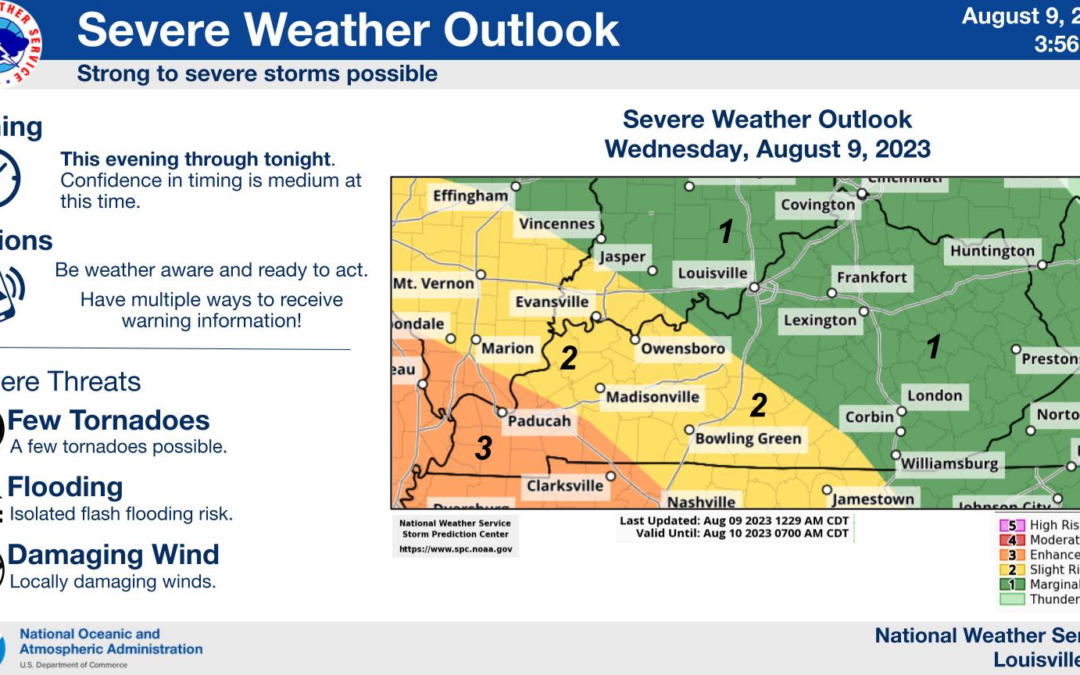
Wednesday – Increasing Clouds and Severe Weather Risk
Today, increasing clouds will be the name of the game, all thanks to a storm complex approaching from the west. It won’t be bad in the outdoors through mid afternoon, with comfortable conditions seeing highs hit the mid 80s. Soak it in before we get into the latter part of today’s daylight hours…
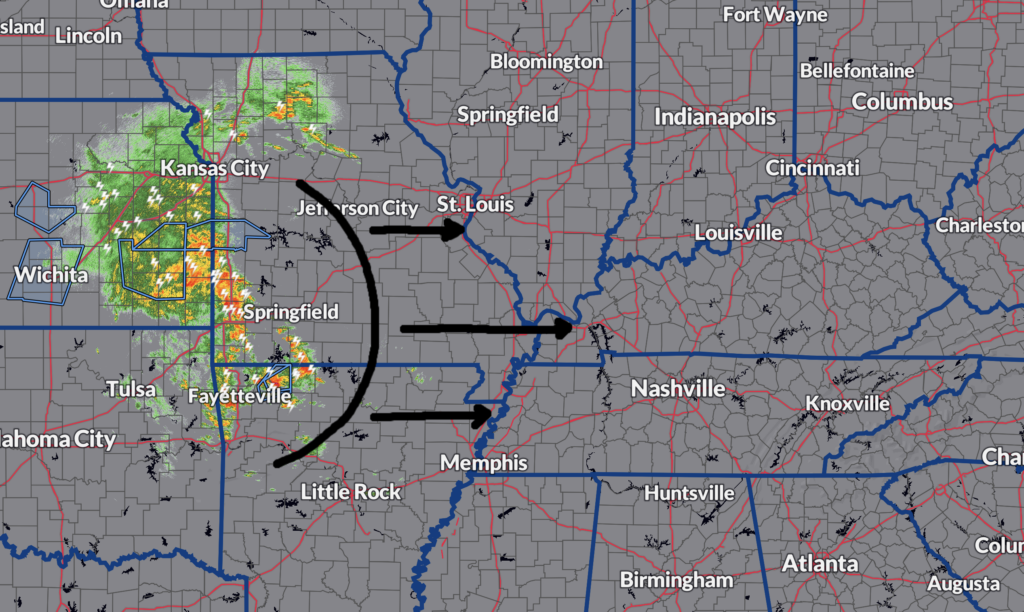
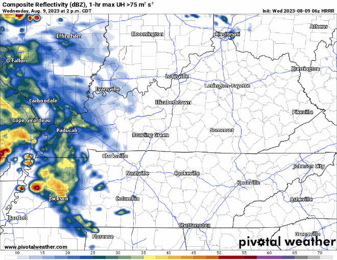
Hold onto your hats, because late this afternoon into tonight, we have the potential to see numerous rounds of strong/severe storms. Timing for the highest threats will be from ~5pm today – 2am Thursday. The latest HRRR, valid from 2pm this afternoon through 9am Thursday morning, illustrates this nicely:
Severe Weather Threats: Damaging Winds and Flooding
When it comes to the threat thresholds, our primary concerns are damaging winds and flooding. While the threat for large hail and tornadoes isn’t as high, it’s essential to acknowledge that the possibility remains. Here’s the latest breakdown from our local NWS office:
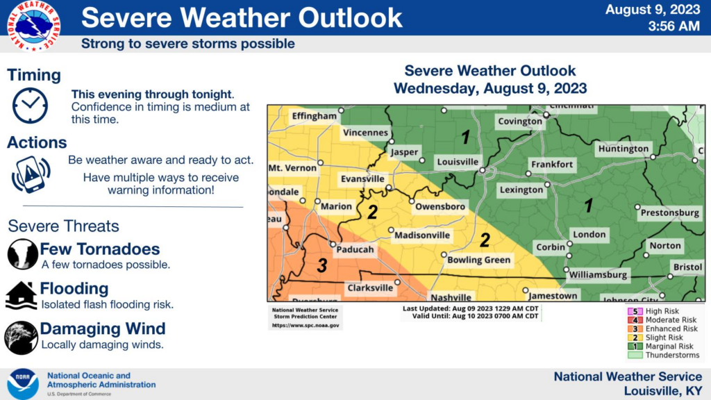
Don’t be scared, be prepared! Have multiple ways of receiving warnings in place.
Thursday & Friday – Improving Conditions
Good news arrives Thursday into Friday! Conditions are set to improve, as if the weather is giving us a breather. Scattered rain chances early Thursday will make way to decreasing clouds, thanks to a passing cold front. It’s the perfect opportunity to take a deep breath and enjoy the break from the stormy scene.
The Weekend – Active Pattern Returns
However, the calm won’t last for long. As we move through the weekend and early next week, an active pattern takes center stage once again. Get ready for more twists and turns, as showers and storms make their comeback.
WABBLES, stay weather aware today. As always, we’ll be updating as necessary @wxornotBG.