Good Monday morning, WABBLES! We’re back in the saddle again as an active period of weather sets up to carry us through the beginning of the month. Aside from some passing showers, things have been relatively quiet over the last several weeks, but that won’t be the case here in WABBLES as we approach the weekend. With an unsettled upper-air pattern in the forecast and some favorable surface conditions for some heavy rain and rumbles of thunder, you’ll want to keep the umbrella and raincoat handy this week. We’re going through all of it together, in today’s weather blog!

Today’s Forecast
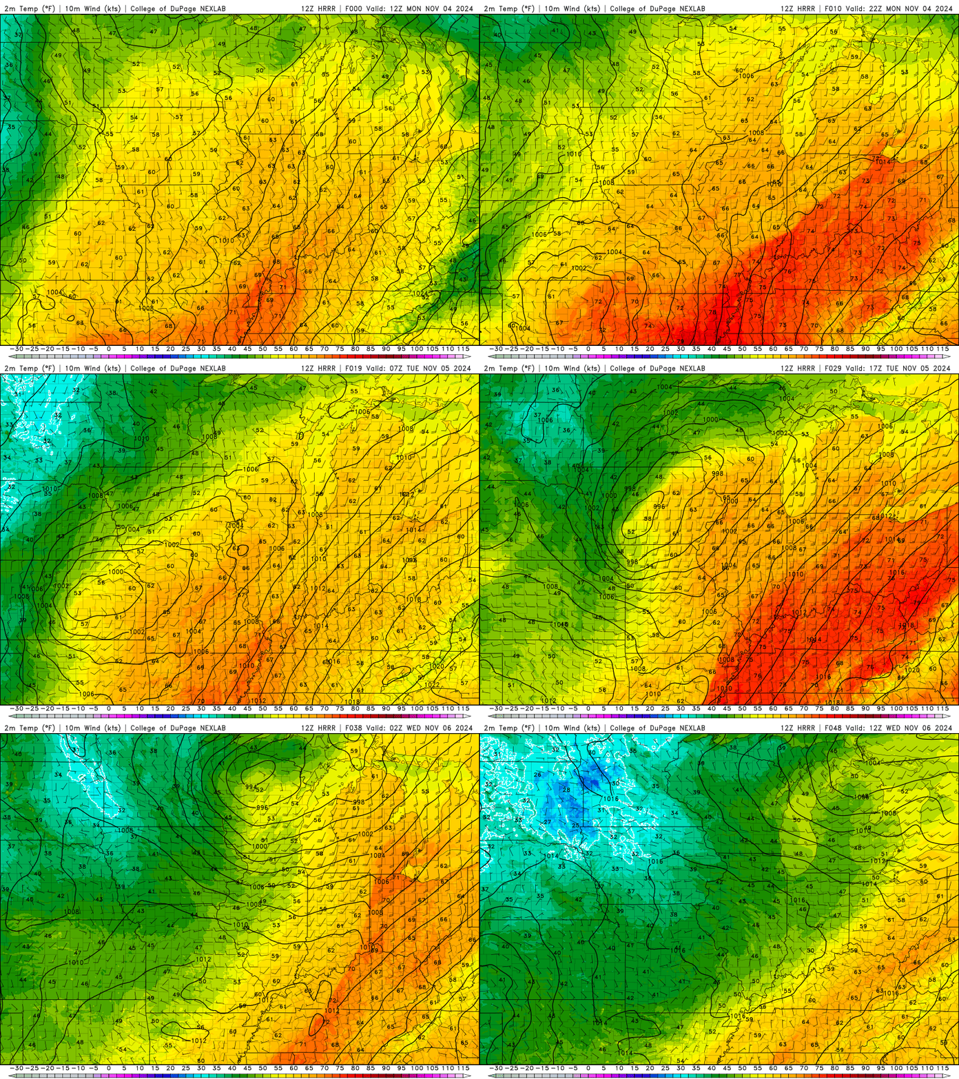
Despite the active forecast ahead, we’re actually expecting a beautiful Monday for just about everyone across the region! Expect to see high temperatures in the upper-70s and low-80s this afternoon, as broken cloud cover gives us a bit of a break from constant bright sunshine. Winds may play a factor for some, however, as gusts up to 28 MPH are possible ahead of a much larger storm system out to the west. Gusts will weaken overnight, but cloud cover will increase, hinting at the active weather likely to arrive on Tuesday night into Wednesday morning.
Okay, so what About the Active Stuff?
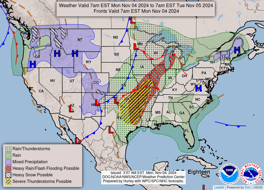
I’m glad you asked! To start off, I’d like to soothe your worries; though our weather pattern has cranked it up a notch this week, we aren’t expecting any severe storms, just rainfall and some possible claps of thunder. In fact, all the severe weather has been located off to our west, where locations in Oklahoma and Kansas have seen repeated waves of severe weather over the last several days. But that isn’t the case for us!
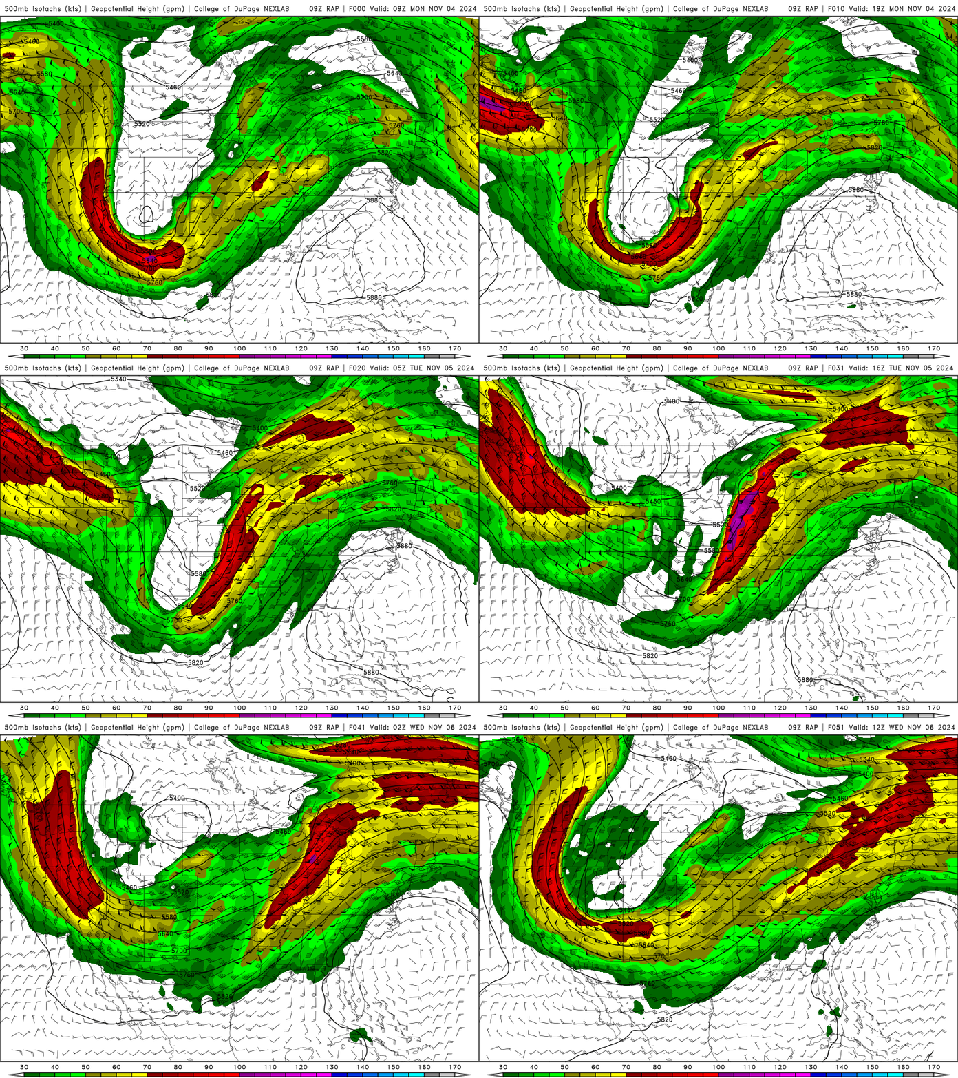
If you take a look at the GIF above, there’s a large digging trough in our mid-level atmosphere that’s been funneling lots of active rain and storms into the Central Plains. But it’s finally beginning to wander off to the east, and it’s expected to arrive here in Bowling Green by Tuesday night and early Wednesday morning. This synoptic feature will both broaden and weaken before it reaches us, however, so we’ll likely just see some heavy rain and possible lightning along a cold front that will knock our temperatures down for the rest of the week.
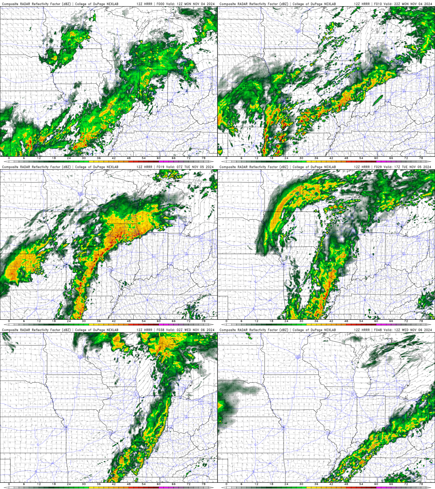
In this reflectivity loop, you can pretty easily see how all the active parts of this system have been positioned off over the Plains and Midwest for the last several days, but will creep closer to WABBLES here in the next 24-48 hours. Umbrellas and raincoats will be necessary if you’re out and about tomorrow night, but the fun won’t stop there. In fact, because the mid-level driving force of this system is moving so slowly, we’ll likely continue to see showers and scattered heavier downpours through Thursday night before finally drying out on Friday.
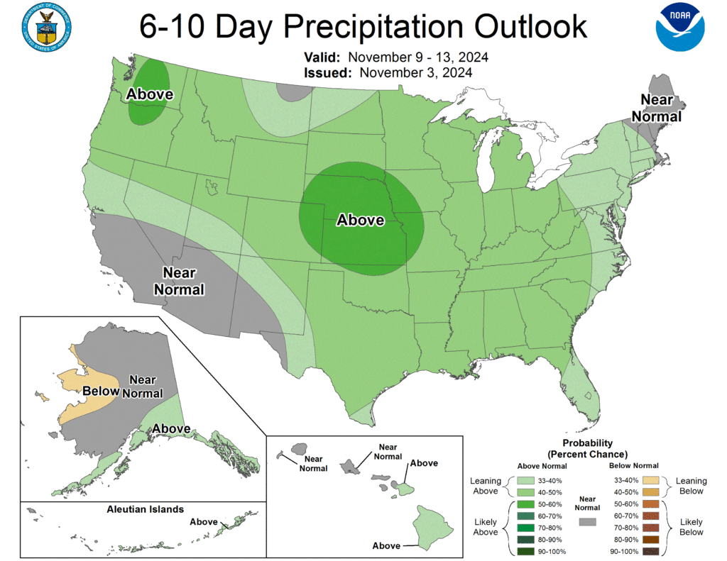
The Climate Prediction Center has called their shot for the week, and it’s clear that pretty much everyone across the mainland US is expected to see a bit more rain than average as a result of our quiet weather pattern becoming much more active. But with no significant severe storms expected, WABBLES will do just fine as long as we keep the rain gear handy for some outside excursions!
That’s about all we’ve got for you today, folks! Take care out there this week, especially with the big day tomorrow. Get out there to do your civic duty before the rain arrives, and if you’d like to stay in touch with our forecast before our next blog post goes up, make sure to check us out on Twitter! We post consistent and accurate updates as often as we can over there, just so that you’ve always got the latest information. Until next time, be safe y’all, and we’ll catch you later!
