")
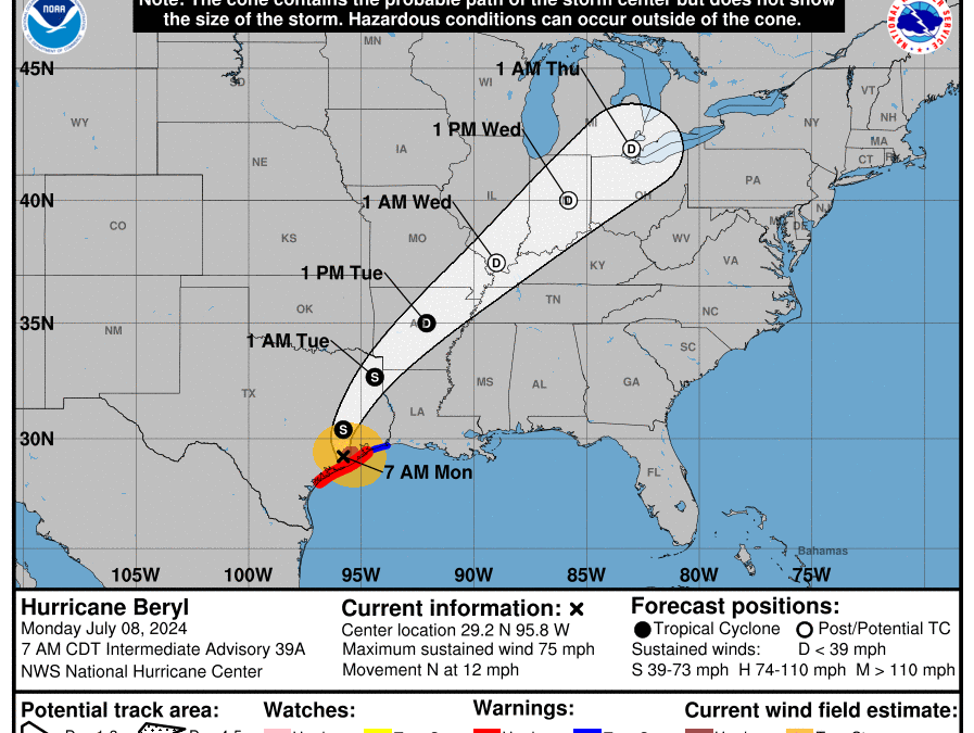
Good Monday morning, WABBLES! We’re in for a wild week of tropical weather as Hurricane Beryl has made landfall once again along the Texas coastline. With its remains on a trajectory that will have us seeing some foul weather as a result, Tuesday of this week could get a bit messy here in the WABBLES region. Strong winds, heavy downpours, and even some isolated spin-up tornadoes could be possible with what’s left of Beryl when she arrives – so start preparing by diving into today’s weather blog with us, where we’re covering everything you need to know!

Today’s Forecast
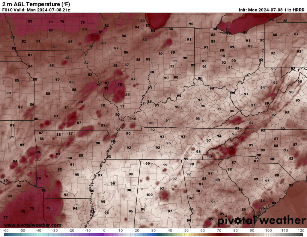
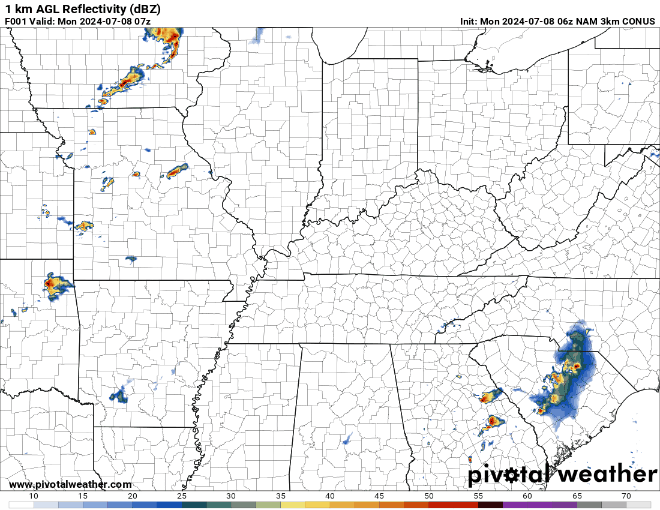
Since our main weather event won’t arrive here in WABBLES until Tuesday afternoon, we’ve got a whole day of weather to work through before we start to worry about Beryl’s tropical shenanigans. Luckily, things are looking pretty nice here across the region for our Monday, with conditions largely calm and partly cloudy for most of us in the WABBLES area. Temperatures will get up into the low-90s this afternoon, but some spotty cloud cover will help to provide shade for anyone who’s out and about today getting some last-minute preparations done before the weather picks up tomorrow.
Tropical Trouble on Tuesday?
Yes, you heard that right! As the remnants of Hurricane Beryl move inward from the Gulf, us folks here in WABBLES could see some issues with what’s left behind, as the soon-to-be tropical depression Beryl makes a beeline for our area tomorrow. In fact, the Storm Prediction Center has already issued a 1 out of 5 or Marginal Risk for severe weather tomorrow – which may not seem that high, for some of our more experienced weather veterans, but no less important to keep an eye on. The reason this Marginal Risk is so important is that the hazards that are associated with it could cause some major problems for folks in the risk area.
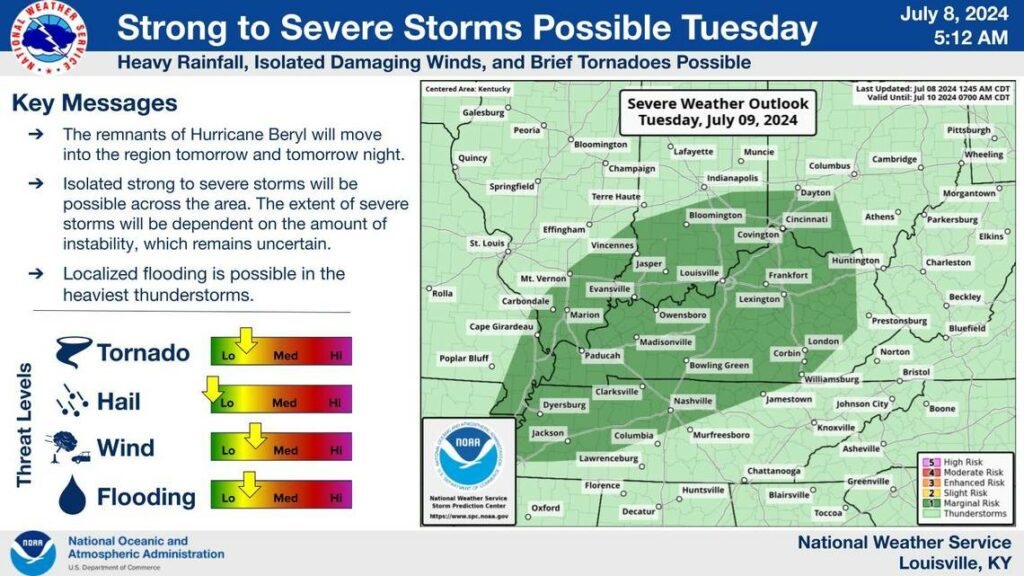
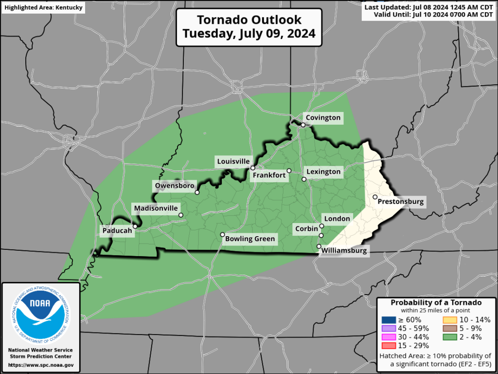
The two major risks associated with this warning area are severe winds and possible tornadoes. In fact, we’ve got a 2% chance for tornadoes, and a 5% chance of seeing severe winds here in the WABBLES region on Tuesday as the scattered showers and storms move northward through our area.
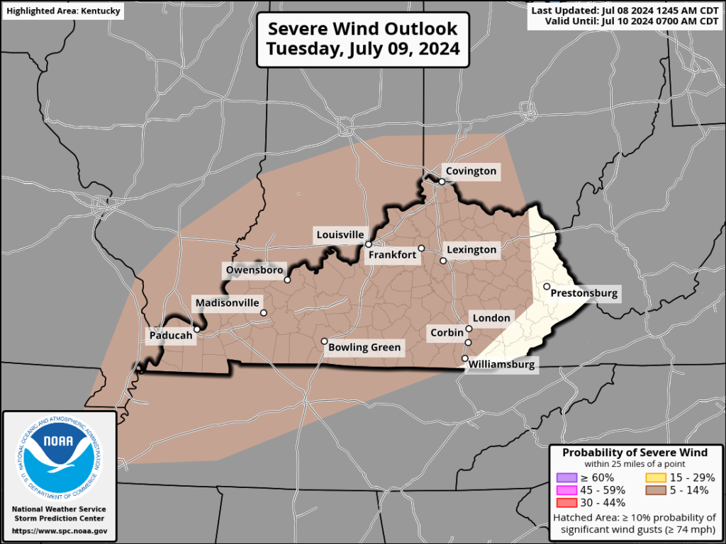
Beginning tomorrow afternoon, what’s left of Beryl will begin to move up into our region, with the main core of precipitation likely oriented to our west. However, the east side of the storm will bring with it lots of scattered individual storms that could all possibly produce very heavy rain, strong winds, and in the right situation, a brief weak tornado. However, there’s no reason to fret too much about tomorrow, because the system will be fast-moving, and once the storms associated with Beryl’s remnants have moved off to the northeast, we’ll be clear!
That’s about all we’ve got for you today, WABBLES! As long as you’re staying weather-aware tomorrow as we deal with Beryl’s lingering tropical effects, you’ll be all set to enjoy the rest of a gorgeous week. If you don’t already, make sure you’re following us over on Twitter, where we post updates on current weather conditions as they’re happening to make sure you always stay in the loop! And check back in with us here later this week for another installment of the blog, covering the rest of this week as we head further into July. Until we see you again, take care out there y’all, and stay safe!