")
Good Monday morning, WABBLES! We’re closing in on the last few weeks of May as summer-like conditions arrive in the area for the first time this season. High temperatures and bright sunshine will make it hard to deny that spring is on its way out the door this week, but it won’t last forever, as rain and storms are back in the forecast by Wednesday night. Just how warm will it get here in WABBLES? And will we see any severe weather when storms return during the midweek? We’re going through it all together, in today’s weather blog!

Today’s Forecast
Temperatures will make it all the way to the high-80s this afternoon, with some in WABBLES maybe even seeing highs of 90 degrees as a heaping helping of hot, summer air pushes its way in from the south! It’s the warmest we’ve been this year by far, and that warmth will continue throughout the week. Little to no cloud cover and light winds will keep humidity high until sundown, with dewpoints in the mid-60s making it really soupy out there. If you’ve been waiting to pull the trigger on an outing to the pool, there’s no better day than today!
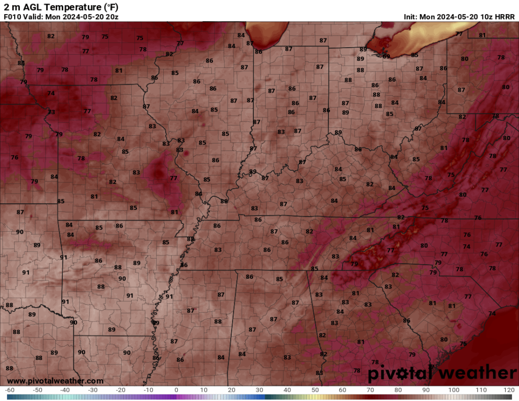
Tuesday will be much the same story, with more bright, sunny skies and a summer-like high temperature in the upper 80s. Little to no significant wind will ensure that we’re feeling every single degree of that heat, so bring along that sunscreen and sunhat, too. But it doesn’t last for long, as wetter weather works into WABBLES again on Wednesday. (See that alliteration I did there?)
Summer Heat = Summer Storms?
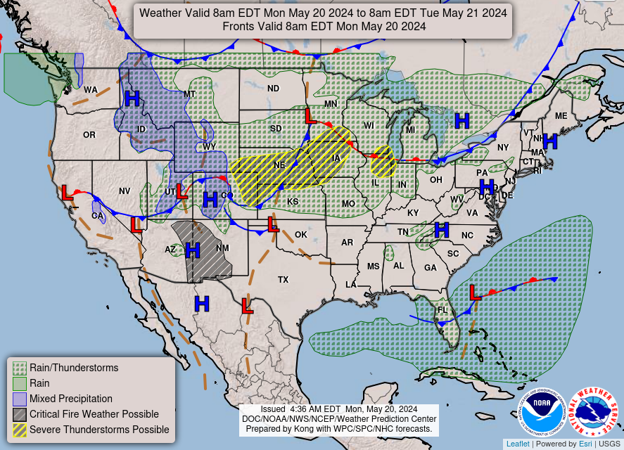
You got it! Wednesday night will mark the return of showers and storms to our beloved WABBLES area, with spotty precipitation chances lingering through the rest of the week once they arrive. Since we’re still a few days out, our short-term models that handle thunderstorm convection aren’t quite able to see exactly how severe these showers and thunderstorms may be, but it’s still important for us to give you a heads-up in case you’ve got outdoor plans Thursday and Friday.
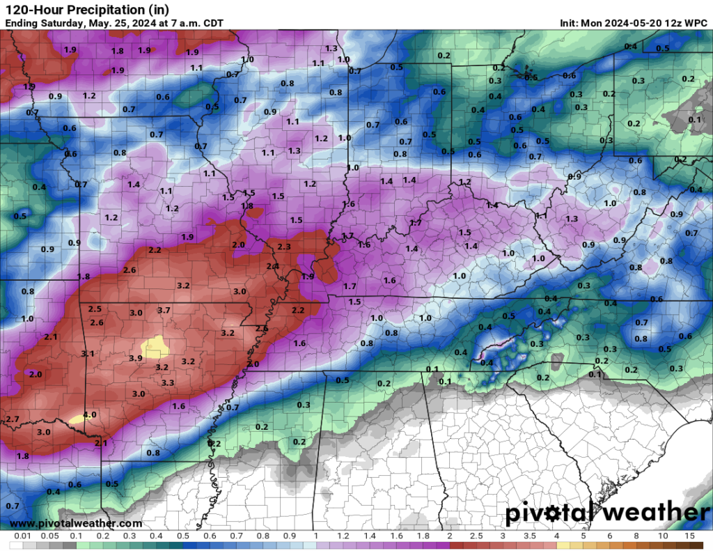
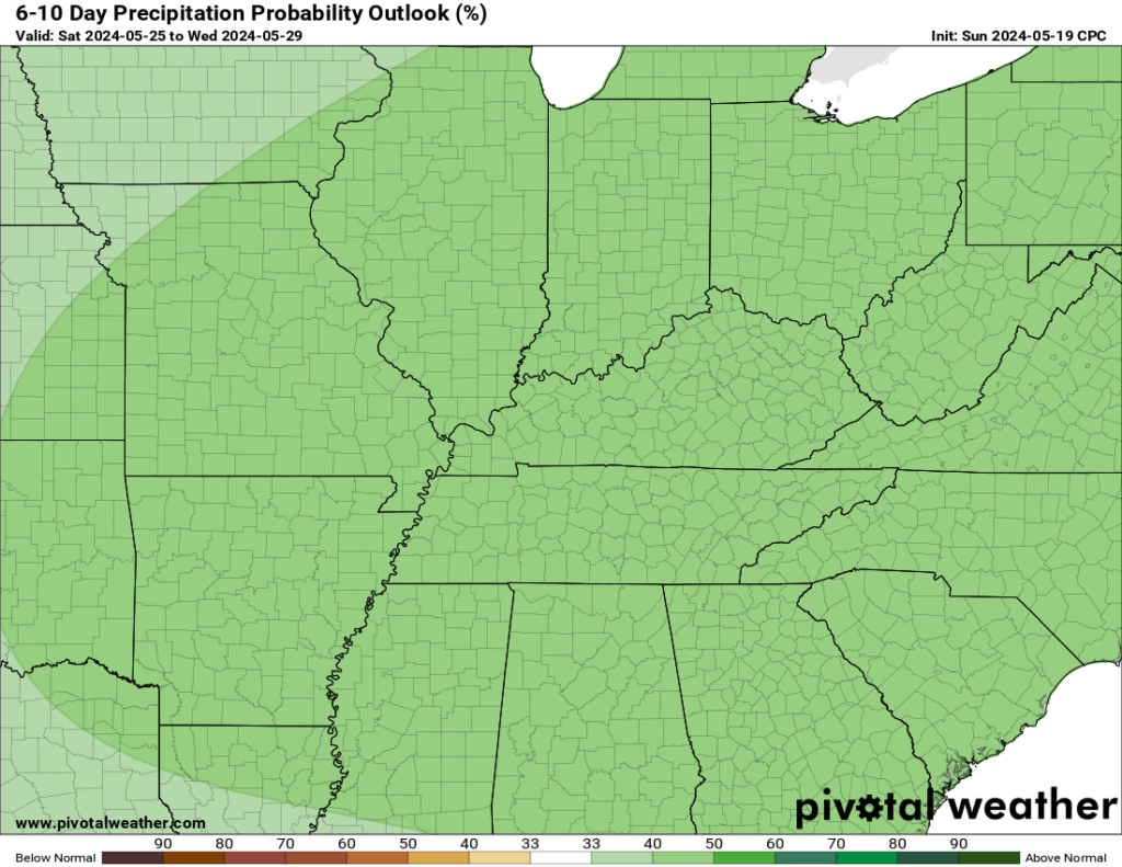
Since we’re entering into a much more summery weather pattern, we can expect to see some more of those typical summer air mass pop-up thunderstorms as we go through the end of May and start into June proper. Because of this, and the fact that we’ll likely have a few more storm systems move through WABBLES before the end of the week, the WPC has also highlighted the state of Kentucky as a region that will likely see more than average precipitation over the next 6 to 10 days.
Try to keep all of these factors in mind as you start making plans for the rest of the month! No matter what we’ll be here to keep you informed as these weather situations approach and evolve; if you don’t already, make sure you’re following our Twitter page, where we post consistent real-time updates on the weather as it makes its way into WABBLES. And follow us on all our other socials too, so you don’t miss it when we go live with our morning weather reports and our severe weather coverage, if necessary!
Until next time, take care out there folks, and we’ll see you later!