

")

After an active week that featured both tornado warnings and ground-covering graupel in WABBLES…within 24 hours no less…things look at least calmer as we head into the weekend, but I don’t think we’re completely dry as we head through the weekend.
Starting the Weekend: Friday and Friday Night
Cool high pressure remains in control as we head through the afternoon today. We may still have some stubborn clouds that just refuse to go away.
Those clouds, combined with the cool air that has settled into the region will allow for highs to stay on the cooler side as we run through the remainder of the day. Highs only make it into the middle 50s. You know…spring.
We’ll have to be on the lookout for some frost around WABBLES as we head into the overnight as slowly clearing skies allow temperatures to plummet down into the lower to middle 30s. Keep those plants covered up if you’ve planted already. A Freeze Warning is in place for Butler and Edmonson Counties, as we head through the overnight hours! Everyone else is in a Frost Advisory.
Into the Weekend: Saturday and Sunday
High pressure finally settles in as we head into the day on Saturday, bringing more sunshine to the region and also helping boost those temperatures a little closer to, you know, where we should be for early April!
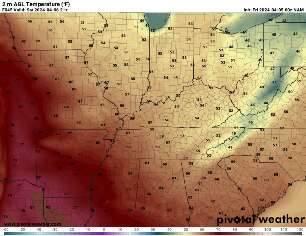
We’ll see a few clouds drift back in a little bit later into our Saturday afternoon and evening. Shouldn’t keep us from getting into the lower 60s for really an outstanding Saturday afternoon, but a bit of a cool evening. Those few clouds and light southerly breezes will keep us slightly milder than previous nights, with lows only making it into the upper 30s.
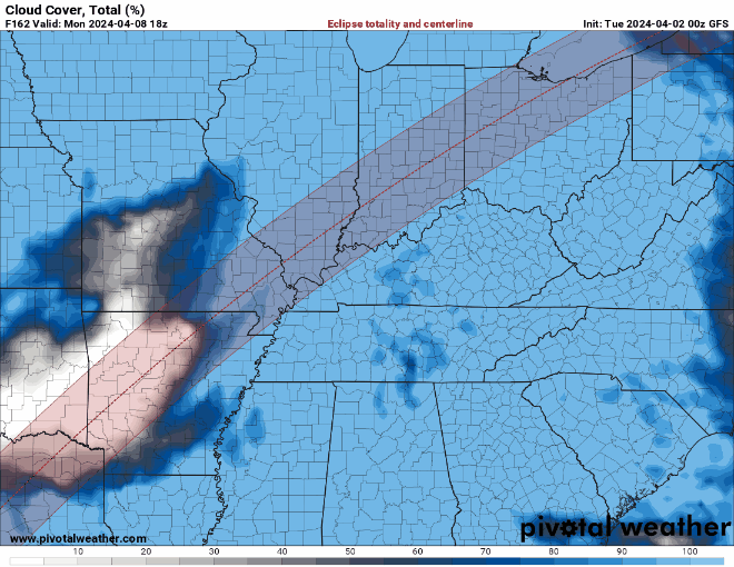
Our next system begins working into the region as we head into the day on Sunday, which also has implications for partial eclipse viewing potential on Monday. A stronger system off to our north and west will attempt to dig into the region, returning showers to the region.
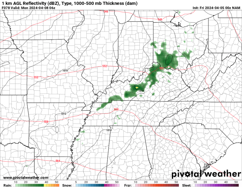
I’m not saying it’s an all-day rain, but it could get damp at times as this system swings through. Skies stay otherwise mostly cloudy, with highs back up into the lower 70s as showers work in. Those showers continue overnight as this impulse of energy works through the region. That keeps us quite mild overnight, with lows in the middle 50s.
Past The Weekend: Into Next Week
Critical forecast headed our way on Monday. No, not for severe weather, but for the solar eclipse!

I mean, not quite total for us, but still a good science lesson and a heck of a sight to see, even without the breathtaking sight of totality that we saw 7 years ago.
Our Sunday night system looks to be moving out as we head into the early hours of Monday. That should allow us to break out into sunshine. The question becomes, though, do the clouds hang on? Do they dissipate and re-appear in the heat of the afternoon? Do we see clouds from showers to our southwest sneaking back in here? Those are all questions that are simply too tough to answer right now.
The good news is that things do appear to be warm and dry, with highs back into the middle 70s! That warming trend continues as we head into much of the week.
Well, the warm part sticks around, but I’m not so sure about the dry part.
Models continue to hint at the potential for more showers and thunderstorms Tuesday, Wednesday, and into Thursday as our unsettled pattern continues. So far, there’s not a big signal for potential severe weather, but it is something we’ll watch, given that we’re deep in spring severe weather season now.
That’s it for me for now! You can always keep up with the latest on all of our social media platforms. Have a tremendous day and a great weekend!