

")
Good Tuesday Morning WABBLES! I hope everyone is enjoying the day so far. I wish I brought good news, but we have potentially significant severe weather expected today.

Current Conditions
In BG currently, we have broken into the 70s with dewpoints well into the 60s. As the morning progresses temperatures are expected to rise.
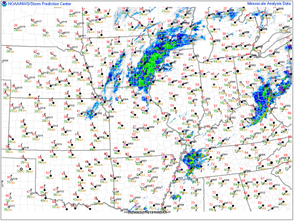
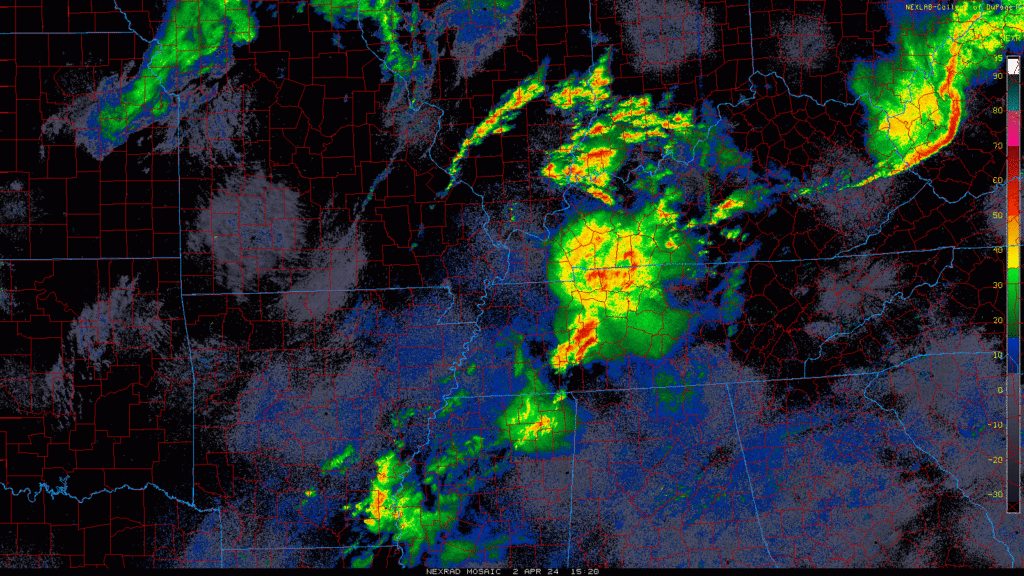
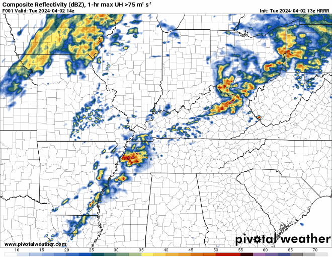
We have a mass of rain and storms starting to enter WABBLES that is currently below severe limits. This will continue to move through over the next couple of hours.
Warren, Allen, Barren, Logan, and Simpson counties in WABBLES are currently under a Tornado Watch until this 3pm afternoon.
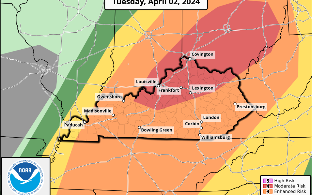
The SPC is maintaining the Enhanced (level 3/5) for WABBLES with all modes of severe weather on the table. This includes tornadoes, damaging winds, and large hail.
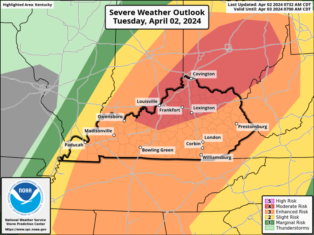
Severe Chances
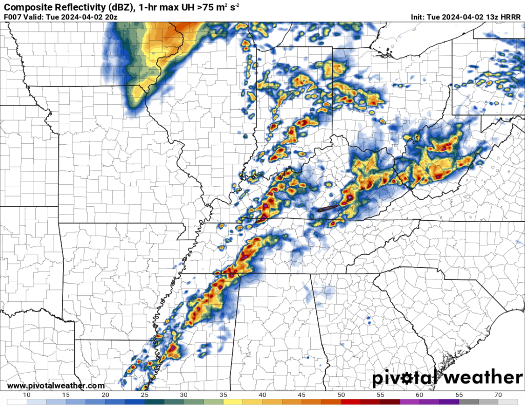
As we are getting closer to this event playing out, there are still plenty of uncertainties with how this will evolve. The current forecast calls for multiple rounds of storms starting later this morning and lasting into the evening.
The big question will be whether or not the atmosphere will be able to remain supportive for severe weather after each round of rain and storms. Currently, the models are saying it will be able to, thus resulting in our heightened severe weather threat.

While any storms today should be in an environment supportive for severe weather, the storms along the cold front should be the strongest.
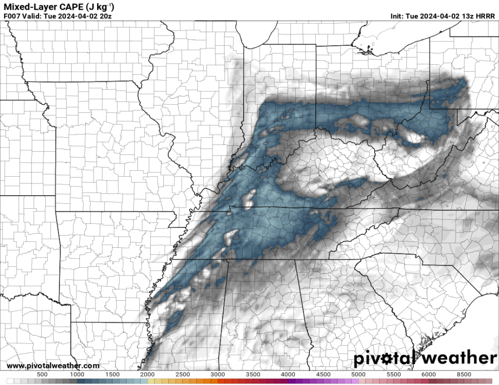
Looking at the instability as the cold front storms approach, we should be in the realm of 1000-1500+J/kg of CAPE. That is more than enough fuel for storms to be strong to severe.
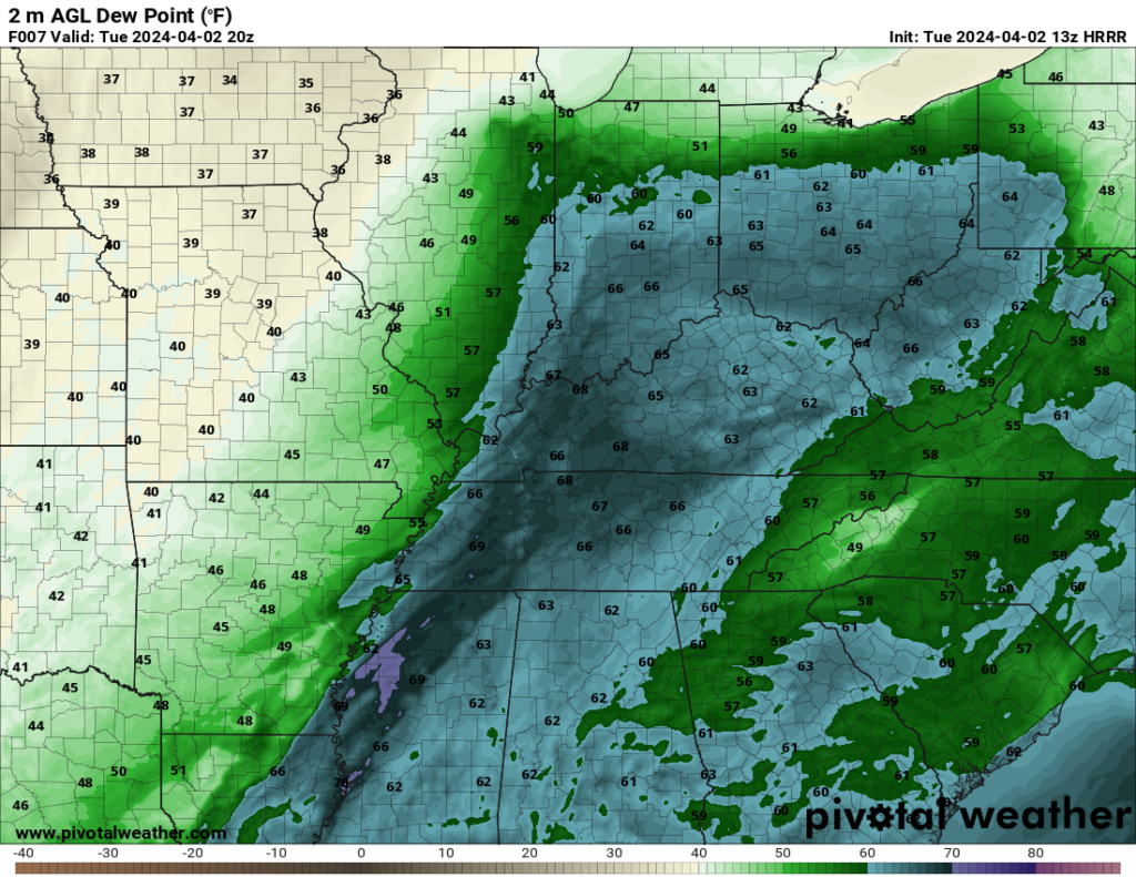
Dew points, which are related to instability and the amount of instability the atmosphere can hold look to be in the upper 60s. That is an incredibly juicy atmosphere for storms to be in and not something you want to see on a day like today.
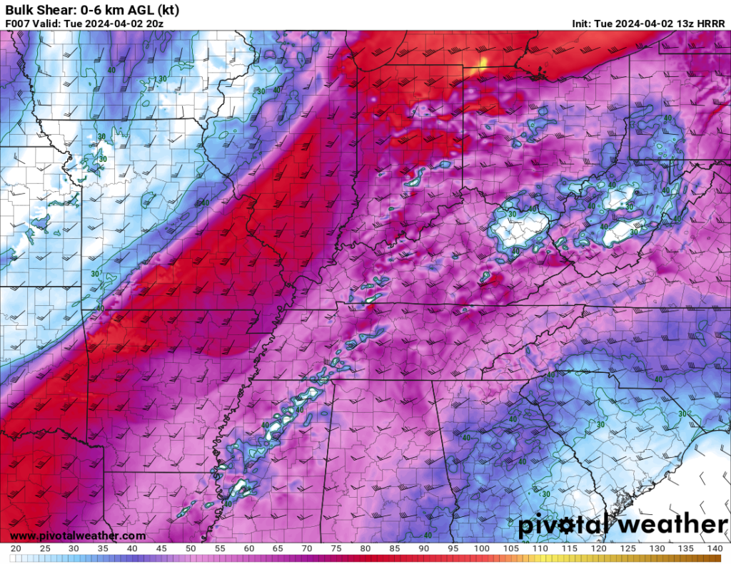
Our bulk shear in the 0-6km range looks to be greater than 60kts. Like instability, that is more than enough to sustain severe storms.
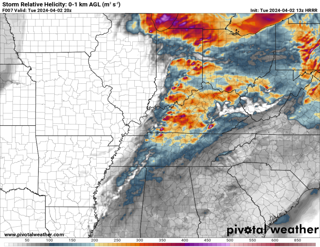
Another parameter related to wind shear is Storm Relative Helicity. This is, basically, the propensity for updrafts within storms to rotate. When those updrafts rotate, your tornado chances increase quite a bit. Values need to be around 150 for a tornado threat and we should be between 200-300+.
All of these parameters come together to say the threat for potentially significant severe weather is there, but not guaranteed. If the first few rounds of rain of rain and storms limit the atmosphere’s ability to destabilize, the threat for severe weather goes down dramatically. That is what we will be watching for today.
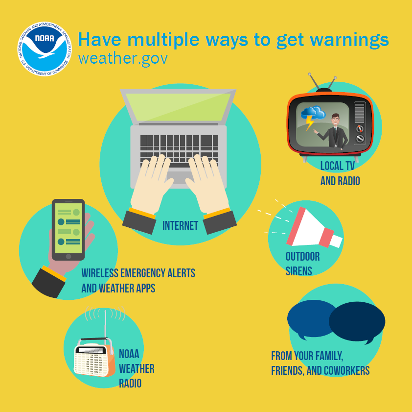
Regardless, however, it is important for everyone not to panic about this. Rather we all need to have a plan in place in case warnings are issued.
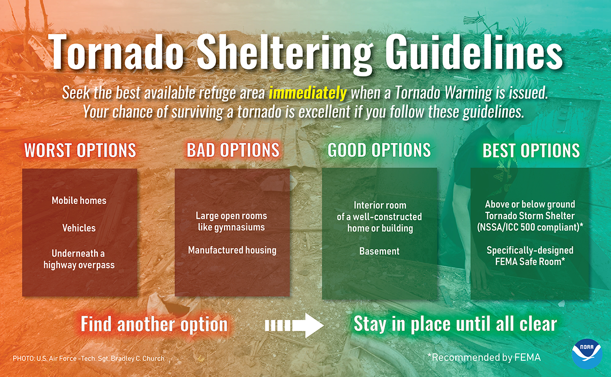
It is also important to have multiple ways to receive warnings in case one system fails, and sirens do not count as a way to receive warnings.
That will be all for today folks! I hope everyone remains safe and I highly encourage everyone to follow us on our socials @wxornotBG. Stay tuned and we will get through this together.
Have a blessed and safe day!