

")

It’s been a mostly pleasant week throughout WABBLES as high pressure meant sunny skies, even if it also meant cooler than average afternoon temperatures. However, that changes this weekend as we re-introduce showers to the forecast as our active pattern slowly returns
Into the Weekend: Friday and Friday Night
Our next system continues to push through the region during the day today, bringing us widespread showers throughout the region today. While this isn’t heavy rain, it does look like rather steady at times, so the gloominess does look to hang on as we head through the afternoon.

We’ll try to make it up to around 60º or so in the afternoon, but some folks may have some trouble as we see plenty of clouds and showers. Those continue into the evening, but should start to wane as we head into the overnight hours. We’re back down into the 40s overnight as cooler air tries to sneak back in.
Weekend Proper: Saturday and Sunday
The good news is that, by Saturday, we’re looking much, much nicer as we head into the afternoon. Skies will continue to clear as we head through the day. Really looking nice for the first weekend of spring as sunshine makes a triumphant return to the region! That will not only be a really nice looking day, but a nice feeling day too…if a little chilly. Highs will make it up into the upper 50s to near 60º as we head into the afternoon on Saturday…and it only gets better from there. The only thing is we have to get through a little overnight chill.

Things are looking cool overnight as high pressure keeps skies mostly clear. Lows are back into the middle 30s as we head past dark and into early Sunday morning. And if you thought Saturday was nice…let me show you Sunday.
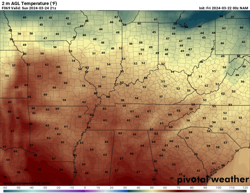
Yet more sunshine as we start off the day on Sunday, appropriately enough. However, southwesterly winds will really helps us boost those temperatures into the afternoon. Highs look to make a run back into the middle 60s, to perhaps even the upper 60s for parts of the region. However, we will start noticing a few changes.
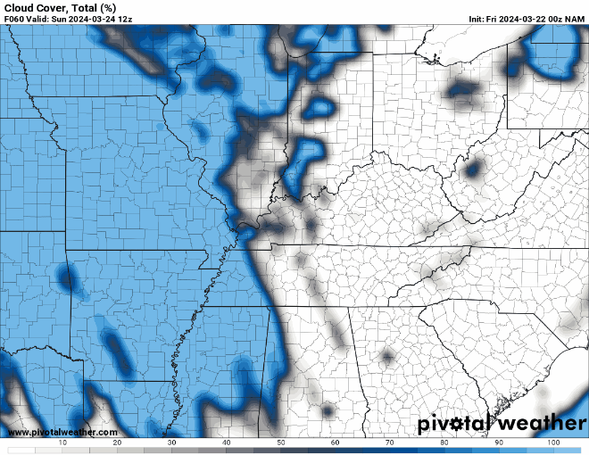
High cloudiness will start to push into the region during the afternoon on Sunday as our next system begins to gather steam to the west of WABBLES.
As skies turn partly to mostly cloudy during the overnight hours, it will keep us much, much milder during the overnight hours. Lows only fall back into the middle and upper 40s during the overnight hours, which is well above normal for this time of year. It’s a harbinger of a storm system still to come.
Past the Weekend: Into Spring’s First Full Week
Things are, of course, looking showery as we head into spring’s first full week.

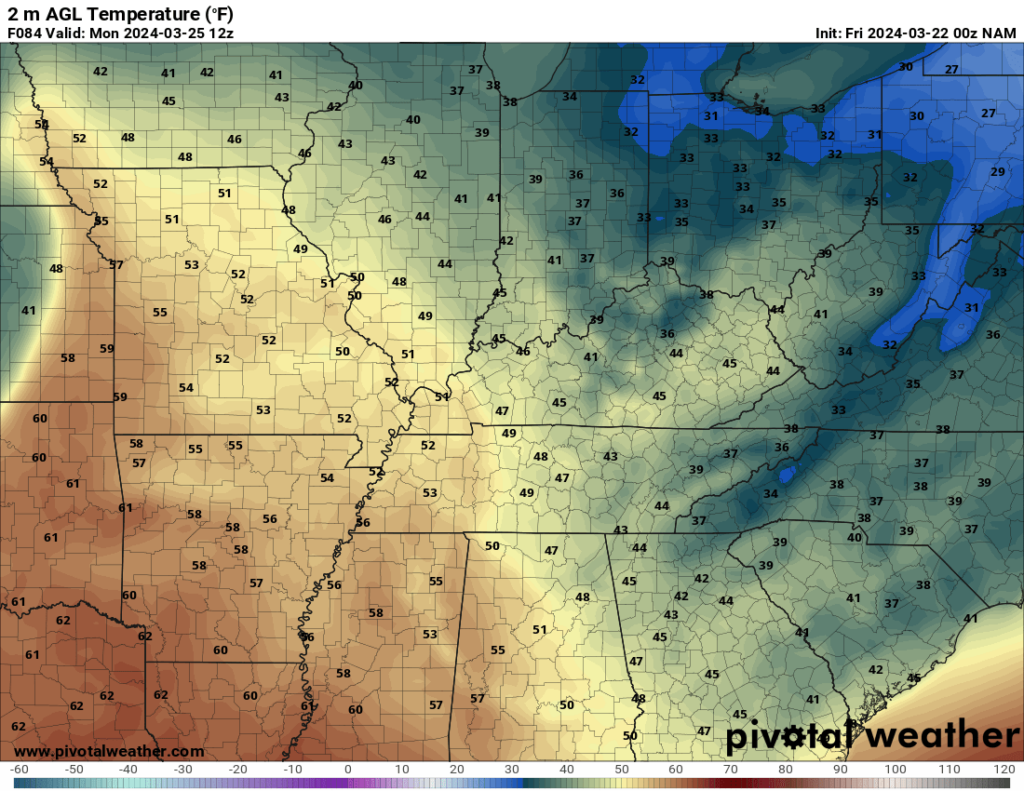
We may start the day on Monday dry, but we’ll be watching an increase in showers as our next system begins working toward WABBLES during the afternoon. Outside of showers, it looks like it will be quite breezy as highs make a run into the lower to even middle 70s possible.
At this point, it’s not looking like much in the severe weather department, but we’re keeping an eye on things as we head into next week. Some showers will continue overnight Monday as gusty winds continue, with lows only back into the middle 50s.
We’ll keep some showers around on Tuesday before some dry weather tries to sneak back in for the second half of next week.

That’s it for me for now! You can always keep up with the latest on all of our social media platforms. Have a tremendous day and a great weekend!