

")
Happy Wednesday everyone! I hope everyone has had a great week so far, even with the rather chilly temperatures out there. Although Spring officially started yesterday, will we be seeing more of spring or winter weather?
NEar Term
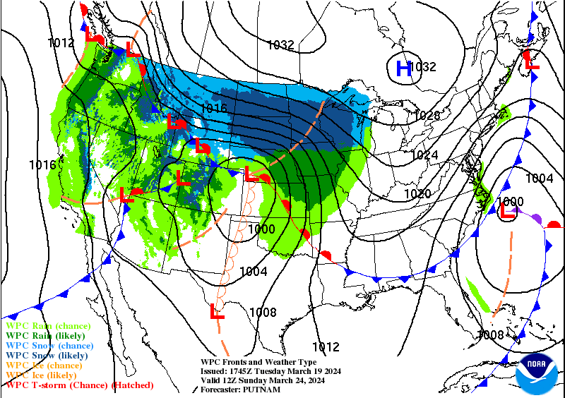
From today until Friday night, we will remain free from rain chances thanks to some suitable high pressure across WABBLES.
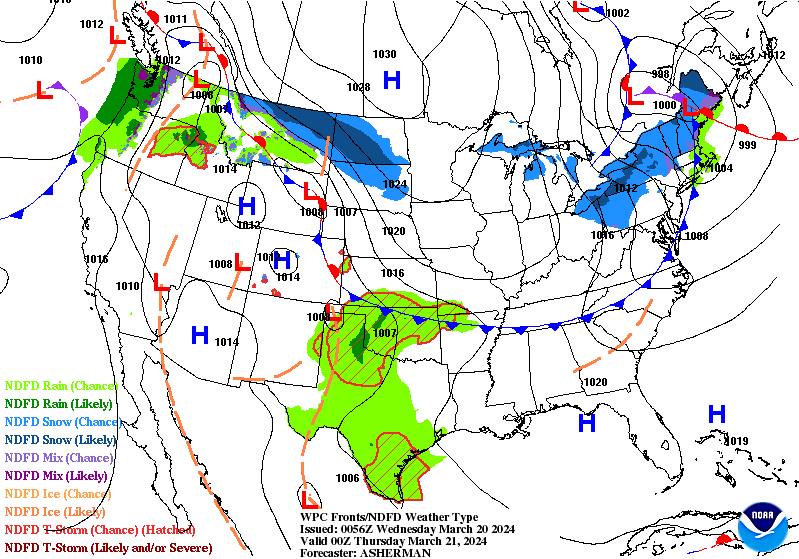
Although we will be free from rain for a little while, we will see a couple of frontal passages which will make our temperatures play hot potato. Oh boy, this should be fun with spring one day and winter-like the other.
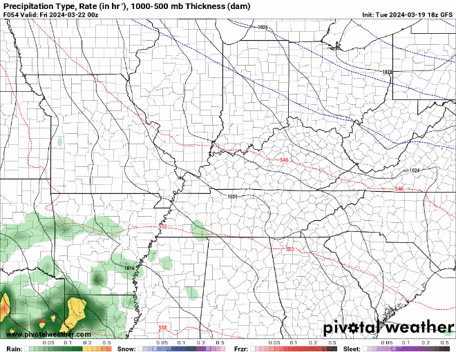
The rain chances Friday night doesn’t look too overly impressive, but it will likely pack just enough rain to be a nuisance.
By Saturday Afternoon, high pressure will build back into the WABBLES region keeping any more rain chances at bay.
Long Term – Spring?
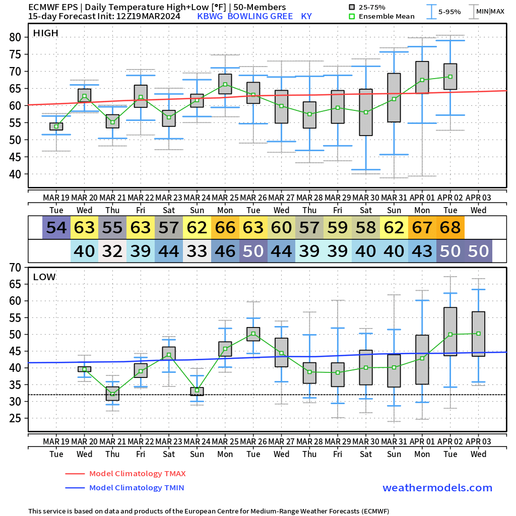
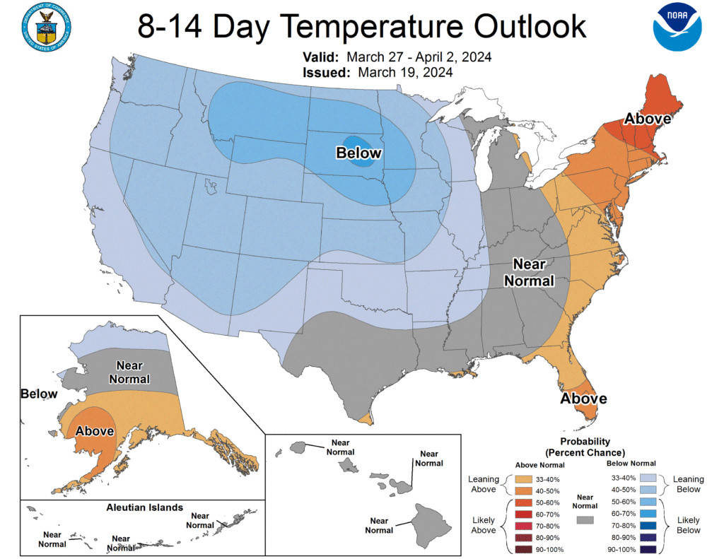
Looking at temperatures in the 8-14 day timeframe, WABBLES can expect near normal to just below average temperatures. With this being technically Spring now, the average temperatures around WABBLES is in the mid-60s. So I would expect around or just below that as we go into April.
That will be all for today folks! I hope everyone has a great day out there and enjoys the weather. I encourage everyone to visit our social media accounts @wxornotBG for the latest!
Have a blessed day!