

")
Happy Wednesday to everyone out there across WABBLES! I hope everyone has had a great week so far and are enjoying the increasing temperatures. The warming trend is here to stay and we will also be seeing active weather returning next week.

Today & Tomorrow
Today looks to be very pleasant with highs in the mid 60s with sun and returning clouds. High pressure will keep any weather makers at bay for another day before we have active weather returning.
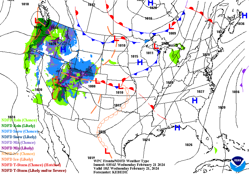
Starting tomorrow, we will be seeing active weather returning with rain and thunderstorms, primarily in the afternoon and beyond. Late evening into the overnight hours is when we could see the heaviest of showers and some thunderstorms.
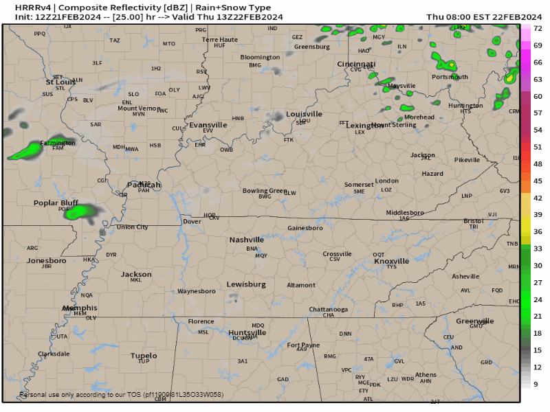
Currently, it is looking like instability and dew points should be low enough to keep any severe weather risk at bay. But, non-severe thunderstorms will likely be embedded in the rain.
Long Range
Starting the long range discussion, we will look at a storm date next week which will continue the active weather returning.

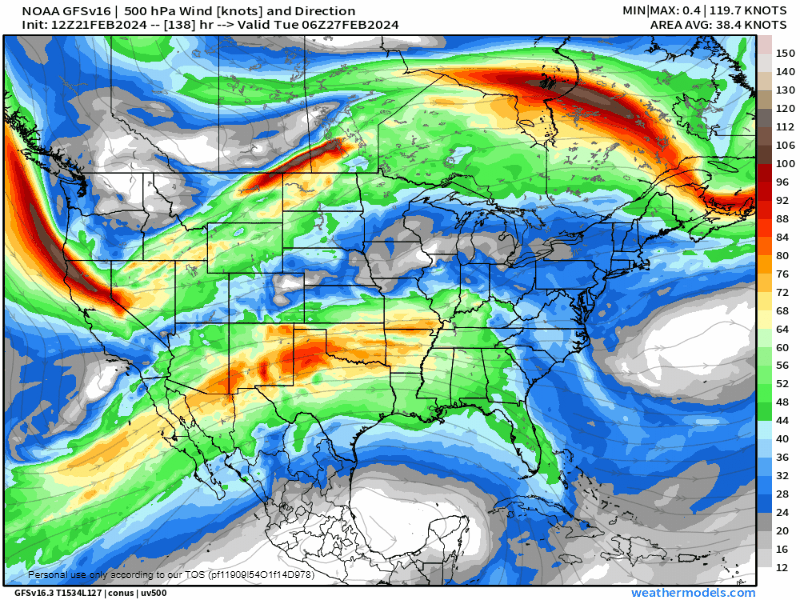
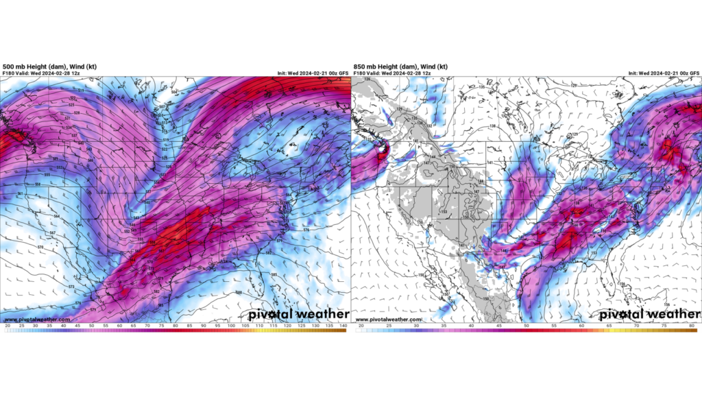
Global deterministic models are picking up on a trough to bring a system through the WABBLES region sometime Tuesday-Thursday next week. This is currently looking like quite the expansive system brining severe weather chances along with it.
Model variability is quite high at this moment with how the upper level pattern will evolve which dictates what weather we will see from this. This variability is making any remotely fine details impossible to pick out right now.
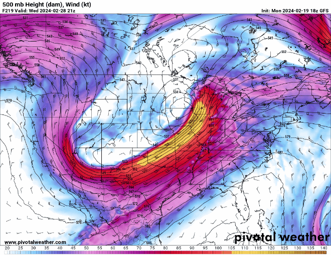
The thing the models have all been consistent on is the existent of a system and the basic severe weather ingredients being present. The four basic ingredients of any severe weather set up is shear, lift, instability, and moisture, or SLIM for short.
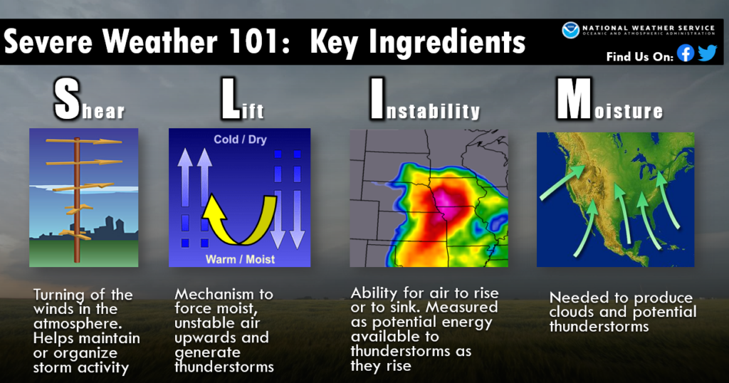
Starting off with shear, this is simply the changing of wind speeds and direction with height. Looking at the big picture (which is what you want this far out), confidence is high that we will see wind speeds increasing as you go up in altitude while simultaneously changing direction, shear.
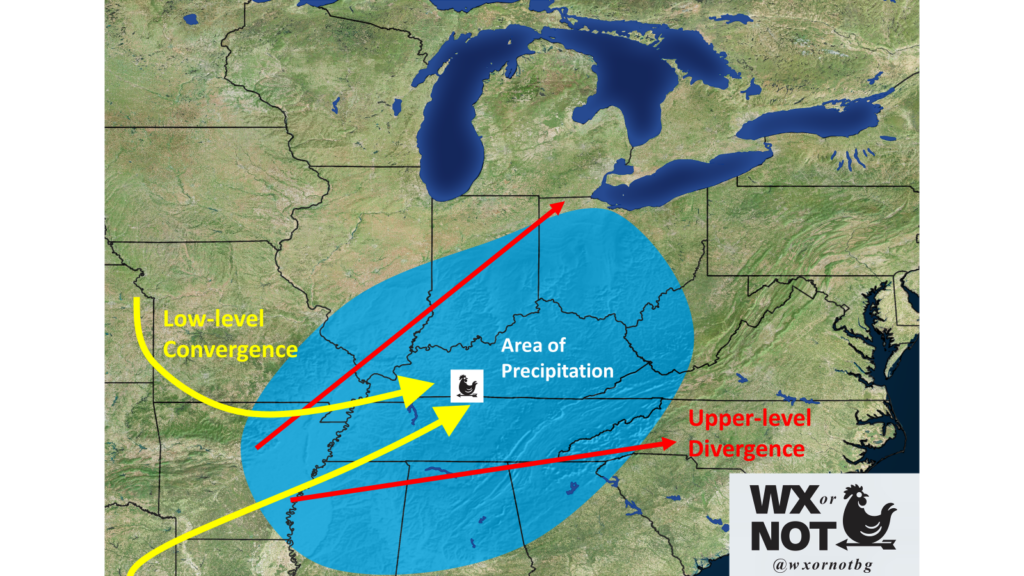
Lift is simply a process to help aide in storm development, we have talked about this before with other systems in the past. Upper level diverging winds and lower level converging winds is a textbook sign of lift. I am confident we will have this ingredient in place next week.
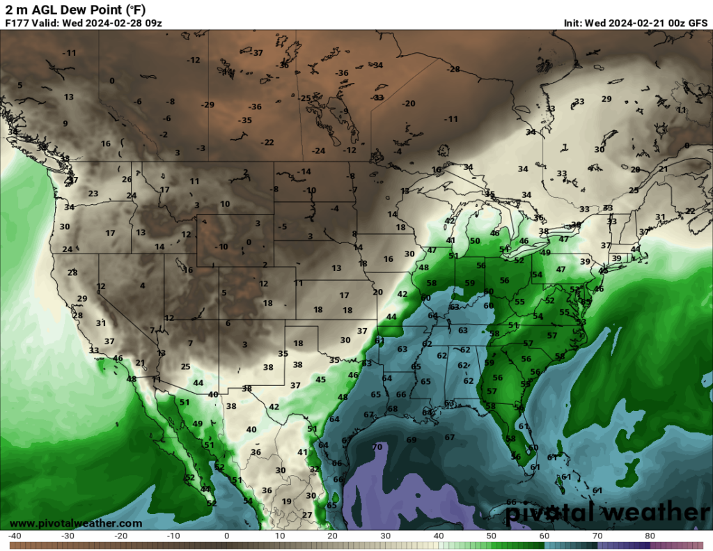
Instability gets harder to predict this far out, but moisture and instability are linked and moisture is easier to predict this far out in the form of dew points. Basically, in areas with higher dewpoints (especially > 60), there is a better chance for instability to exist and for more of it to exist. A large swath of those 60+ dew points has been consistently showing up in the models so confidence is fairly high with this ingredient as well.
So, it looks like we will have our four basic ingredients for severe weather in place next week which warrants us keeping a close eye on this. However, there are still much more questions than answers this far out. These questions will primarily revolve around timing, and who sees the best mixing of these ingredients.

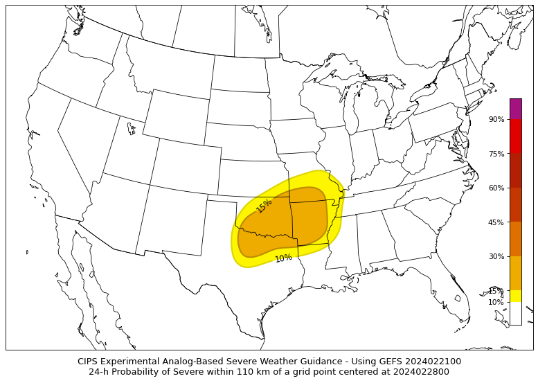
To further back up the idea that severe weather might be possible, other data sources are picking up on it as well. Firstly, the CIPS Analogs have areas highlighted just to the west of WABBLES for next Wednesday.
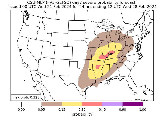
Colorado State University has a model based off of machine learning that can also be used to look at severe weather probabilities. It is highlighting a different area than the CIPS, but that isn’t as important this far out, rather just the fact that it is highlighting an area for severe weather chances.
In Conclusion:
- Models in agreement for severe weather risk between Tuesday-Thursday of next week.
- Models in disagreement over exact area to see severe weather risk.
- Basic severe weather ingredients will be present.
- No way of knowing finer details yet.
- Something to keep an eye on, but not something to be alarmed about.
That will be all for today folks! I hope everyone enjoys the nice weather today, for updates on the active weather returning I encourage everyone to visit our socials @wxornotBG.
Have a blessed day!