

")

It has been a rather sunny and mild week around WABBLES, especially for mid-February! That trend looks to continue…of course, after an early weekend cold snap.
Easing into the Weekend: Friday and Friday Night
After several days of sunny weather throughout the region, the bill comes due today as showers start to push into the region early in the afternoon. With temperatures well above freezing to start with, showers should be all rain, highs look to make it into the lower 50s. Things look to change a bit, though, as we head into the overnight.
It’s an interesting forecast, no doubt about it…however, I’m not convinced that big weather issues are in the cards for us. Those showers continue to push through WABBLES during the evening and overnight hours. Temperatures will drop overnight, with lows making a drop down into the middle 20s.
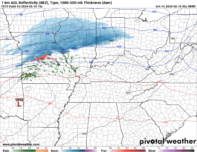
For us, indeed, we’ll see rain showers switch to snow showers during the overnight hours. However, thanks to the mild temperatures on the roads and the less-than-intense snowfall rates, I’m just not sure we’ve got enough there for any kind of major impact. At the same time, those crashing temperatures may help freeze existing wet spots on area roadways, especially elevated surfaces like bridges and overpasses. Just keep that in mind if you have to be out early on Saturday morning as we will have to watch for isolated slick spots.
We cool down quick once snow showers come to an end. As we clear out, temperatures tumble back into the middle 20s overnight.
Heart of the Weekend: Saturday and Sunday
The good news is that we don’t expect much in the way of impactful weather once the sun comes out on Saturday!

High pressure takes back over as we head through the early hours of Saturday. Expect plenty of sunshine on the way as we head into the afternoon! Just don’t expect it to be warm! Temperatures will only make subtle progress above the freezing mark during the afternoon hours. Topping out in the middle 30s. The overnight chill continues as lows tumble down into the lower 20s.
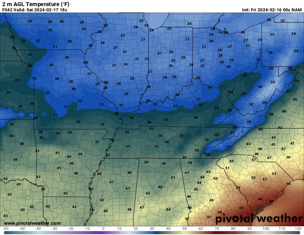
The sunshine rolls along as we head into the day on Sunday, though things will appear slightly nicer!
High pressure begins pushing to the east. That won’t end its influence, but it will allow southwesterly winds to warm those temperatures back into the upper 40s to right around 50º with plenty of sunshine on the way as the afternoon rolls along!

Overnight, clear skies look to continue as lows fall back into the middle 20s.
Past the Weekend: Into Next Week
We are keeping things mostly tranquil as we head into next week or so with high pressure staying in control.

Sunshine continues into tMonday and Tuesday with only a few passing clouds pushing through the region. The big story will be the mild air! Well above normal temperatures expected through the middle of the week. We’re back in the 50s on Monday, but look to peak in the lower to perhaps the middle 60s by later next week!
As we head toward the middle and end of the week, models are hinting at the possibility for some showers to saunter back into the region with our next system. It will be something to watch as we head into the coming days.
That’s it for me for now! You can always keep up with the latest on all of our social media platforms. Have a tremendous day and a great weekend!