

")
Good morning to everyone out there across WABBLES ! I hope everyone has had a great start to the week so far and are ready for another beautiful day across the region. On top of that, we are looking at a warmer pattern returning.

Wednesday – Thursday
Sunny to mostly sunny conditions will dominate the pattern for today and tomorrow as high pressure has set up shop over our neck of the woods. We will also be looking at highs in the low 60s.
Another Snow Chance
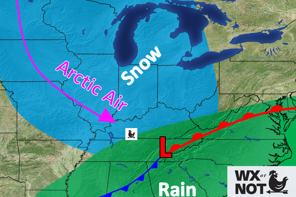
Contrary to the title of this blog, we are looking at some **low** potential for a wintry system to impact WABBLES Friday night into Saturday before we have a warmer pattern returning. I am confident that a weather maker will exist, but the question will be whether or not we end up on the warmer side of the storm or the colder part of the storm.
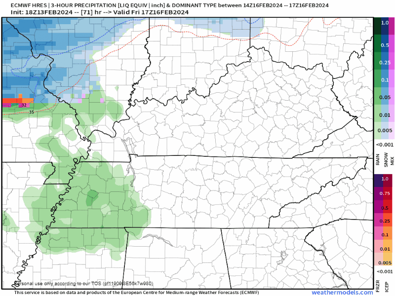
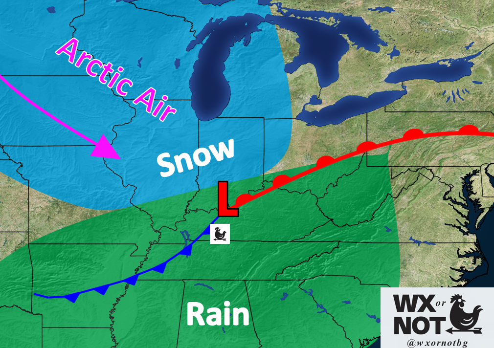
So, scenario 1 involves a low that tracks to the south through Tennessee and points eastward. This will result in WABBLES being closer to the cold pool of air which will increase our chances for snow, but, this low would need to track further south through northern Alabama for it to be a more sure deal.
Scenario 2 involves the low tracking more northward through Kentucky or even Southern Indiana. This will put WABBLES firmly in the warm sector and virtually destroy any meaningful snow chances.
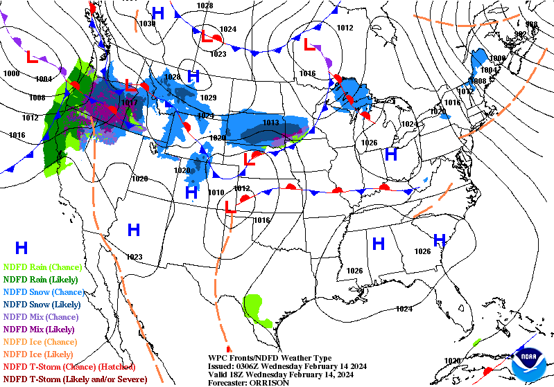
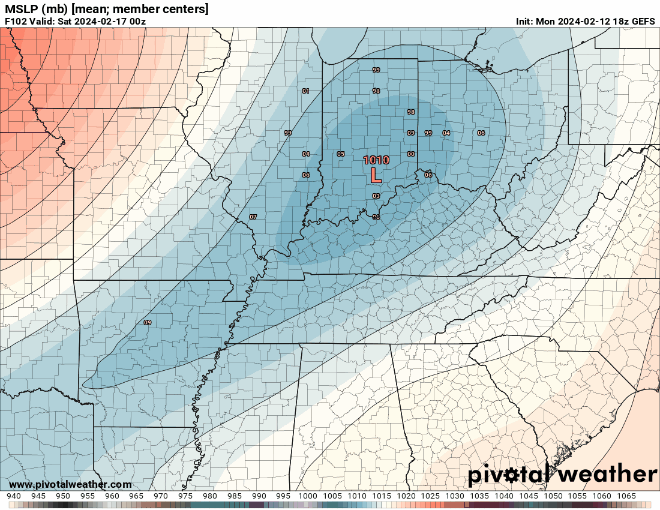
The GEFS ensemble is currently depicting a low going through Kentucky is the highest probability. This model has trended more and more south with the last few runs, this trend will need to be watched to see if it continues.
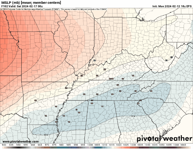
The EPS ensemble has been trending ever so slightly northwestward, the latest Euro deterministic run has had something similar with a low tracking through Tennessee.
So, ensemble data is suggesting more of the southern track scenario which would keep snow chances on the table for WABBLES but still not incredibly likely. A low track through northern Alabama would result in the best chances for snow, but I do not see that happening in our situation right now.
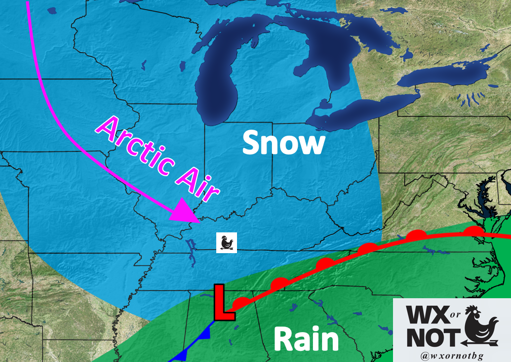
We will be keeping an eye on this system to see if anything changes with regards to snow chances. As of now, I would not suggest getting your hopes up for a snow storm.
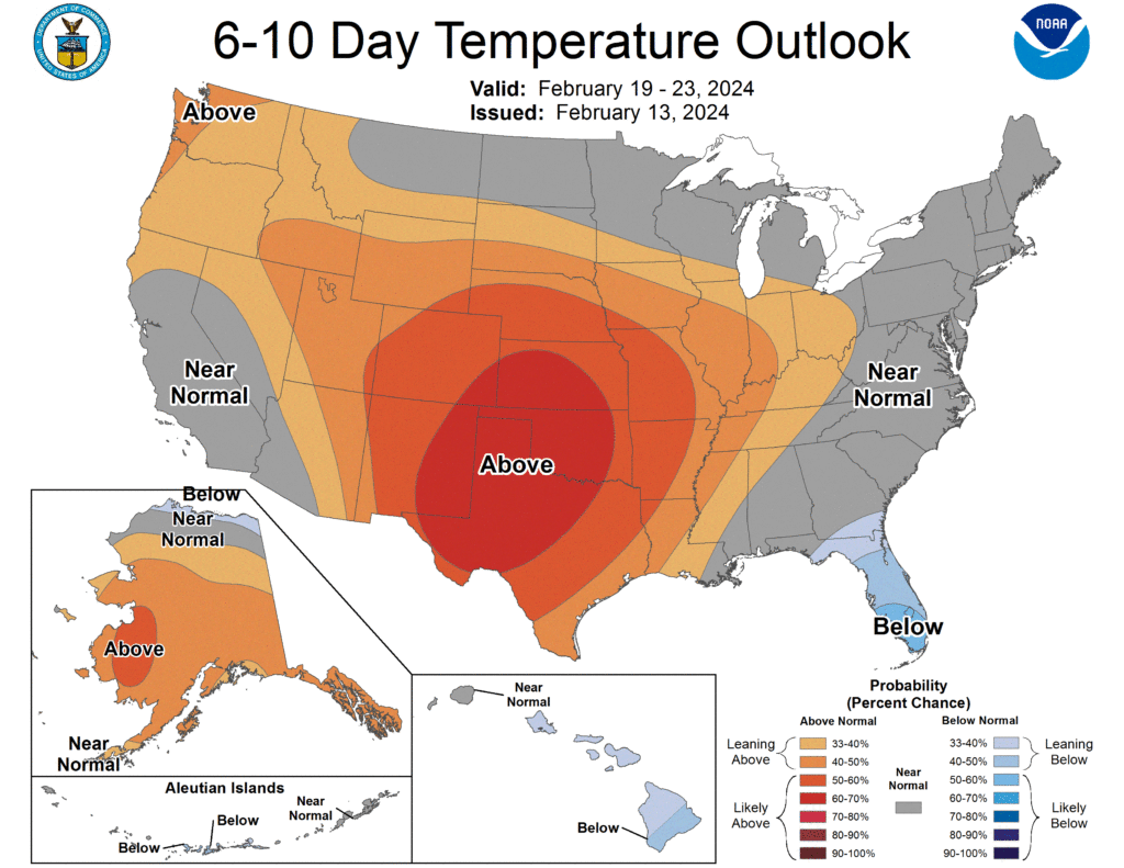
Warmer PAttern Returning
After this dip with colder air this weekend, we will see a quick rebound to temperatures around and just above normal with a warmer pattern returning. These above average conditions look to stick around for the 6-10 day timeframe.
That will be all for today my friends! I hope everyone has a great rest of the day and enjoys the nice weather outside. For the latest on our next weather maker, I encourage everyone to visit us on our social media accounts @wxornotBG.
Have a blessed day!