

")
Happy Friday, WABBLES! We’ve finally made it to the weekend! Not only that, but we’ve got plenty of sunshine to help inaugurate February across the region!

Easing Into the Weekend: Friday and Friday Night
We’re watching a weak little system try to push through the region going through the afternoon today. I can’t rule out a sprinkle, but most of us won’t see anything more than an extra few clouds pushing through WABBLES. We’ll remain quite mild for early February, with highs getting up into the middle to upper 50s.
Clouds should continue to move out of the region as we head into the overnight hours, which should help us cool back off below 40º or so after a bit.
Weekend Forecast
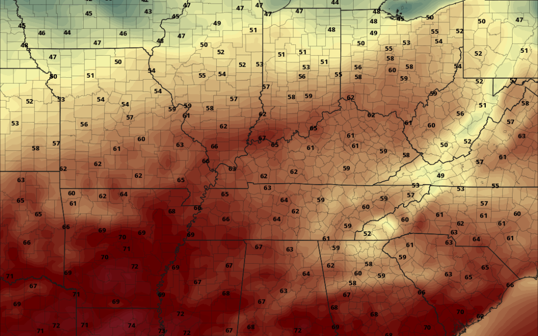
Sunshine is in full force as we head into the weekend with brief high pressure in place as we glide on into Saturday. That sunshine, combined with the milder, pacific air in place will help those high temperatures make a run back into the upper 50s and lower 60s throughout the region. Definitely an outdoor day for the first time in a while! Overnight on Saturday, we may see a few clouds try to sneak on into the region. But for the most part, we’ll keep it on the cooler but above average side with lows staying in the lower to middle 40s.
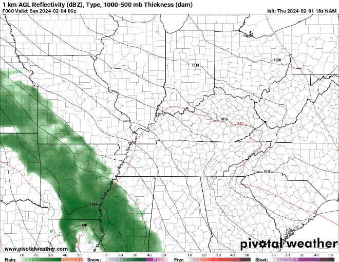
We’re watching a system trying to work through the region by late in the weekend and early next week, but I think it’s more of a glancing blow than anything else. We’ll see clouds build during the daytime hours as a disturbance from our south starts to work closer to the region. I don’t think we’ll see a ton, but a few showers can’t be completely ruled out, with a better shot at rain the closer you are to the Tennessee border.
We’re keeping it mild regardless of how much rain we run into, with daytime highs on Sunday in the middle to upper 50s. If some northern parts of WABBLES happen to run into some early sunshine, we may see those temperatures pop to 60º or slightly higher. Some showers may linger overnight, and with the clouds in place, we may keep those lows on the milder side: in the lower to middle 20s.
Past the Weekend: Into Next Week
Some of those showers may hang tough through the early hours of Monday…which is just what we need as we head back to work and school.

However, it won’t hang with us too long, as we should see some clearing as we head into the afternoon and evening hours. May be a little late to warm us back up big time, but we should still see some warmer-than-normal temperatures during the day, with highs in the mid 50s. After that, we see some cooler temperatures push back in as things clear out overnight. Lows fall back into the lower to middle 30s.
Sunshine in more abundance as we head into the middle of next week as high pressure settles back into the region. Even so, it’s more “pacific” high pressure versus “arctic” high pressure, so things will stay milder than normal as we work through next week. Highs look to stay in the middle to even upper 50s at times through the middle of next week.
We may turn our attention to another system that could head our way as we work into the end of next week and into next weekend. This doesn’t look to be a big system, but could throw some showers our way as we head into next weekend.
That’s it for me for now! You can always keep up with the latest on all of our social media platforms. Have a tremendous day and a great weekend!