

")
Good morning, WABBLES! Long time, no see! And just in time for the weekend!

It has been a soggy, soggy, soggy week throughout WABBLES as we have watched several systems drop upwards of two inches of rain in some spots! The good news is that we’ve got a break on the way as we head through our Friday…the bad news is…well…

Into the Weekend: Friday and Friday Night
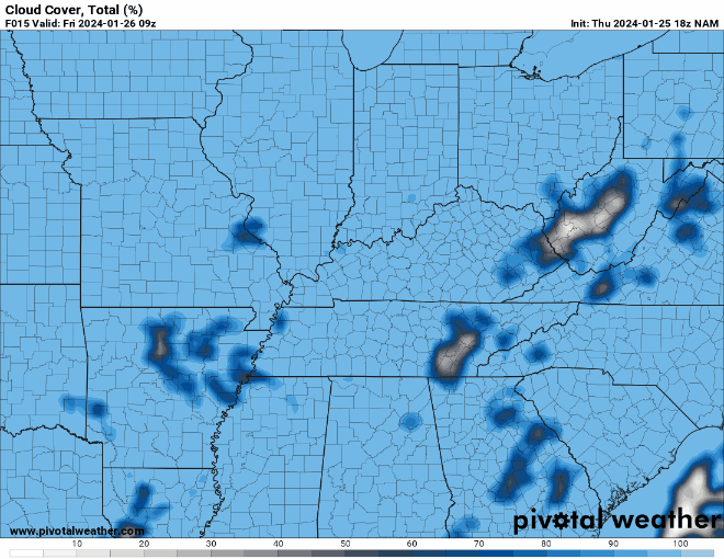
Today is our “day in-between” as our mid-week system continues to push its way out of the Ohio Valley. We should experience dry weather throughout the day today, but definitely will watch for the cloudiness to continue as we head through the afternoon hours.
Even with the cloud cover, with a milder airmass in place, we’ll see highs make a run up into the middle 50s throughout the region, a good eight to ten degrees above normal for late January. Overnight, our next system will begin working closer to the mountains, with showers beginning to break out as we head toward daybreak. Overnight lows are nearly 10 to 15 degrees above normal, only falling into the lower to middle 40s.
Weekend proper: Saturday and Sunday
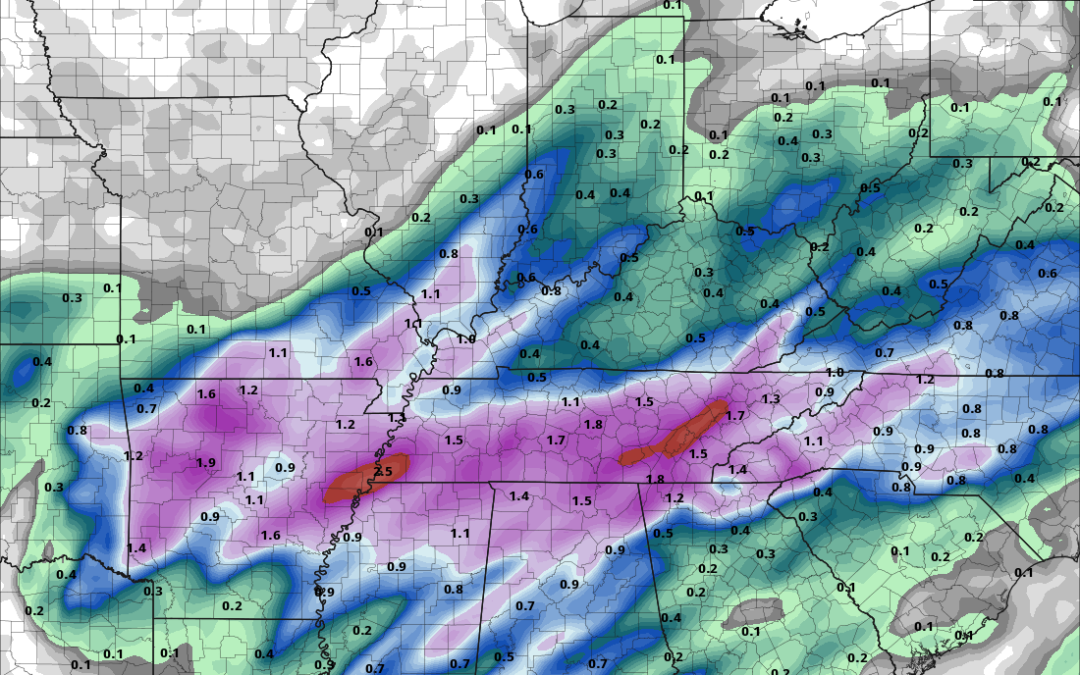
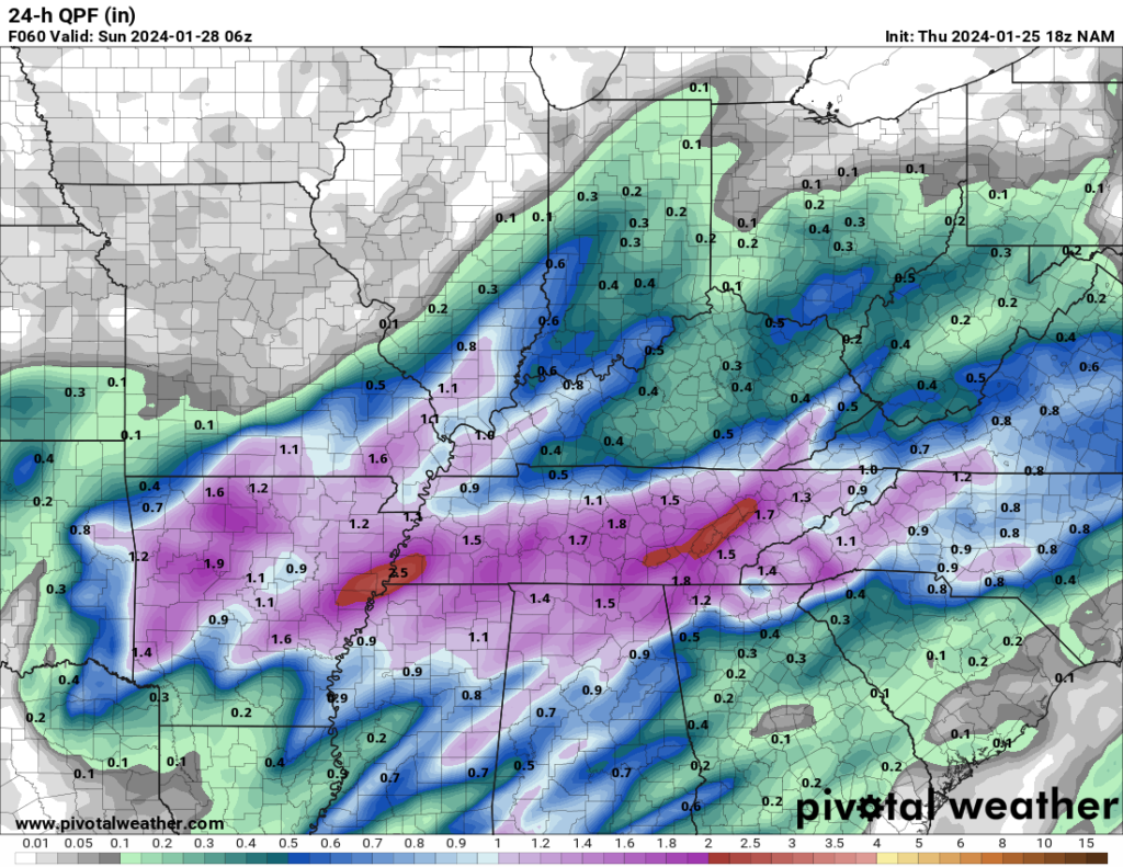
The weekend is once again upon us and, naturally, so are the rain chances.

A system gathering steam out in the southern plains looks to track just to our south during the day on Saturday, yet again providing us with ample opportunity for showers as it passes on by.
Showers will work through WABBLES as we head through the daytime hours and into the afternoon. This rain shouldn’t be too, too heavy, but pockets of moderate rain will help swell a few of those creeks and streams throughout the region.
Highs will stay above average as we kick off the weekend, with temperatures back in the middle 50s during the day on Saturday. We’ll only head down into the upper 30s to near 40º as showers start to taper off and our low pressure begins departing. However…we’re not quite done with the precip.
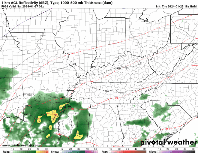
As temperatures start to cool off behind the front, moisture wrapping around the backside of the departing low pressure may allow us to squeeze a few rain showers, or even snow flurries early on Sunday morning.
Worry not, however, because with as warm as it’s been and with us settling above freezing, nothing should stick as we head through the morning and the chance for precipitation tapers off in the afternoon hours. We’re cooler on Sunday, with highs only in the middle 40s. We’ll try to clear off a bit as well as we head into our Sunday night, but skies stay mostly cloudy as lows fall back into the middle 30s.
Beyond the weekend: Into Next Week
I definitely have some good news here! It’s looking like we’ll get through at least the first part of the week with no big weathermakers setting their sights on us!

Clouds could hang tough for a bit, though, especially during the daytime hours on Monday. Combine the seemingly incessant cloud cover with cooler air filtering in behind our latest rainmaker, and we’re going to be closer to average with highs in the lower to middle 40s. Clouds will try to break up as we work through the overnight hours, that should allow lows to fall back into the upper 20s to lower 30s throughout the region.
Through the middle of next week we’ll welcome back one feature to the forecast we haven’t seen in awhile: sunshine! Highs will try to moderate as a milder air mass works into the WABBLES region, with partly to mostly sunny skies in abundance as we head through Tuesday and Wednesday. Highs respond nicely, with lower 50s looking like a good bet during the afternoon hours. We may sneak a weak system through here that could lead to a sprinkle or two, but that should be the extent of the action early next week.
That’s it for me for now! You can always keep up with the latest on all of our social media platforms. Have a tremendous day and a great weekend!