

")

With the passing of scattered snow showers this morning, our focus is now turning to yet another Arctic blast across the WABBLES community.

An Arctic front has now shifted southeast of the area, allowing for blustery, northwest winds to develop. Gusts upwards of 25-35+ mph will continue to punish us through the afternoon, lasting all the way into our Saturday.
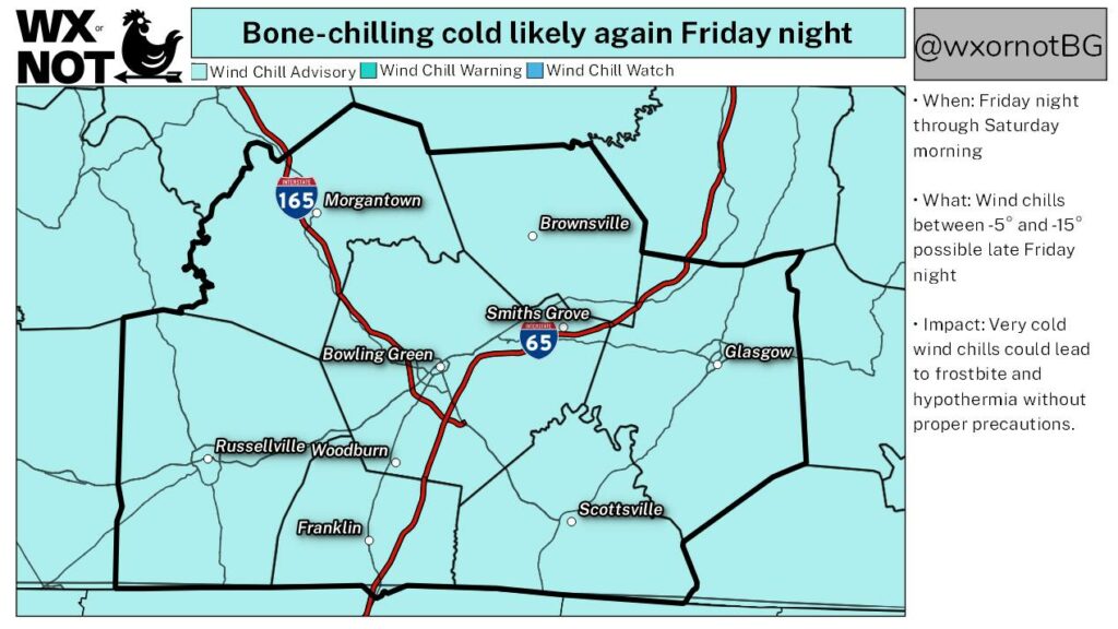
As a result, thermometers will continue to tank. Overnight lows will end up in the single-digits, with subzero wind chill readings a guarantee. As a result, the NWS has placed the entirety of our coverage area in a Wind Chill Advisory late tonight through Saturday morning.
Highs will only hit the mid & upper teens Saturday, before another opportunity at subzero temps arrives by dawn Sunday. 30˚ is our forecast high come Sunday afternoon. With plenty of sunshine, roads conditions should improve greatly.
A major warming trend ensues through the upcoming work week, along with numerous chances for showers & storms. As of this writing, rainfall forecast over the next 7 days will tally between 1-3″+.
Y’all stay warm, and have a safe weekend, WABBLES!