

")

Good Saturday Morning to everyone across WABBLES! I hope y’all had a great week, and a big congrats to the WKU students out there as this semester has come to a close. In weather news, we have an approaching system today bringing weekend severe weather chances.

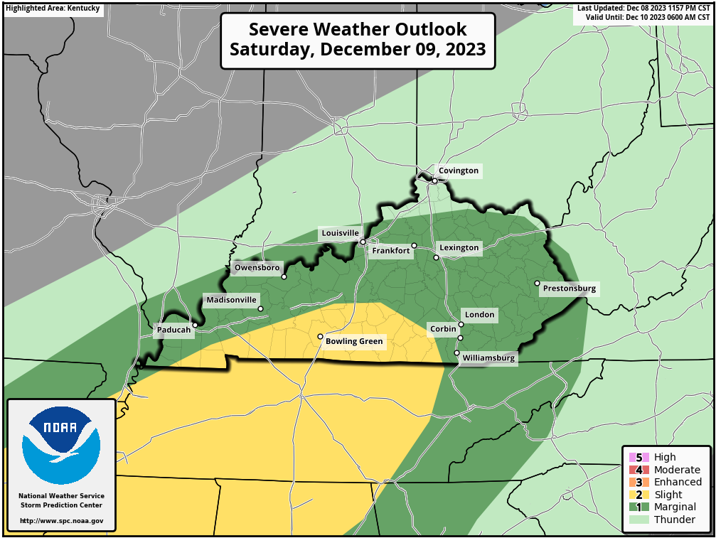
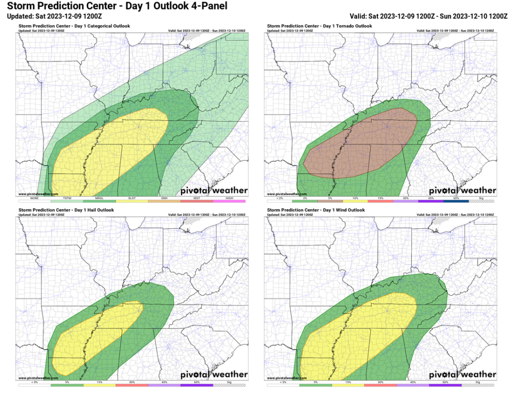
To get right into it, we are monitoring the potential for strong to severe thunderstorms this afternoon. This is on the SPC’s radar as well and has placed all of WABBLES in a Slight (Level 2/5) Risk.
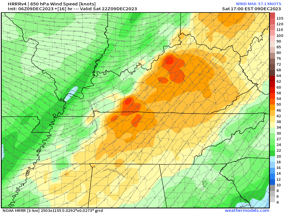
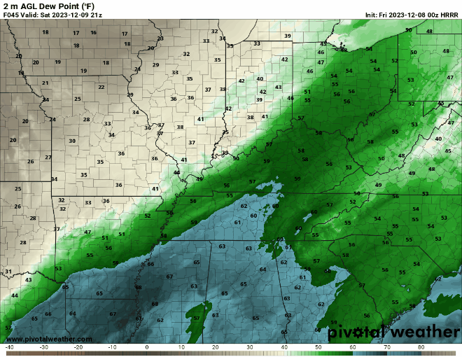
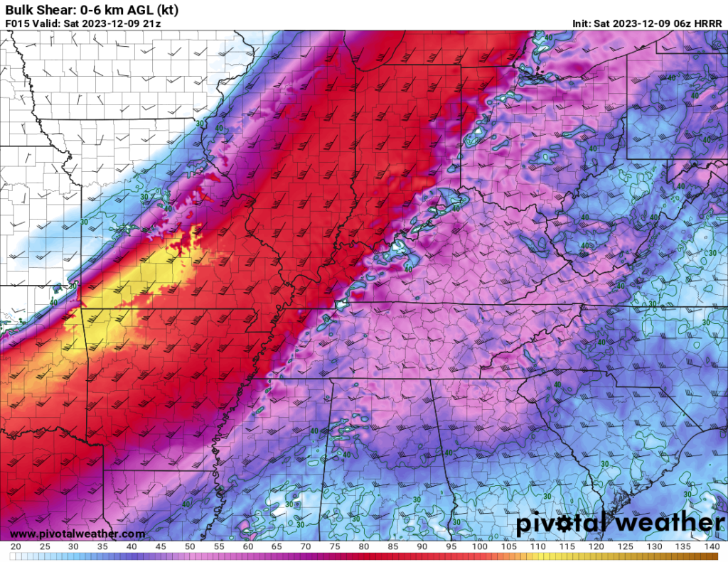
It has been fairly obvious for the past several days that there would be plenty of wind energy and wind shear to make things interesting around WABBLES. Instability and moisture on the other hand have been looking too weak to warrant any serious risk.
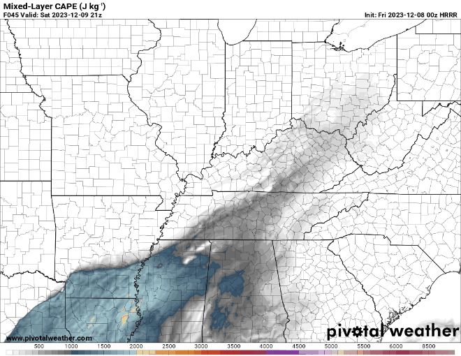
As the short range, high resolution models started to pick this system up, however, moisture and instability values have been trending upwards. That trend has caused a bit more concern over the potential for storms to become severe.
The HRRR model has been very aggressive with instability values being more than enough to fuel severe weather at this time of the year. The HRRR, however, has a tendency to overdo the instability sometimes and I think this is the case in this situation as well.
Even though it is likely overdone, I still think there will be enough for severe weather to be on the table. At this time of the year, with this much wind shear in place, it just doesn’t take much.
The hazards for tomorrow, if storms can become severe, will be damaging thunderstorm winds and tornadoes. The tornado threat is there tomorrow, but is still very low.
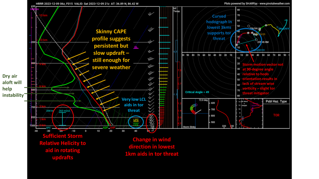
An excellent tool for looking at the overall environment in one package are skew-t soundings. A model sounding as storms are approaching WABBLES indicates an environment supportive for severe weather, including tornadoes, but that does not guarantee said things to happen.
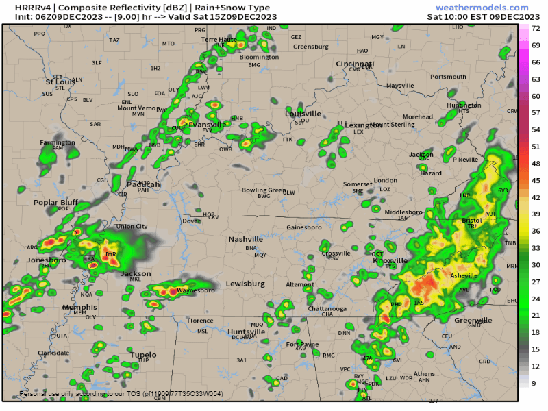
Quickly timing out this event, scattered showers and thunderstorms will be ongoing throughout the morning but shouldn’t amount to much. By 1-3pm the main line of thunderstorms will be approaching WABBLES. The best timeframe for severe weather is 1-8pm.
Something important to stress on days like today is that although the ingredients are there, severe weather is not guarantee. If the moisture doesn’t make it far enough north or if the instability doesn’t materialize, your severe weather chances drop dramatically. Watching how the atmosphere evolves late this morning will be crucial.
In conclusion:
- Atmosphere will likely be supportive for severe weather – including damaging winds and tornadoes
- Slight concern if instability can materialize
- Slight concern if moisture can get far enough north
- Go about your day like normal but have a plan in case severe weather happens
That will be all for today folks, I hope everyone stays safe out there. I highly encourage everyone to follow our social media accounts @wxornotBG for the latest on the severe weather chances.
Have a blessed day!